Laura remnants, cold front could bring severe weather to East Coast Saturday
A new storm system will also develop in the southern Plains.
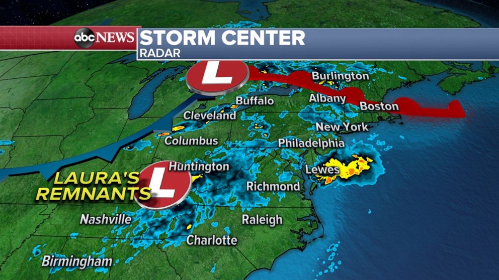
The remnants of Hurricane Laura are now pushing up against a storm system moving across the Great Lakes Saturday. Radar is indicating some areas of rain moving eastward across the Appalachians.
That storm system and its associated frontal boundaries brought gusty winds from Iowa to New Jersey Friday, when 60 mph wind gusts were reported in both New Jersey and Pennsylvania.
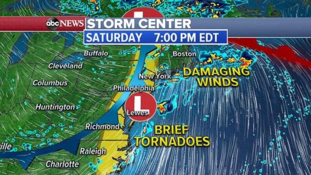
The combination of Laura's remnants and a cold front Saturday will bring showers and thunderstorms to much of the East Coast. There is a slight risk for severe weather from eastern North Carolina to New York. The threat is mainly severe storms that could form and possibly spawn brief tornadoes and gusty winds.
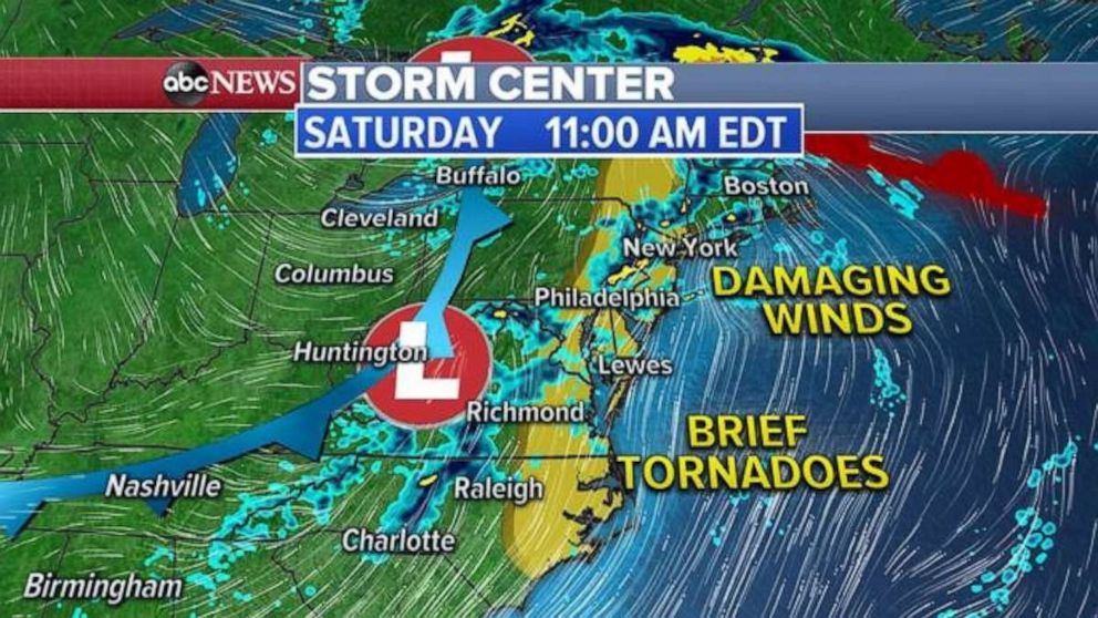
Unlike the traditional summer storm threats for parts of the Northeast, it will likely remain rather unsettled for most of the day. Any slow-moving storm could produce some flooding concerns.
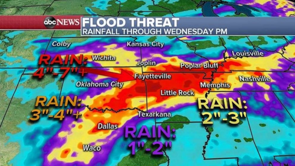
Meanwhile, behind this frontal system, a new system will develop in the southern Plains. This will be the beginning of a rather unsettled period for parts of southern Plains and mid-south.
First, a storm capable of brief tornadoes and damaging winds in parts of Oklahoma, Arkansas, and southern Missouri is possible Saturday. Then through the next few days, a stationary front will develop, which means it's possible for several waves of rain and thunderstorms to develop over this region.
Forecast model guidance is showing at least 4 to 7 inches of rain over the next five days from eastern Oklahoma to Arkansas to Southern Missouri. This will result in a flood threat that will persist for the next few days.
2 tropical waves in the Atlantic
There are two tropical waves being monitored in the Atlantic. The first is still pretty far east of the Caribbean Islands and has a 30% chance of development in the next five days.
The next one is a wave pushing off Africa, which has a 40% chance of development in the next five days.
It's important to note that the next five weeks are the peak for hurricane activity. The good news is both of these waves have their set of hurdles for longer-term development. However, it is almost certain that we will see hurricane activity ramp up, possibly even more dramatically than the last week, in the coming month.
Related Topics

Popular Reads
ABC News Live