Major flooding continues in South as Northeast hit with cold blast
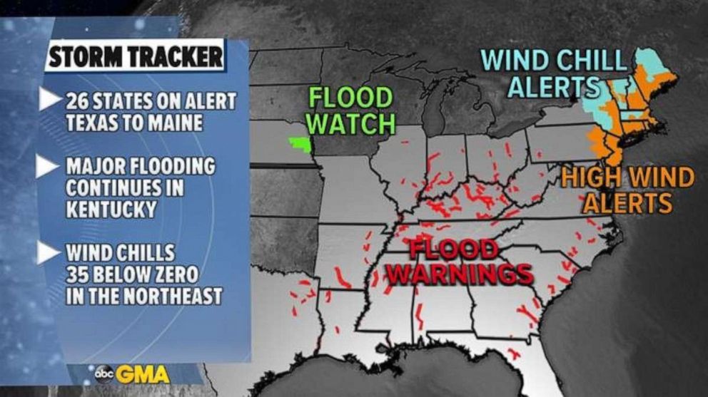
There are 26 states from Texas to Maine under flood and wind chill alerts.
There is major to near historic river flooding in parts of the Mid-South, especially in Kentucky on Tuesday.
Locally, 7 inches of rain fell over the weekend in the Mid-South helping local rivers to rise quickly and flooding entire towns. A state of emergency has now been declared for these areas.
Damaging thunderstorms moved through Georgia on Monday, killing one person when a tree feel on a home.
These storms also produced an EF-1 tornado with winds of 90 mph, not related to the victim’s death.
There are flood warnings from Texas to Ohio on Tuesday and 26 states from Texas to Maine are under flood, high winds and wind chill alerts.

The heavy rain has ended in Mid-South but some rivers are still rising or will remain in major to moderate flooding through over the next few days.
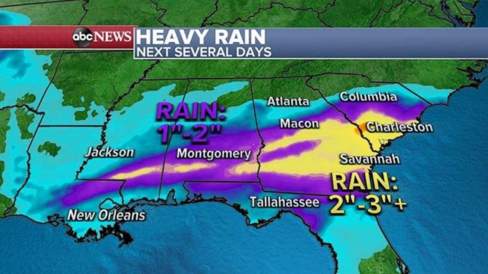
The heaviest rain shifted closer to the Gulf Coast from Mississippi to Alabama, Georgia and South Carolina where over the next few days 2 to 3 inches of rain is expected with locally higher amounts possible.

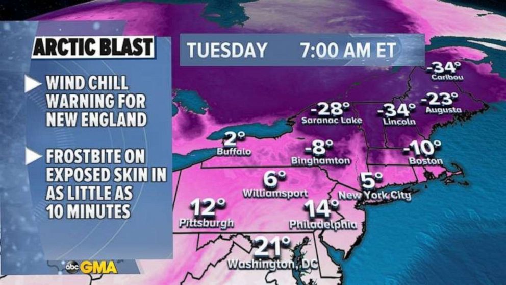
Meanwhile, in the Northeast, arctic cold air is moving through with very gusty winds that are producing power outages.
Wind will continue to gust in the Northeast from New Jersey to Maine at 40 to 60 mph through this morning and will subside in the afternoon.
Wind Chills this morning are below zero from upstate New York to Boston and into New England.

This bitter blast will not last and already by Wednesday most of the Northeast will see temperatures quickly rebound into the 40s and even 50s.
But it is still early March so the cold will be back end of the week as wind chills are expected to fall into the teens and single digits for the I-95 corridor and below zero in upstate New York and into New England.


