Major storm to bring snow and rain to West Coast
Rain and mudslides are possible in the wildfire areas.
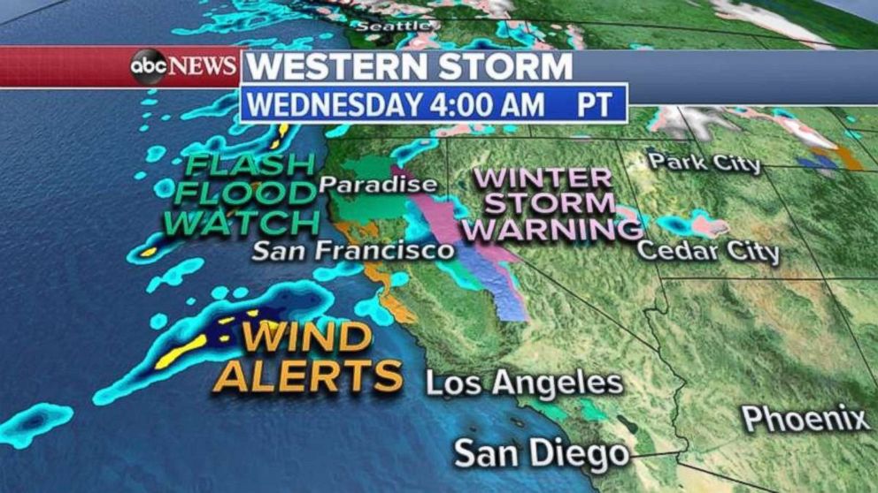
A new storm system is about to slam California with heavy rain and heavy snow.
Numerous flash flood watches have been posted for burn scar areas in the northern part of the state all the way to just outside of Los Angeles and San Diego.
A winter storm warning has been issued for the Sierra Nevada mountain range for multiple feet of snow. A high wind warning has also been issued for coastal California, including the San Francisco Bay area.
The heaviest rain will arrive in San Francisco down to Santa Barbara on Wednesday night around midnight local time. Flash flooding and mudslides, especially in those areas scorched by wildfires, are the biggest threat.
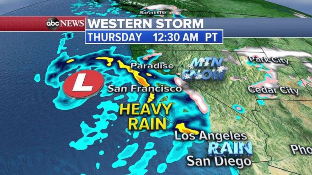
Heavy rain will continue in the coastal mountains of Southern California into Thursday evening. Flash flooding is expected there, especially in the recent burn scar areas resulting from the Woolsey Fire.
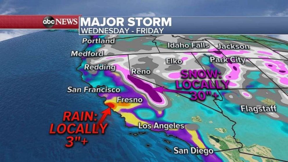
Heavy snow will spread into the Rockies on Thursday afternoon with rain possible in the deserts of Arizona and Nevada.
Over the next 48 hours, some areas in southern and central California could see 2 to 4 inches of rain. More than 30 inches of snow is possible in the Sierra Nevada Mountains.
Lake effect snow
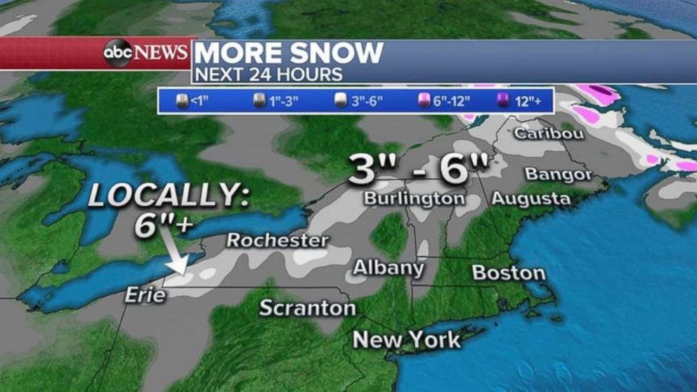
Numerous winter weather advisories and a winter storm warning continue for the Northeast as a storm system pulls out and lake effect snow continues behind it.
Up to 20 inches of snow fell in Vermont on Tuesday, with New Hampshire seeing as much as 16.5 inches and northern New York receiving 16 inches.
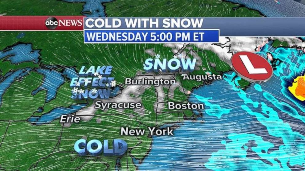
As the slow-moving storm system moves out of the Northeast, gusty winds over the Great Lakes will produce more lake effect snow from Pennsylvania to New York.
An additional half a foot of snow is possible locally in western New York and into northern New England.
Related Topics

Popular Reads
ABC News Live