Thunderstorm watches, tornado watches issued as major storm moves in: Latest forecast
Some schools in Dallas are closing early Friday as the severe weather moves in.
A major storm is closing in on Texas, Oklahoma, Louisiana and Arkansas Friday afternoon.
Over next the 24 hours, 57 million Americans will be in the storm zone across the South and under threat of tornadoes, damaging winds and large hail.
Here's the latest forecast:
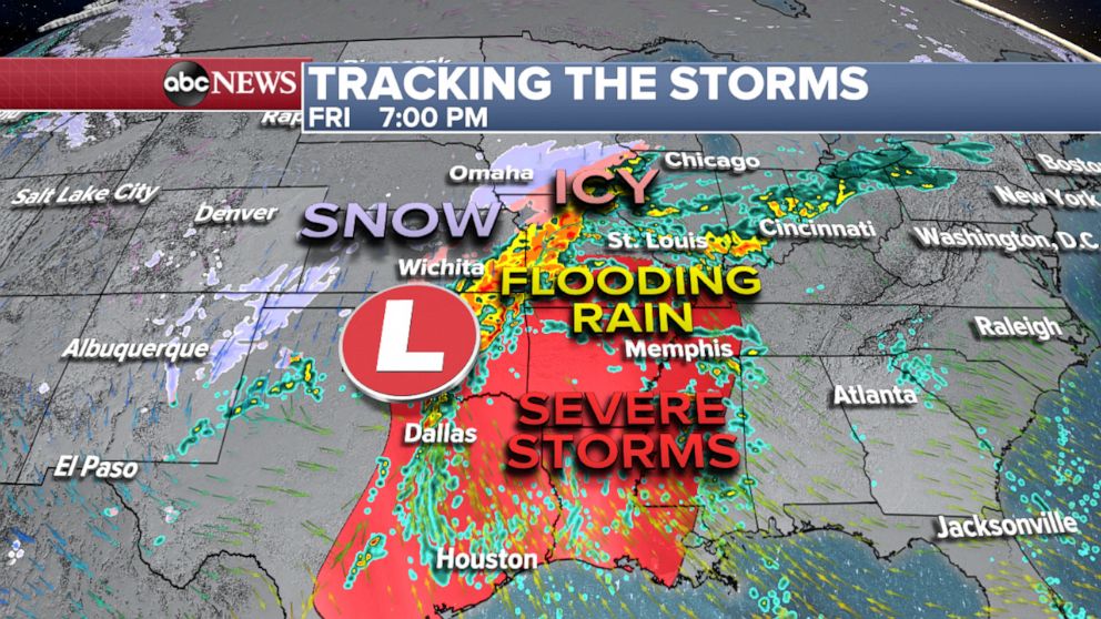
Friday
Dallas, Little Rock, Memphis and Shreveport appeared to be in the path of the storm as of Friday night. Tornadoes, damaging winds and hail are expected.

Some schools in Dallas closed early as the severe weather moved in, according to ABC Dallas affiliate WFAA.
A severe thunderstorm watch was issued in Wichita for the afternoon, while a tornado watch is in effect in Dallas, Oklahoma City and Tulsa.
Heavy rain could create a flood threat across the Mississippi and Ohio Valleys. Snow and ice will develop on the cold side of the storm.
The tornado threat continues into the overnight hours across eastern Texas, Arkansas and Louisiana. Overnight tornadoes are more dangerous because more people are asleep and miss warnings.
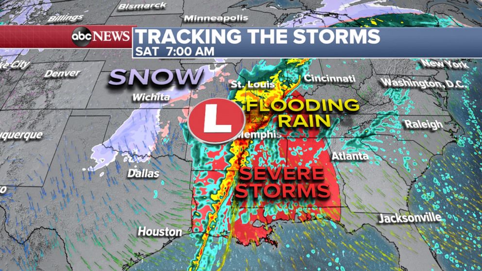
Saturday
That line of severe storms packing damaging straight-line winds and tornadoes will continue to slice across the South into Saturday morning, affecting areas from Memphis into Louisiana.

The storms should continue east, stretching across Mississippi and Alabama, with an enhanced risk for damaging winds and tornadoes late Saturday morning through the afternoon. By the evening, the storm will reach western Georgia, including Atlanta, where people could see some scattered severe storms.
The flooding rain is likely to continue from Missouri to Indiana on Saturday as snow falls on the backside of the storm across the Plains and into the Midwest.
The heaviest rain and highest risk of flooding is across parts of the Mississippi, Tennessee and Ohio, where 3 to 5 inches of rain is possible Friday night into Saturday.
Meanwhile, ice will be turning to snow from St. Louis to Chicago on Saturday afternoon and evening.
In Chicago, the "storm may bring a mix of rain, snow, ice and heavy gusts of wind that can cause hazardous road conditions and poor visibility," said Commissioner John Tully of the city's Department of Streets and Sanitation.
Snow also is expected in Wisconsin and Michigan, where some areas could see more than 6 inches.
By Saturday evening, the severe threat will be winding down.
Sunday
On Sunday morning the storm will be moving into the Northeast, delivering ice and snow, mostly confined to northern New England.


