Major storm slams into West Coast with powerful winds, heavy rain and snow
The storm brought 70 mph winds and caused mudslides in California.
A strong Pacific storm came ashore late Saturday in the western U.S., bringing widespread strong gusty winds, very heavy rain and mountain snow.
Rainfall rates of nearly eight-tenths of an inch in just 30 minutes were reported in parts of the Los Angeles metro region causing flash flooding, as well as a mudslide in Malibu. The mudslide, which caused some vehicles to get stuck, happened late Saturday night along the Pacific Coast Highway on the Los Angeles and Ventura county line. The storm also produced rotating cells near Point Conception in Southern California with sightings of funnel clouds along the Southern California beaches.
Wind gusts of 50 to 70 mph have also caused downed power lines and trees across the West Coast, with several thousand power outages from California to Washington. Winds gusted to 52 mph at San Francisco International Airport and 72 mph at Big Rock Ridge, north of San Rafael. In Oregon, winds gusted to 54 mph at Portland International Airport late Saturday night. Cape Disappointment, in southwest Washington, had already seen a gust of 69 mph.
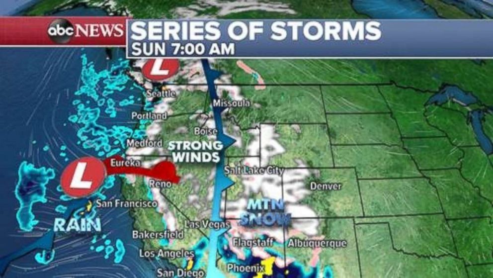
Heavy snow was falling in the Sierra Nevada Mountains overnight with major delays on Interstate 80. Several inches were reported early Sunday with snowfall totals through the next few days expected to reach 4 feet locally.
The storm brought widespread heavy rain to major cities, like Los Angeles, Portland and Seattle, on Sunday morning. Heavy snow fell through the Cascades, Sierras and into parts of the Rockies.
Winds in Seattle could approach 60 mph early Sunday morning.
The storm will be followed by at least two more storms in the coming days. Winter weather alerts and wind alerts are posted for much of the western U.S.
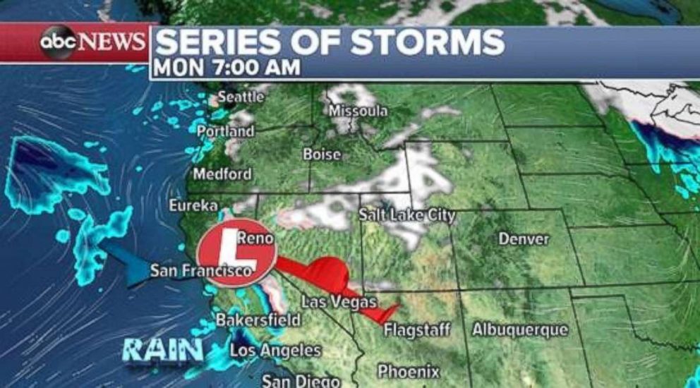
The storm will slide east later in the day on Sunday. The next storm is a little weaker and moves into California late Sunday with more rain and mountain snow. Rain is possible for Los Angeles by Monday.
Locally, 4 to 8 inches of snow are possible in the mountains around Los Angeles through Sunday. Additional rainfall of about a half inch per hour are possible locally, which could cause more debris flows and mudslides Sunday.
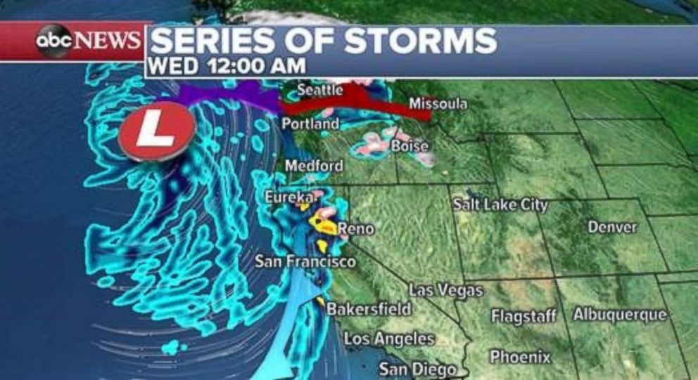
Another storm will arrive in the region by Tuesday and Wednesday and bring another round of heavy rain. This storm is looking a little wetter and milder than the previous storms with heavy rain likely again for much of Northern California.
Quick storm brings snow to Midwest, Northeast
Meanwhile, a new storm will develop as the unsettled weather pattern shifts a little east. A quick-moving storm will bring impacts to the Midwest on Monday and the Northeast on Tuesday.
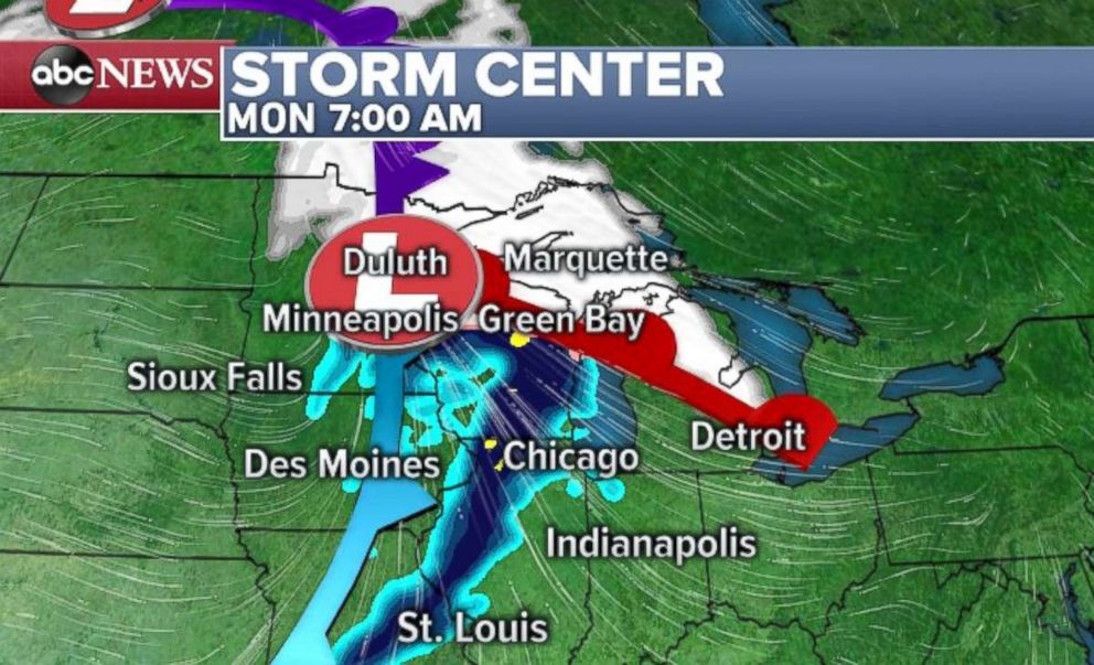
Some snow is possible in northern Minnesota, Wisconsin and Michigan for the Monday morning commute. By Tuesday morning, there will be another round of snow in parts of the interior Northeast.
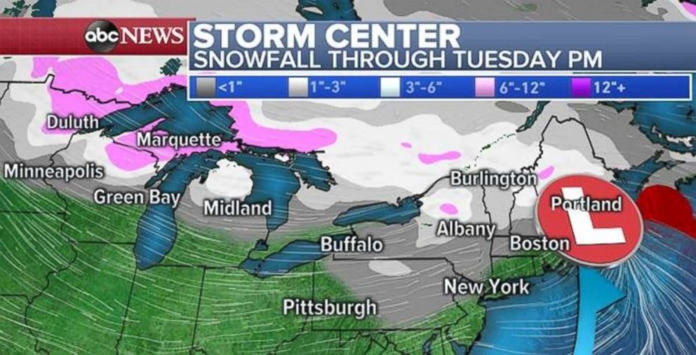
However, since this is a quick-moving storm, much of the major population areas will see low snowfall totals. The higher snowfall totals should remain confined to the northern parts of the country, with locally more than 6 inches of snow falling from Duluth, Minnesota, to Marquette, Michigan. There could be some locally enhanced snowfall north of Albany, New York, and northwest of Portland, Maine, through Tuesday with 3 to 6 inches possible.
