Major winter storm dumping snow in the Rockies
Montana could see 4 feet of snow before this storm is over.
A major winter storm has developed in parts of the northern Rockies and is currently bringing very heavy snow and strong winds to the region.
Winter storm warnings and winter weather advisories are in effect for the area on Sunday.
Wind alerts have also been issued from California to Wyoming due to the gusty winds along the cold front associated with the storm.
Snowfall rates of of 1 to 2 inches per hour have been reported in parts of northern Montana and Idaho. Snow is expected to continue through the day Sunday for the northern Rockies, with local snowfall rates possibly reaching 2 inches per hour.
Gusty winds, locally over 45 mph, are possible across parts of Utah and Colorado, where much drier air is in place. There is critical fire danger in parts of this region.
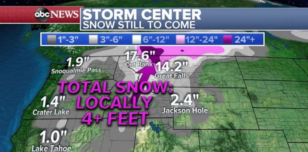
There was a report of 23 inches of snow in Montana, but parts of the state could see totals approaching 4 feet before the storm is over.
Luckily, the storm moves into Canada on Monday and its impacts shift north of the United States.
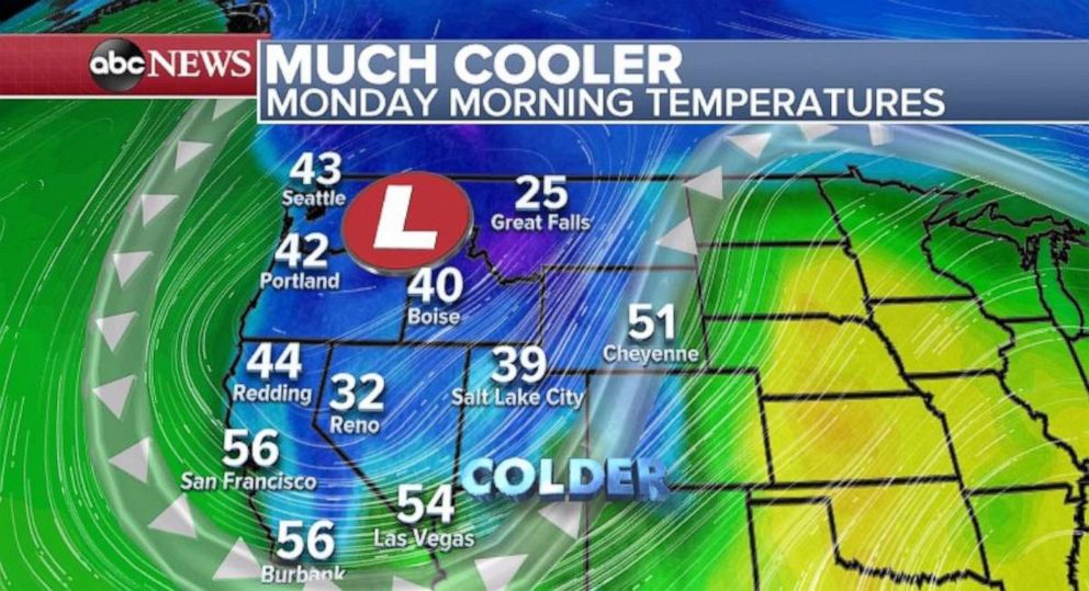
Meanwhile, behind the storm, temperatures are going to take a major plunge. Temperatures will drop to 15 to 30 degrees below average across the West Coast on Monday, with some record-low high temperatures possible.
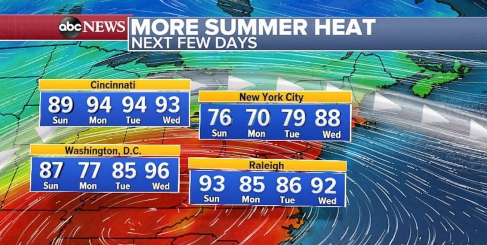
The weather pattern will also force very warm air across the East Coast with temperatures rising 15 to 20 degrees above average. Temperatures will be near or above 90 degrees in the coming days for parts of the region, including Washington, D.C., and New York City.
Hurricane Lorenzo
Hurricane Lorenzo has weakened to a Category 4 Storm again with 155 mph winds. Lorenzo is currently in the middle of the Atlantic. Overnight, when it was a Category 5 storm, it set a record for being the most intense storm this far north and east in the Atlantic Basin.
Lorenzo will pass the Azores by Wednesday and could affect the islands, though it is a little too early to determine how significant the impacts would be.
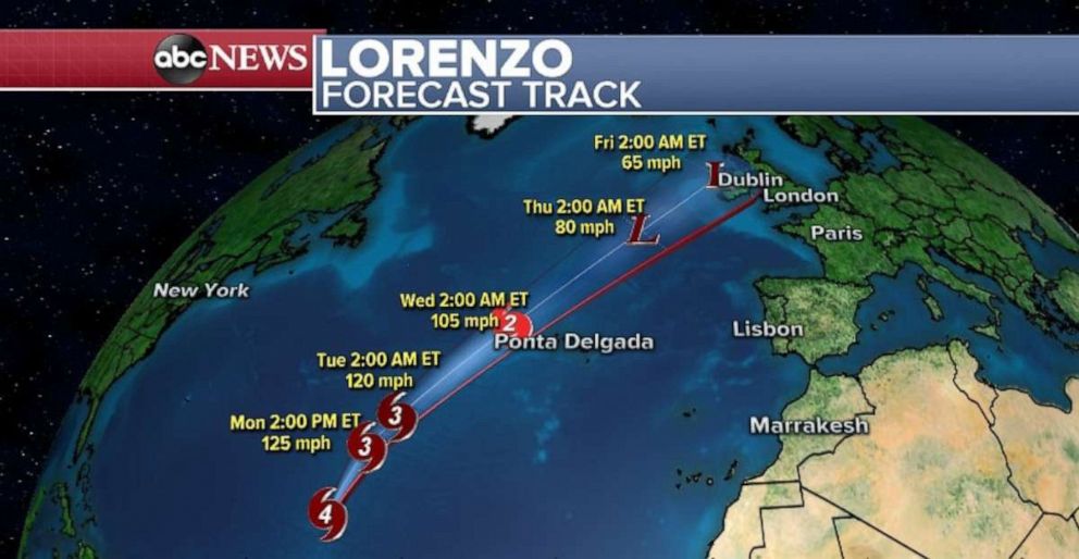
Unfortunately, Lorenzo will likely still be a strong storm when it moves closer to northern Europe and possibly Ireland later in the week.
Related Topics

Popular Reads
ABC News Live