Severe weather hits Southern US
The worst storms are over parts of northern Florida, Georgia and South Carolina.
A storm system moving through the Southern U.S. has already brought at least 150 reports of severe weather from Texas to South Carolina, including 7 Reported tornadoes so far -- one in Texas and six in Mississippi.
Additionally, wind gusts up to 74 mph were reported in parts of Alabama and 60 mph in parts of Florida. Hail up to the size of an egg was also reported in Mississippi.
There have been numerous reports of downed trees and power lines and a couple isolated incidents of damaged homes in the region so far from this outbreak of severe storms.
Flash flooding has also been reported in parts of Mississippi, Alabama and Georgia. Although there has been no official rainfall reports yet, radar estimates that 3 to as much as 6 inches of rain have fallen some parts of the region, mainly in and around Hattiesburg, Birmingham and Central Georgia.
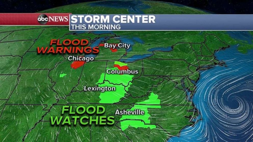
This morning the most intense storms are over parts of northern Florida, Georgia and South Carolina. Tornado watches have been issued for parts of these states, with the eastern edge of these watches in effect until 11 AM EDT. Additionally, there are flash flood watches still in effect for parts of the Southeast due to ongoing heavy rain occurring in the area.
There is an enhanced risk for severe storms this morning for parts of the Carolinas where there is likely the greatest chance for strong winds, large hail and tornadoes.
The severe threat will end this afternoon as the storm moves out to sea. However, there are two other systems that could bring severe weather to other parts of the U.S. Tuesday and Wednesday.
On Tuesday, a fast moving cold front will approach the Northeast U.S. and tap into some relatively warmer air. Forecast models are showing a line of storms that will likely move across Pennsylvania, New York and New Jersey followed by parts of New England on Tuesday afternoon. With this line of storms, strong winds, hail and heavy rain will be possible.
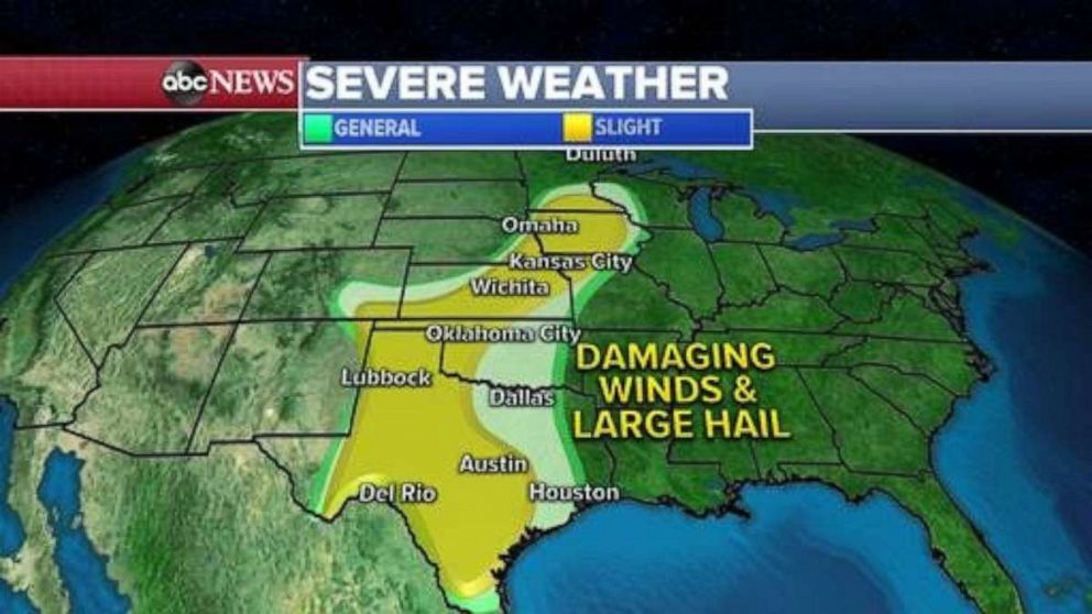
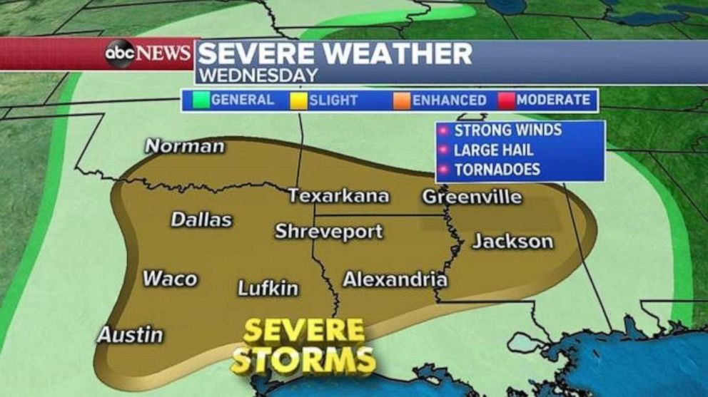
Unfortunately, yet another system will move into the West Coast today and arrive in the southern Plains by Wednesday. When this storm system arrives it will likely spawn another round of severe weather from Texas to Mississippi. Unlike the last few rounds of storms, this threat will be a little bit more concentrated along the I-35 corridor of Texas and Oklahoma.
Climatologically speaking, we expect the severe threats to nudge closer and closer to the southern Plains, followed by the central Plains as we head into May when severe weather typically rapidly escalates.
Related Topics

Popular Reads
ABC News Live