Plains at risk for severe storms while heat returns to Northeast
There is also a threat for flooding in the Southeast.
Very heavy rainfall was falling across parts of eastern Kansas and western Missouri on Saturday morning, while gusty winds up to 75 mph have been reported in Kansas as well. Some storms are also firing in parts of Illinois and Indiana, too.
Flash flooding will remain a concern through the morning hours in these regions, before the flood concern shifts slightly eastward through Missouri and parts of Illinois through the day.
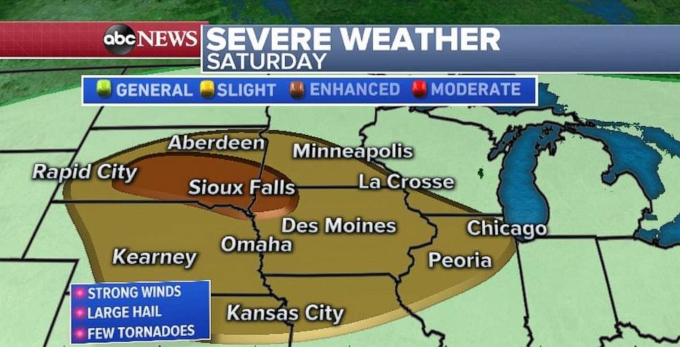
The storms will eventually lose strength by mid to late morning, however, as the system moves closer to Chicago by midday storms, some severe, could fire up again. Meanwhile a frontal system approaching from the north and west will also reignite severe storms in parts of the Dakotas, and into parts of Iowa and Minnesota. A couple lines of strong to severe storms are likely there late Saturday and early Sunday.

As a result, there is an enhanced risk for severe storms in parts of the region, including Sioux Falls, South Dakota. There is a slight risk for severe weather from Nebraska to Illinois, including Omaha, Nebraska; Des Moines, Iowa; and Chicago.
Heavy rain in Southeast
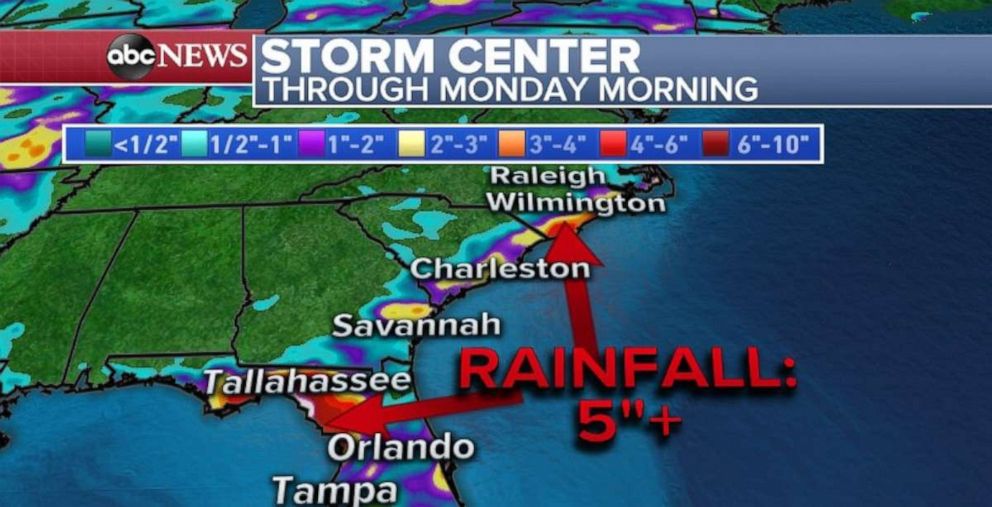
A stalled stationary boundary continues to interact with tropical moisture in the Southeast. There have been reports of over 11 inches of rain in parts of the swamps west of Gainesville, Florida. Some of the towns in parts of that region of Florida have reported flooding, but it appears the heaviest of the rain is falling mainly over swampland.
Unfortunately, the chance for tropical downpours will continue through the weekend as the stationary front slowly falls apart. The National Hurricane Center is monitoring the entire system for possible tropical development, as a the low moves into the Atlantic Ocean over the next few days. However, chances remain relatively low that anything truly tropical develops from this.

Summer heat returns
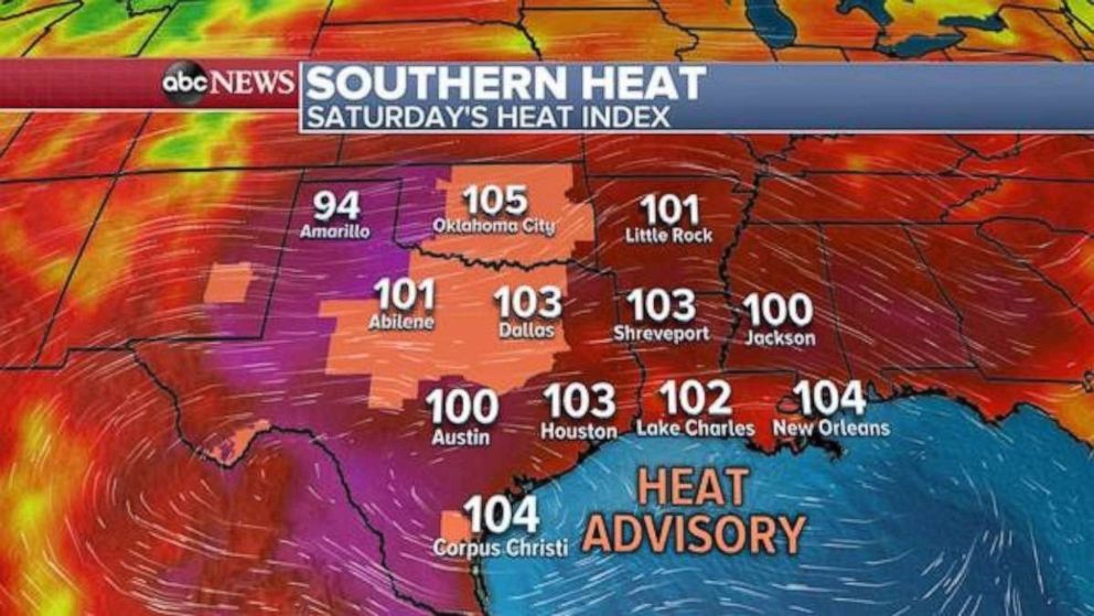
Heat will subside slightly in the West on Saturday, but some of that heat will build into the Southern Plains with heat indices reaching over 100 degrees in parts of Texas and Oklahoma. There are some heat advisories in effect for parts of that region on Saturday.

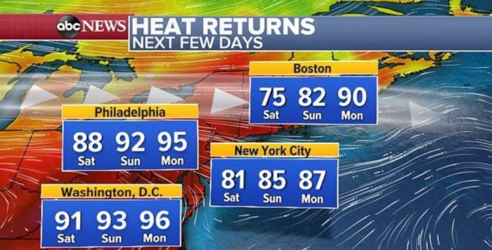
After a relatively cool period in the Northeast, heat will return to the major Northeast cities over the next couple days, with temperatures rising close to or above 90 degrees from Washington, D.C., to Boston. On Monday, it will be 95 degrees in Philadelphia and 96 degrees in Washington, D.C.


