More rain on the way for already-soaked Northeast
New Jersey suffered serious flash flooding on Saturday.
The first half of the weekend was a washout for much of the Northeast thanks to heavy showers and thunderstorms that continued throughout the day.
Many areas received 2 to 3 inches of rain, while Caldwell, New Jersey, received 4.92 inches and New York's Central Park received 2.9 inches, a new record for the day. Flights at Newark Liberty International Airport were delayed and one entrance of New York City's Penn Station was closed due to floodwaters.
The atmospheric setup remains similar on Sunday with a tenacious stationary front remaining in place in the Northeast. That means more showers and thunderstorms will develop today.

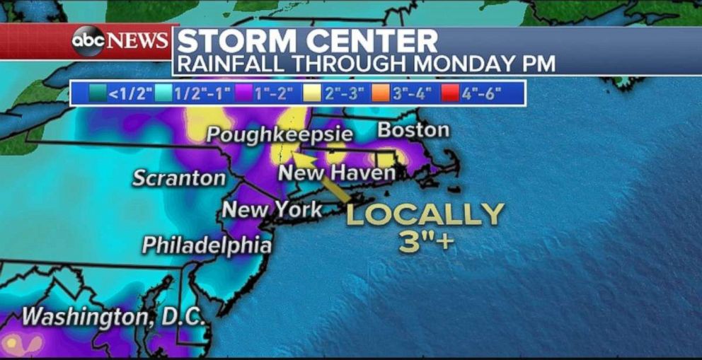
However, the worst is over for the Northeast. Showers on Sunday should be less intense and less frequent than Saturday. Rainfall amounts through Monday evening will range between 1 and 2 inches for most spots, with upwards of 3 inches possible in New England.
Fire weather in Northern Plains
At least three new wildfires were sparked Saturday in Montana thanks to gusty winds, low humidity and extensive heat, according to Great Falls ABC affiliate KRTV.
Temperatures were so high in the region Saturday that numerous records were broken, including Glasgow, Montana (107 degrees); Helena, Montana (102 degrees); Pocatello, Idaho (100 degrees); and West Glacier, Montana (100 degrees), which reached triple digits for the first time in recorded history.

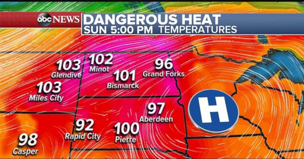
A high centered over Minnesota will steer warm air from the south into the Upper Plains again on Sunday. High temperatures will reach into the 100s in some places with the potential of new records being set.
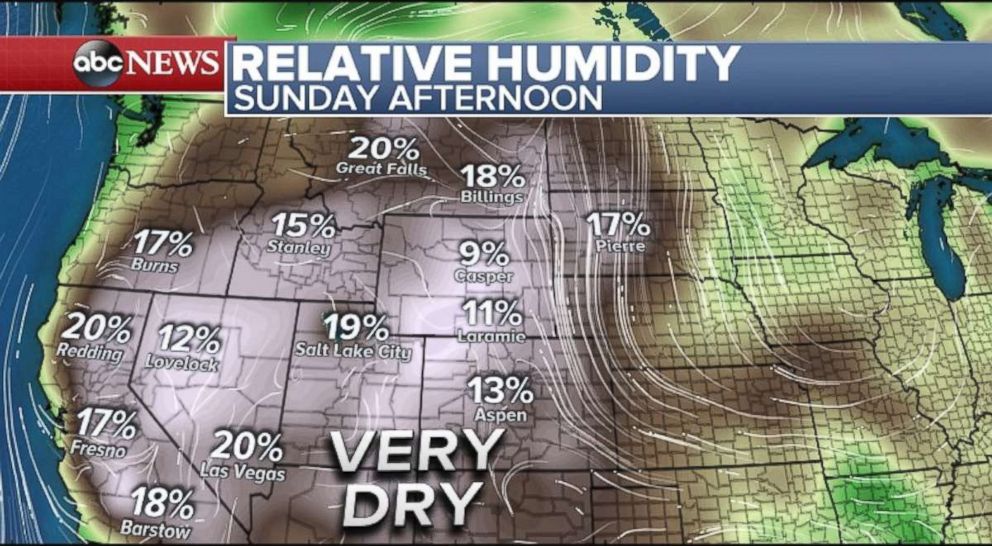
Very dry air over the West, coupled with a cold front in western Montana, will produce gusty winds and the formation of dry thunderstorms on Sunday. Lightning strikes from these dry storms can easily spark new wildfires, while the gusty winds can facilitate their rapid spread. Red flag warnings remain in effect for much of the region through tonight.

Monsoons calm down
Monsoon thunderstorms rolled through the Las Vegas area again Saturday night. Dust storms and flash flood warnings were both issued by the National Weather Service for the region. Winds, some that gusted to over 71 miles per hour, and rain were so severe that at one point 62,000 customers of NV Energy were without power.
Drier air is expected to move in from the west on Sunday, which will decrease the probability of monsoon thunderstorms for the next few days.


