Record-breaking blizzard continues to slam Rockies, Northern Plains
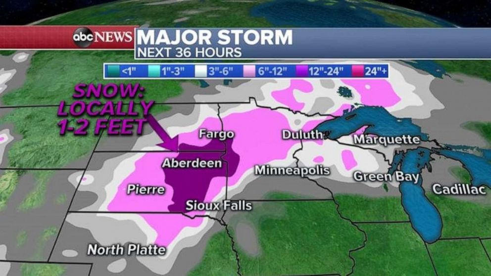
Parts of Wyoming and South Dakota are climbing toward 2 feet of snow.
A record-breaking April blizzard continues to slam the Plains with gusty winds, blinding snow and severe thunderstorms on Thursday.
Parts of Wyoming and South Dakota had already piled up 18 inches of snow by Thursday morning -- and the total continued to mount. In Colorado, Denver got about 3 to 4 inches of snow, while mountains to the west got up to 9 inches. Minneapolis saw about 5 to 6 inches by early Thursday as the snow continued to fall.
The blizzard warning was cancelled in Denver by early Thursday and downgraded to a winter weather advisory as the storm moves out of Colorado.
Twenty-two states from the Rockies into the Ohio Valley are under snow and high wind alerts on Thursday morning.
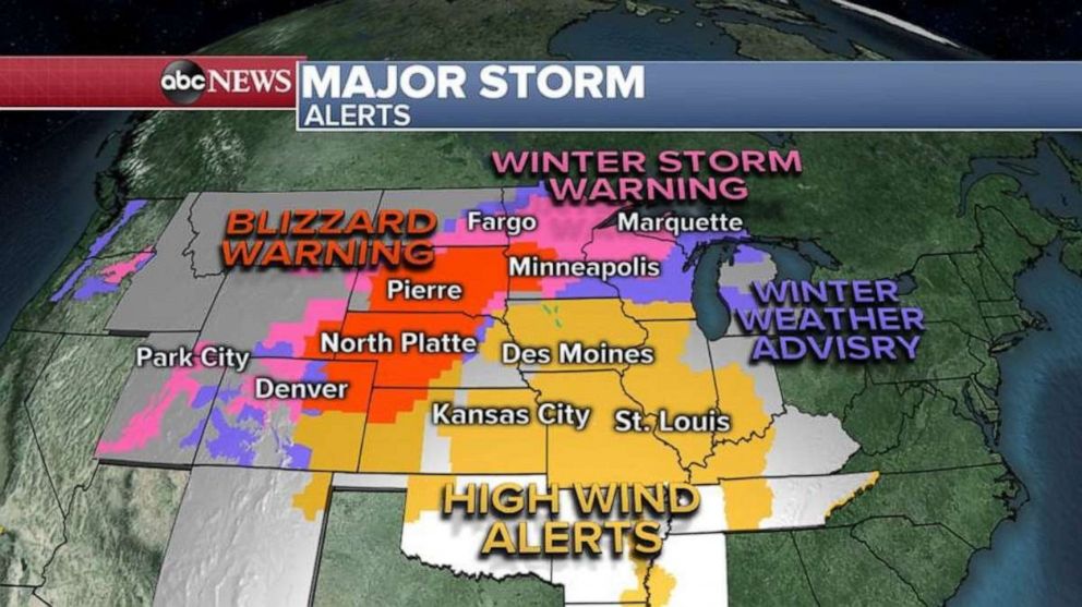
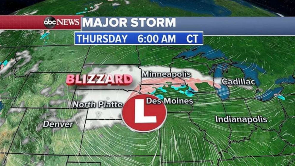
The storm system is centered near Omaha, Nebraska, on Thursday morning with heavy snow continuing from Kansas to Wisconsin.
Snowfall rates Thursday morning in some areas are 1 to 2 inches per hour with winds gusting near 50 mph.
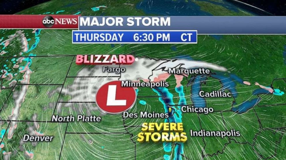
The storm system moves north Thursday afternoon and evening into the Dakotas and Minnesota, with blizzard conditions continuing from Nebraska to the Dakotas and into northern and western Minnesota.
Snow and ice will also fall in Wisconsin and part of northern Michigan, but it is not expected to be as severe as in the Plains.
The Twin Cities will be on the eastern side of the storm, so snow will change to rain as milder air gets pushed north ahead of the storm.
To the southeast, from Iowa into Illinois and Indiana, severe thunderstorms are possible with damaging winds, hail and an isolated tornado.
By Friday morning, the storm system slowly lifts north into the western Great Lakes. It will continue to bring heavy snow and gusty winds with near blizzard conditions for the eastern Dakotas and northern and western Minnesota.
A threat for strong to severe storms will continue east of the storm in Indiana, Michigan and Ohio. The biggest threat will be hail and gusty winds with lightning.
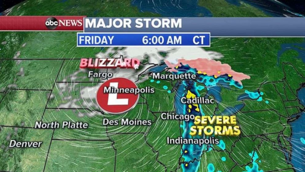
Additional snowfall of more than a foot is possible for the Dakotas and into Minnesota on Thursday. After Thursday morning’s heavy snow burst, the Twin Cities will be done with significant snow accumulation.
