Record-breaking heat in Southwest continues this weekend
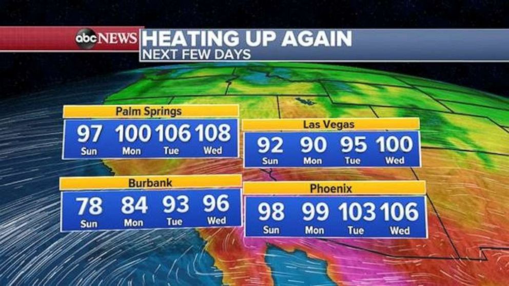
Phoenix could reach 106 degrees next week.
Parts of the Southwest saw record-breaking heat on Friday.
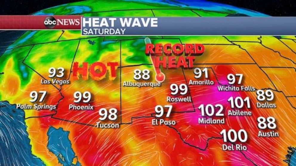
In Texas, El Paso broke its daily record on Friday with a high temperature of 97 degrees. Midland hit 101 degrees, which was also a record. Lubbock hit 101 degrees on Friday, making it the earliest date the city has hit 100 degrees or higher. In New Mexico, Roswell hit 101 degrees, breaking its record of 97 degrees from in 2012. Albuquerque hit 88 degrees, which tied its record from 1992.
Records will be possible again Saturday in the region.

El Paso’s record is 95 degrees, but Saturday's forecast is 97 degrees. Additionally, there will be some fire dangers in both new Mexico and western Texas Saturday due to dry and gusty winds.
The heat will persist for a few more days in the region. Heat records will be possible Sunday and Monday in parts of western Texas with some spots breaking 100 degrees.
Temperatures will rise into the 90s in parts of the I-35 corridor from San Antonio to Waco, Texas. The heat will begin to subside in the western parts of Texas by Tuesday, with temperatures dropping back into the 80s.
By the middle of next week, attention will shift back towards the west, with triple-digit temperatures returning to Las Vegas, Phoenix and Palm Springs, California. Phoenix’s record for May 6 is 106 degrees, and right now, the forecast is calling to at least tie that record.

In the eastern U.S., April was pretty chilly, with many locations below average for the month. It is noticeable that April was below average since the first three months of 2020 were well above average.
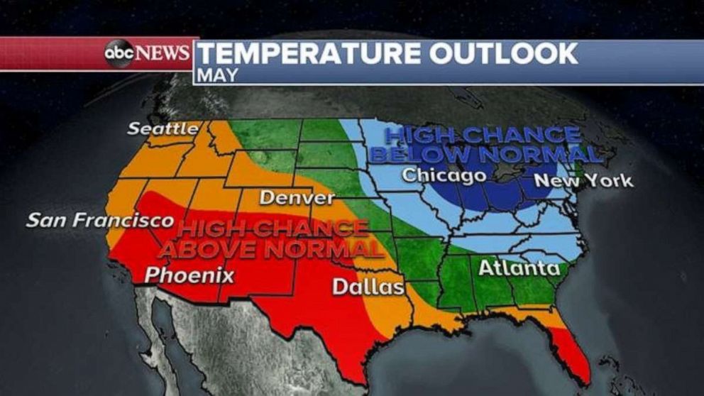
The May temperature forecast is once again peculiar with an overall pattern that suggests more chances for below-average temperatures in the Great Lakes and Northeast. Meanwhile, it appears there will be more chances for above-average temperatures in the Southwest.

This type of predominant May weather pattern that is being forecasted might influence the ability of severe weather to develop. A prevailing pattern of heat ridge in the west and trough in the east would likely have some ability to damper the potential for severe weather in the central and southern Plains. Severe weather could still happen, but the pattern suggests a couple of relatively calmer weeks ahead.
Typically May is the time of year where severe weather, especially tornadoes, dramatically ramp up. The last few weeks of April were extremely active in terms of tornadoes, including 140 tornadoes on April 12-13.
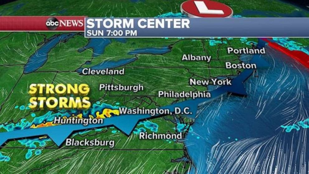
Meanwhile, in the short term, a fast-moving storm system will bring a cold front into parts of the Midwest Sunday morning, with some strong storms likely from Missouri to Ohio. The storms could have some gusty winds and very heavy rain, which could bring some flash flooding. Ahead of this cold front, warm air will build in the east and it will be a couple of very nice spring days.
Storms will move into the Appalachians and Mid-Atlantic by Sunday evening, where 1-2 inches of rain will be possible.


