Rivers continue to rise in flood-prone mid-Atlantic states; heat wave hits Southwest
Maryland, Virginia and Delaware have been pounded by rain for weeks.
Already rain-soaked states in the mid-Atlantic are looking at another dose of downpours to end the weekend.
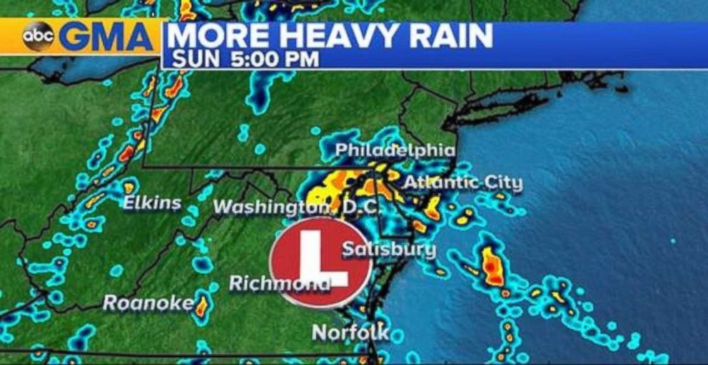
Tropical moisture is working up from the South on Sunday and colliding with a stalled low-pressure system across southern Pennsylvania, Maryland, Delaware and Virginia. Heavy rains and even scattered thunderstorms are expected to continue through Sunday night in the region.
With the ground already saturated from prior periods of rain, flooding is a concern.
Salisbury, Maryland, saw 9.79 inches of rainfall in May 2018, breaking their monthly rainfall record for May of 6.96 inches in 1978. Meanwhile, Asheville, North Carolina, received a whopping 14.68 inches of rain in May, more than 5 inches over the previous record for May.

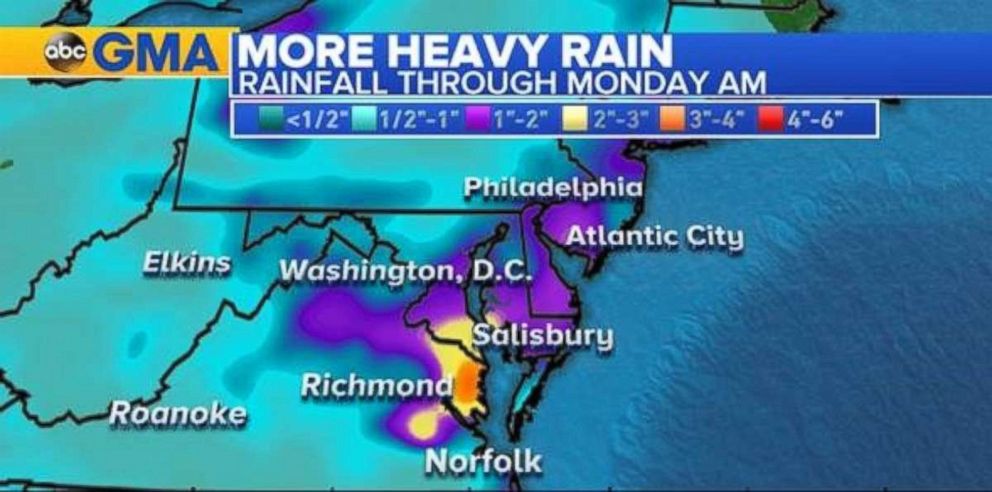
Some locations in southern Maryland and coastal Virginia could see 3 inches of rain or more by Monday morning.
While there could be flash flooding from this rain event, it is also important to note that river flooding can still occur days after a storm as water travels down the terrain and into drainage basins and rivers.

The Potomac River in Little Falls, Maryland, is currently in action stage, and is projected to crest in minor flood stage at 11.3 feet on Tuesday morning. Meanwhile, the Potomac River at Edwards Ferry, Maryland, about 30 miles upriver, is entering action stage early Sunday morning and is projected to crest in moderate flood stage at 19.9 feet on Tuesday morning.
Excessive heat out West
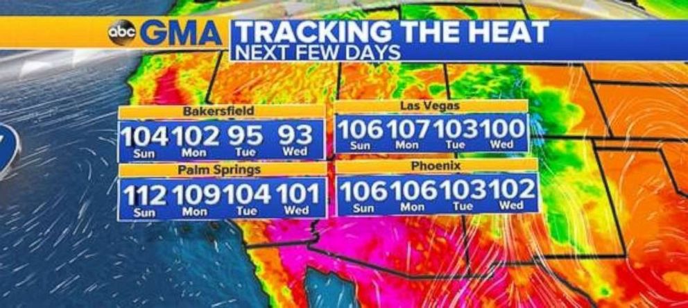
An excessive heat warning remains in effect from 11 a.m. Sunday to 8 p.m. Monday as temperatures are expected to be within the 105- to 110-degree range. Excessive heat can significantly increase the potential for heat-related illnesses such as heat stroke.

The Desert Southwest is looking at temperatures at or above 100 degrees for the next four days. This will not be helpful to the ongoing firefighting efforts.


