Severe storms headed to Northeast, Plains: Latest forecast
A severe thunderstorm watch is in effect from Ohio to Vermont.
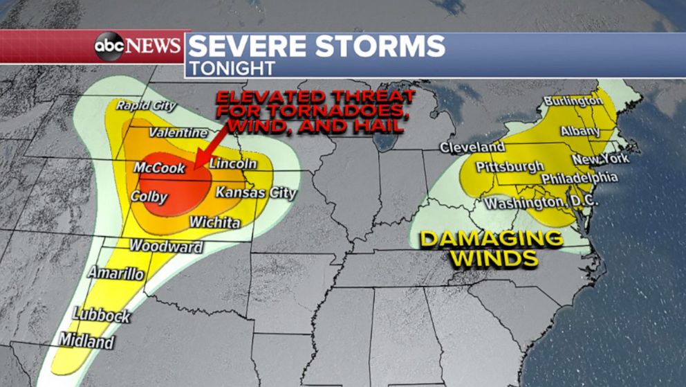
The Northeast and the Plains are bracing for severe weather Wednesday as two storm systems move in.
The first storm, which brought powerful winds to the Midwest on Tuesday, is now closing in on the Northeast's Interstate 95 corridor.
A severe thunderstorm watch is in effect across Maryland, Pennsylvania, New Jersey and most of New York state.
Those in New York City, Philadelphia and Washington, D.C., could face damaging winds and possibly tornadoes.
The second storm is expected to bring rough weather to Texas, Kansas, Iowa, Nebraska, South Dakota and Missouri.
Tornadoes are possible Wednesday night, especially in Nebraska and Kansas.
Intense, damaging wind gusts and very large hail are expected from the Texas Panhandle through South Dakota.
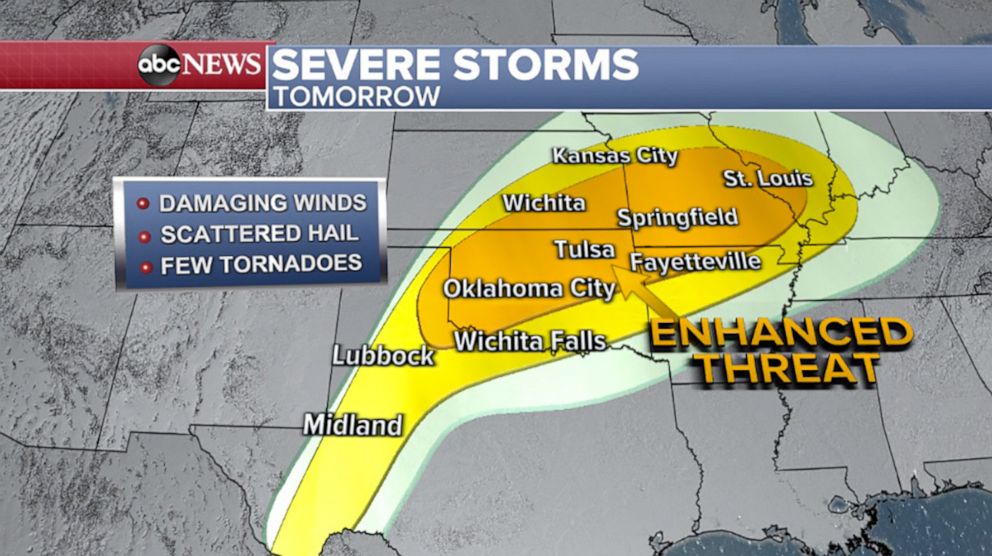
By Thursday, the brunt of the second storm will shift to Oklahoma, Missouri and Kansas.
Damaging winds, hail and tornadoes are possible from St. Louis to Oklahoma City on Thursday afternoon and evening.
Related Topics

Popular Reads
ABC News Live