New severe weather outbreak looms for South just week after 131 tornadoes confirmed in region
More tornadoes are possible in the South this weekend.
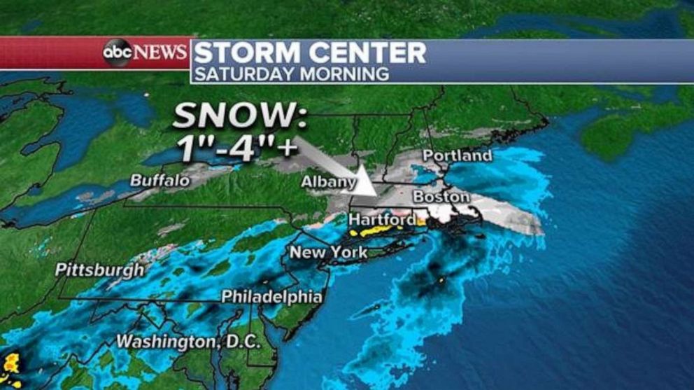
A quick-moving spring snow maker brought several inches of snow to parts of the Midwest and Appalachians on Friday and now it's hitting the Northeast Saturday morning. Locally, more than a foot of snow in southern Iowa Friday. Parts of southern Michigan and the Pennsylvania Appalachians received 6 inches of snow from this system on Friday afternoon.
Radar is showing that snow is falling in parts of the New York Hudson Valley and into parts of Connecticut and Massachusetts Saturday morning. Social media pictures confirm that snow is accumulating in these areas, mainly on the grassy surfaces.
This storm is moving quickly and will be clearing the Northeast later Saturday morning. The snow the fell will melt rather quickly due to the strong spring sun angle, and above freezing temperatures.
Attention immediately turns to a new storm system organizing in the West. Once part of this system reaches the southern Plains and Gulf Coast, another severe weather outbreak begins, including the threat of strong tornadoes. The strong system comes exactly one week after a tornado outbreak brought at least 131 tornadoes to parts of the region.
The most recent confirmed tornado count from the April 12-13 tornado outbreak:
Georgia: 28
Alabama: 24
South Carolina: 21
North Carolina: 16
Mississippi: 15
Louisiana: 15
Texas: 6
Tennessee: 4
Maryland: 2
Florida: 1
Sunday’s severe weather threat includes much of the same region. There is an enhanced risk for severe weather from eastern Texas to South Carolina. It is in this area that there is the highest risk for tornadoes, damaging winds and large hail. Tornadoes, damaging winds, and large hail will be possible in the slight risk area as well.
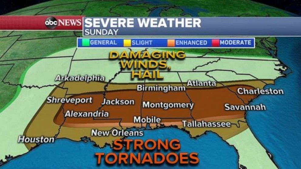
Convection is expected to begin by mid-Sunday morning in eastern Texas, with numerous storms firing as the system moves east throughout the day. There will likely be a day-time tornado and large hail risk for parts of the region on Sunday.
The system will be moving into a region of enough instability to support widespread thunderstorm activity Sunday. Initially in the afternoon hours, the wind profiles may not be conducive enough to support tornadoes. However, in the early evening hours, wind profiles will become more favorable for possible supercell thunderstorms that could spawn tornadoes.
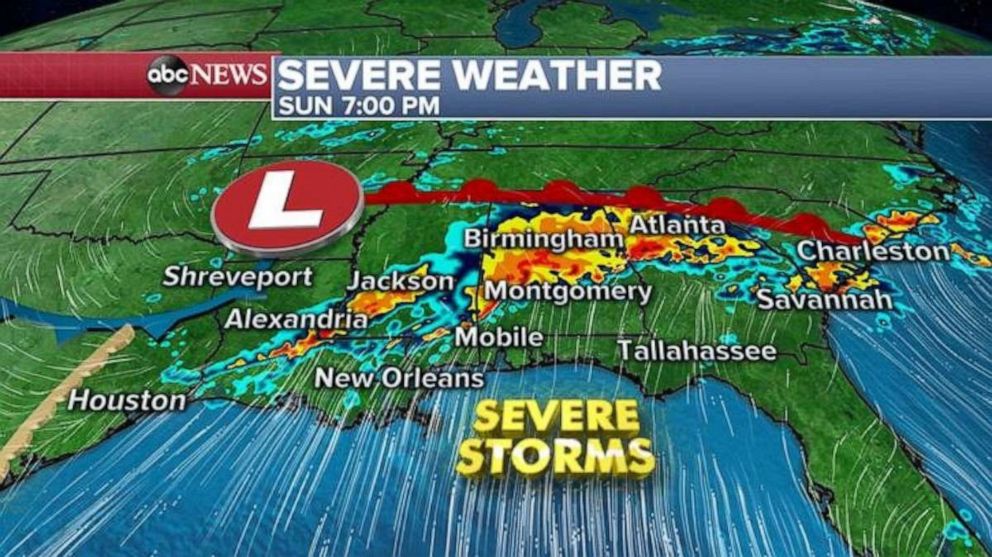
This set up is messier and less clear cut last than Sunday’s outbreak and the confidence on the scope of the greatest tornado risk is not as high. While it doesn’t seem like the threat is as concerning as last weekend, the ingredients are concerning enough to expect tornadoes, damaging winds and hail over a large region.
Additionally, due to the nature of the convection in the forecast, there is more risk for thunderstorms with torrential rain.
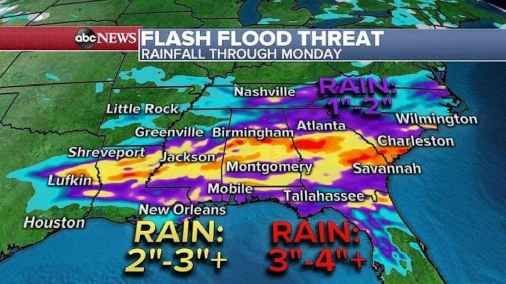
Locally, 3 to 4 inches of rain will be possible in spots, and that could cause flash flooding.
Related Topics

Popular Reads
ABC News Live