Severe weather threat moves into Southeast
The storms produced 22 reported tornadoes in Illinois.
A major storm in the central U.S. is bringing severe weather, flash flooding and heavy snow to the eastern half of the nation. This same major storm was responsible for setting off a tornado outbreak in Illinois on Saturday evening.
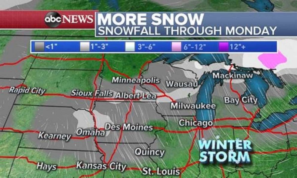
There were 22 reported tornadoes on Saturday, all in central Illinois, near Springfield. On the colder side of the storm, heavy snow continues to fall in parts of the upper Plains and Midwest. Mullen, Nebraska, has received 14 inches of snow; Norris, South Dakota has 8.5 inches; and Hudson, Wisconsin has seen 5.6 inches.
On the warmer side of the storm, parts of the south have seen over half a foot of rain, including 9.71 inches in Pace, Florida, and 6.57 inches in Lillian, Alabama.

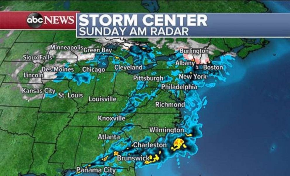
The storm is slowly moving through the central U.S. and will gradually slide east on Sunday. Severe weather and flash flooding remain likely in the Southeast, while heavy snow will be slow to move east across parts of the Midwest. Meanwhile, an icy mix is possible ahead of the storm in parts of the Northeast on Sunday morning.

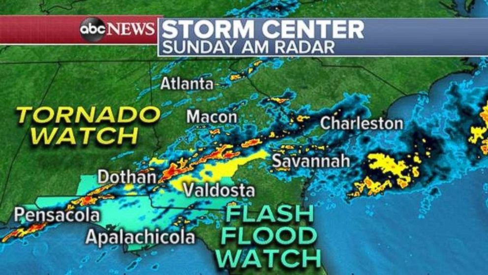
A new tornado watch was issued for parts of southern Georgia and Alabama until 11 a.m. Sunday morning. Additionally, a flash flood watch has been issued for parts of this region, as well as a large part of the Florida Panhandle, due to heavy rainfall rates up to 2 to 3 inches per hour. This could cause flash flooding this morning and some flash flood warnings have already been issued Sunday morning in parts of this region.
The radar Sunday morning is showing numerous thunderstorms moving into the region, with some of the storms showing some weak rotation. This line of storms will slowly slide eastward and extend into the rest of the Southeast from Georgia to North Carolina. A slight risk for severe weather exists in the Southeast with damaging winds and brief tornadoes possible.

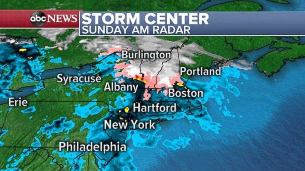
Meanwhile, heavy rain has moved into the major I-95 cities in the Northeast. Away from the coast, temperatures are near freezing, especially in some of the higher elevations of New York, Massachusetts, Vermont and New Hampshire. As a result, a mix of freezing rain, sleet and snow will fall at times through the early morning hours. This could create slick conditions in parts of the interior Northeast. The wintry weather threat will end during the day on Sunday as temperatures begin to warm up.
On the back side of this storm, colder air is supporting snowfall through the remainder of Sunday from Nebraska to Michigan. However, the bulk of the snow has ended, with the heaviest accumulations to come expected in parts of Wisconsin and Michigan.

The bulk of this storm will wind down by Sunday night. However, a glimpse ahead does show another strong storm headed for the West Coast by midweek, which likely will become another major storm to track for parts of the central and eastern U.S. in the upcoming week.


