Snow and rain hit the Midwest as new storm brings snow from the Rockies to the Mississippi Valley
Eastern states will experience a major warm up.
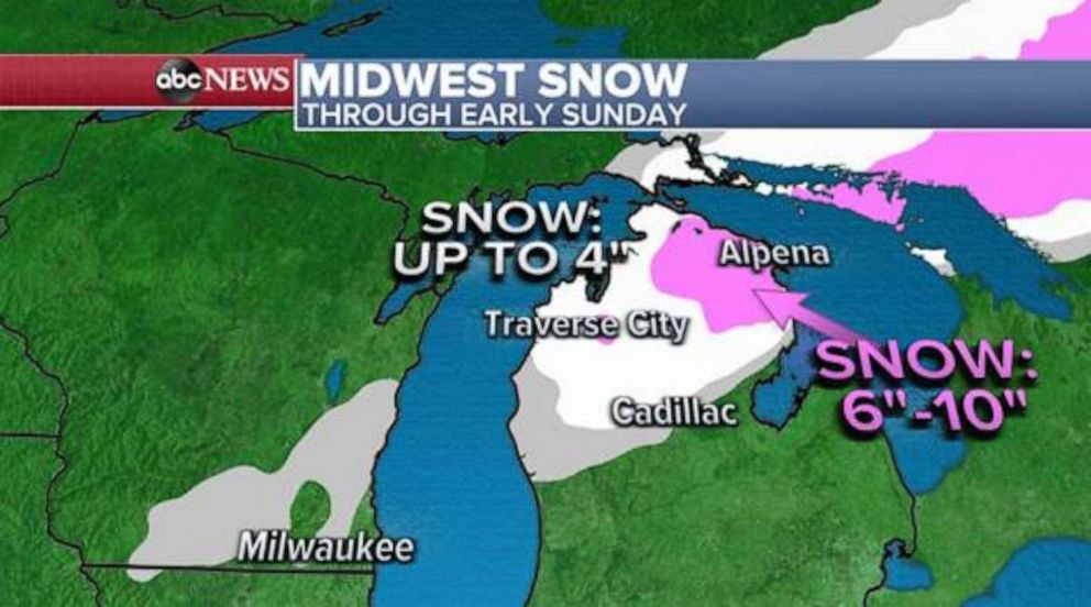
Snow fell Friday night into Saturday in parts of the Midwest from Nebraska to Wisconsin. On Saturday morning, snow and rain continue as the storm moves to the North of the country.
The storm is expected to cross the Lower Peninsula of Michigan later in the day and move into Canada. It will bring windy and snowy conditions across the Lower Peninsula and will leave behind up to 10 inches of snow in some parts of the area by Saturday night.

A storm hit the Pacific Northwest Saturday morning bringing rain and snow to a large part of the country. By the end of the weekend, between 1 to 3 inches of rain may fall along the Pacific Northwest coastline from Northern California to southern Washington state.

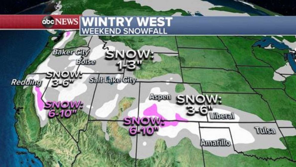
The storm is bringing light snow in the valleys and heavier snow in the eastern mountains of California. Later in the day, it will cross over parts of the Rocky Mountains and eventually end up in the Southern Plains and Mississippi River Valley by Sunday evening.
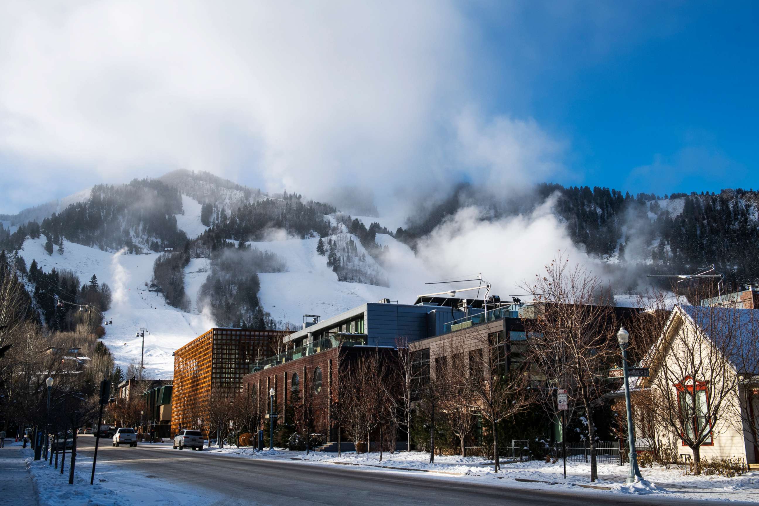
It will likely bring up to 10 inches of snow in the higher elevations of eastern California and the Colorado Rockies, while the valleys will see around 3-6 inches. The storm will also bring a few inches of snow across the Southern Plains from southern Kansas to North Texas

As soon as Saturday's storm departs the Pacific Northwest, a second storm will move in. Parts of the Pacific Northwest will once again see rain and snow to finish off the weekend and kick off the work week.

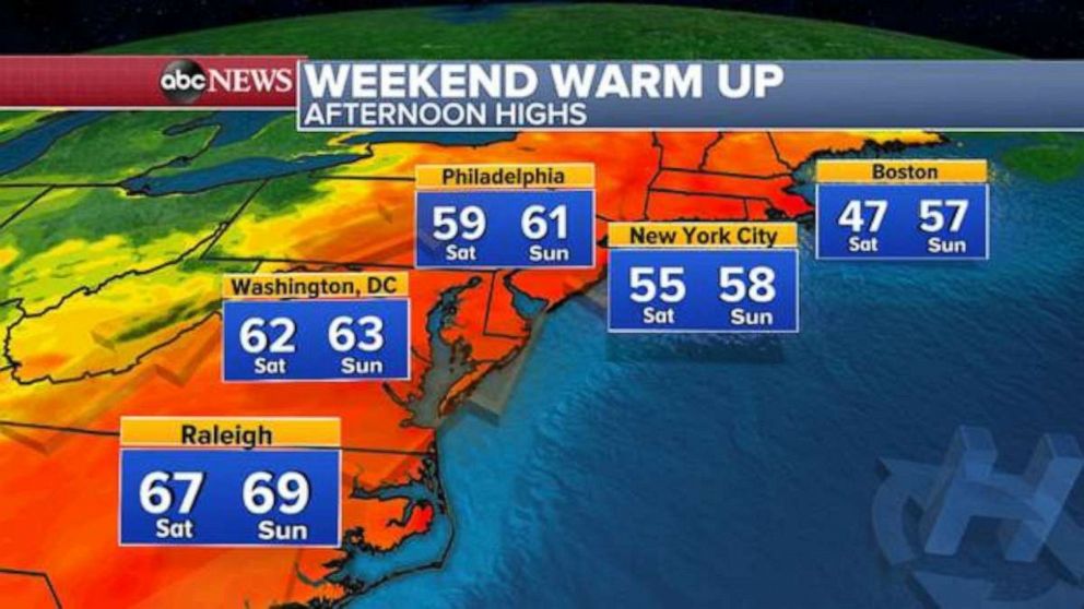
While many parts of the country will see cold weather Saturday, the eastern states will see a dramatic warm up. Afternoon highs from the Carolinas to Philadelphia will be near or above 60 degrees Fahrenheit through the weekend before a return to cooler temperatures on Monday. New York City will approach 60 degrees by Sunday afternoon.
Next week, a storm will likely develop in the West and push toward the Northeast by Wednesday. It has the potential to bring in cold air on the backside by Wednesday evening, which poses the threat for a potentially rare early winter storm in major cities like Washington, D.C., Philadelphia and New York City. This would be significant considering the lack of snowfall over the past few winters in that part of the country.


