Summer storms batter East Coast, while fires scorch West
There are still a handful of flash flood watches across parts of the Northeast.
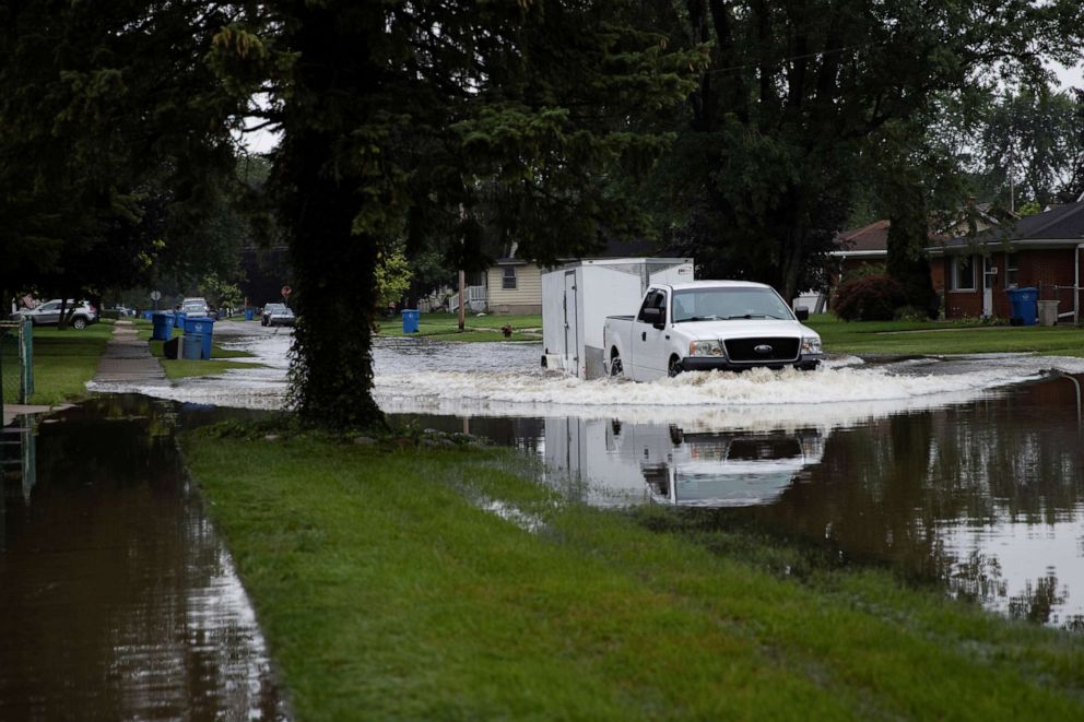
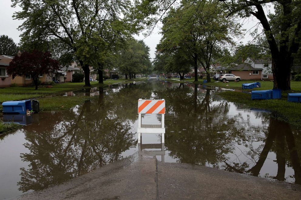
There were over 170 reports of severe weather in the U.S. on Saturday, the majority of them on the East Coast. Out West, fire alerts range from California to Wyoming and wildfires continue to blaze.
In New Jersey, A 58-mph wind gust was reported at Newark Airport. A 78-mph wind gust was reported just off shore of Cape May.
Quarter-sized hail was reported in New York, Massachusetts, New Jersey and Pennsylvania.

Nearly 4.55 inches of rain fell in Stanton, New Jersey, on Saturday. 3.39 inches of rain was reported near the New York-Connecticut border and nearly 4 inches of rain was reported near Buffalo, New York
New York City now has had 9.11 inches of rain so far for the month of July. The average rainfall for all of July is 4.60 inches. The wettest July on record in New York city is 11.89 inches of rainfall.
Boston has had 8.93 inches of rain so far in July. The wettest July on record in Boston is 11.69 inches.
Hartford, Connecticut, has had 8.40 inches for the month of July. The wettest July on record in Hartford is 11.24 inches.
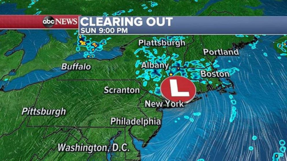
There are still a handful of flash flood watches across parts of the Northeast Sunday. That is because some of the rain is still moving out and could cause some additional flooding. Some more rain showers will linger in parts of New England through the day Sunday. On Monday, there will still be an isolated chance of a shower, but overall the region will be drier and milder.
Temperatures will drop to comfortable levels in the Northeast for the next 48 hours, before the heat builds back up on Tuesday.
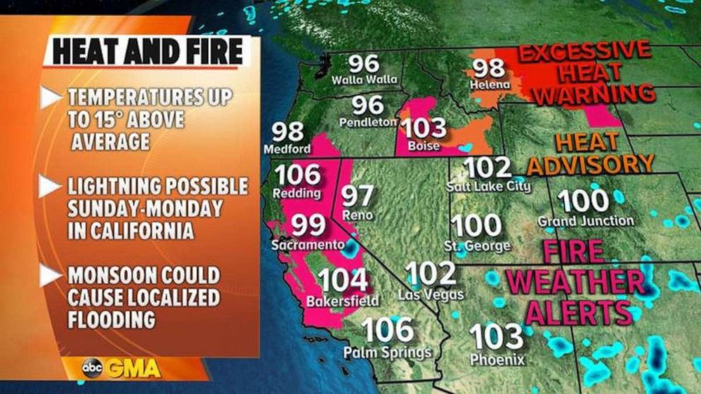
In the West, there are fire alerts from California to Wyoming. In California, monsoon storms could bring dry lightning which could easily start wildfires.
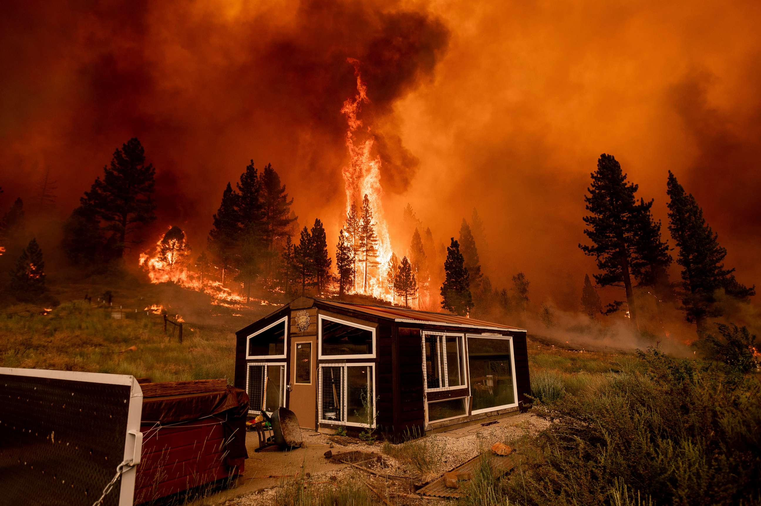
The Bootleg Fire in Oregon is now at 298,662 acres, still 22% contained. The Tamarack Fire in Alpine County, California, which began earlier in July, is at 18,299 acres and 0% contained. This fire rapidly grew this weekend and there are new evacuation orders for parts of the region.
The Beckwourth Complex Fire burning in northern California, near Beckwourth is currently at 105,348 acres, 73% contained. The Dixie Fire burning in northern California's Butte County is at 15,074 acres and 15% contained.
The River Fire burning in Mariposa County, California, is at 9,656 acres and 75% contained. The Snake River Complex Fire burning in west central Idaho, not far from the Oregon state line is at 103,907 acres, 44% contained. And the Red Apple Fire burning in central Washington state at 11,952 acres and 78% contained.
A third of the state of California is now in an "exceptional drought." This is the highest drought level. Three months ago the drought was just 5%.
Red Flag Warnings are in effect from California to Idaho Sunday afternoon. Excessive heat will continue Sunday in parts of Idaho and Montana. The heat will slide eastward this weekend and give some of the upper Midwest hot temperatures including parts of North Dakota which could be over 100 degrees during the first part of this week.
Later today and then again on Monday, monsoon moisture surging up across much of the West will trigger scattered thunderstorms into portions of the region over the next couple of days. Some of the thunderstorms will bring torrential rain and other drier ones will bring the threat of dry lightning.
Afternoon temperatures in southern Idaho and eastern Montan will hit the triple digits on Sunday afternoon. The heat eases tomorrow in Idaho, however much of the eastern half of Montant will see highs in the triple digits yet again. Daily record highs will be possible on Monday in Billings and Glasgow, Montanta.
Flash flood watches are in effect across much of New Mexico, including Albuquerque, and into parts of southern California, west of Palm Springs.
Related Topics

Popular Reads
ABC News Live