Tornadoes possible on East Coast Thursday as excessive heat continues in West
Record highs are possible out West.
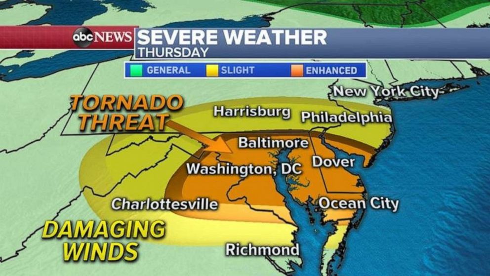
A frontal storm system will move into the Mid-Atlantic states Thursday and will bring a threat for damaging winds and tornadoes from Washington, D.C. to Philadelphia.
Severe storms are expected to blossom in the early afternoon Thursday in western Pennsylvania and West Virginia and move east into the I-95 corridor between 5 and 6 p.m. ET.
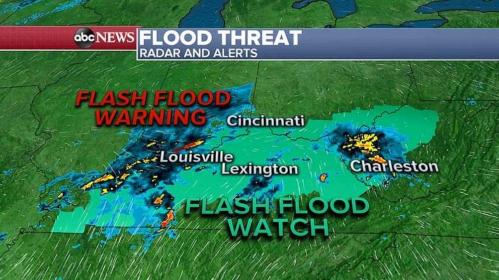
These storms come after more than a foot of rain fell in the southern Plains. Now a flash flood threat moves into Ohio Valley for Thursday.
Rounds of heavy rain will continue to move over the same areas and that could produce flash flooding Thursday morning and into the afternoon. Locally, an additional 2 to 3 inches of rain is possible from Louisville, Kentucky, to Cincinnati and into Charleston, West Virginia.
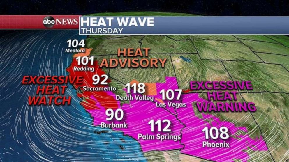
Meanwhile, a heat dome will continue to build in the West, pushing temperatures into the 100s.
Numerous heat warnings, watches and advisories have been issued for Oregon, California, Nevada, Arizona and Utah.
Some cities could even see near-record highs Thursday, including Medford, Oregon and Portland, Oregon.
Over Labor Day weekend, it will get even hotter in the West, as Los Angeles will reach 100 degrees by Saturday, and Las Vegas and Phoenix could see 110 degrees. More record highs are possible in the next few days.
In the tropics, Nana made landfall overnight in Belize as Category 1 hurricane with winds of 75 mph. The biggest threat for Central America and Mexico will be flooding rain, where some areas could see up to a foot of precipitation.
Several systems off the coast of Africa are worth monitoring. They are expected to move east and could become our next named tropical cyclones. Next week, which is the peak of the Atlantic hurricane season, could be very active.
Related Topics

Popular Reads
ABC News Live