Wildfires rage in Colorado, much cooler temperatures expected East
Snow is falling across parts of Montana, South Dakota, Nebraska and Wisconsin.
While there are no red flag warnings and no significant fire weather for the entire U.S. today, plenty of damage has still been done.
The Cameron Peak Fire in Colorado has now burned just shy of 200,000 acres as of Saturday evening and is 62% contained.
The Calwood Fire in Colorado has now burned over 7,000 acres near Boulder while the Mull Mullen Fire is over 175,000 acres and is 55% contained.
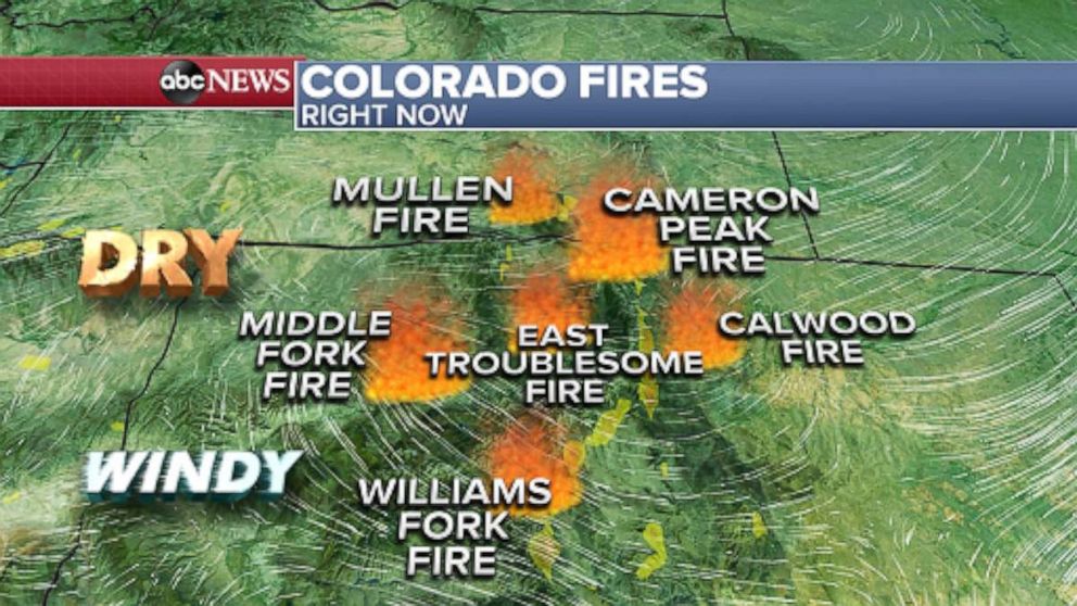
Elsewhere, the Middle Fork Fire is almost 20,000 acres within Routt National Forest while the the Williams Fork Fire is more than 14,000 acres and 26% contained and the East Troublesome Fire is over 11,000 acres and only 5% contained.
Cooler temperatures will aid relative humidity levels, generally keeping them out of critical territory. However, locally strong westerly winds of 30 to 40 mph will return over the higher terrain, above roughly 8,000 to 9,000 feet.
We’re off to a chilly start for much of the East Coast and the Northern Plains this morning.
Frost Advisories are in effect for mountainous areas from Appalachians in North Carolina into parts of upstate New York through Massachusetts. However Boston, New York City, Philadelphia, Baltimore, Washington, D.C. and their respective metro areas are not expecting freezing temperatures this morning.
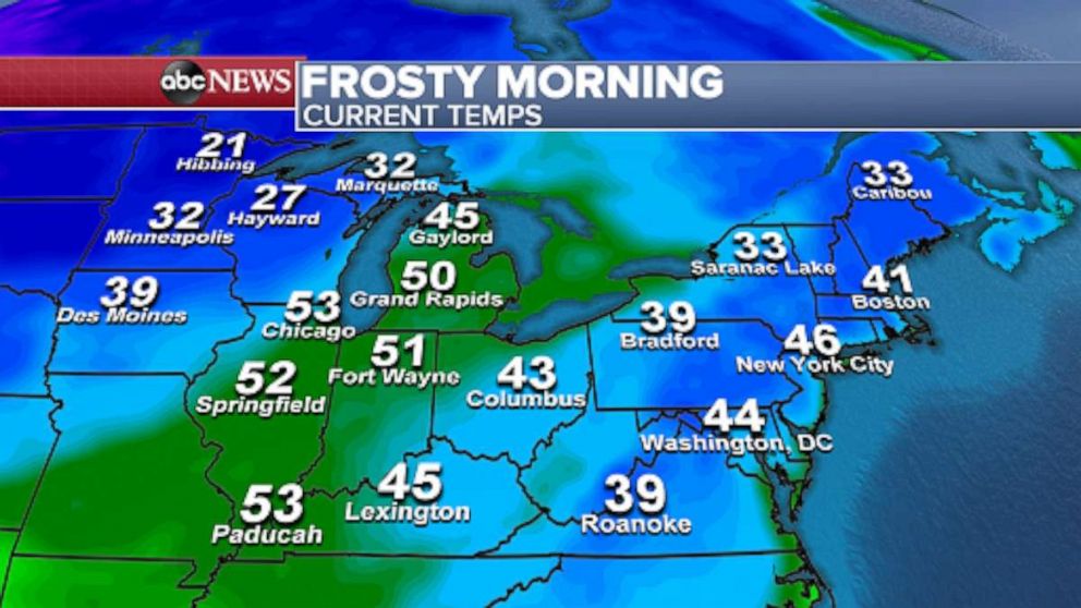
Snow is falling across parts of Montana, South Dakota, Nebraska, Iowa and Wisconsin this morning as a frontal boundary dips southward from Canada. Snow showers are forecast to continue in the northern Rockies and continue through Monday with snowfall amounts of 6 inches possible in the highest elevations of Montana.
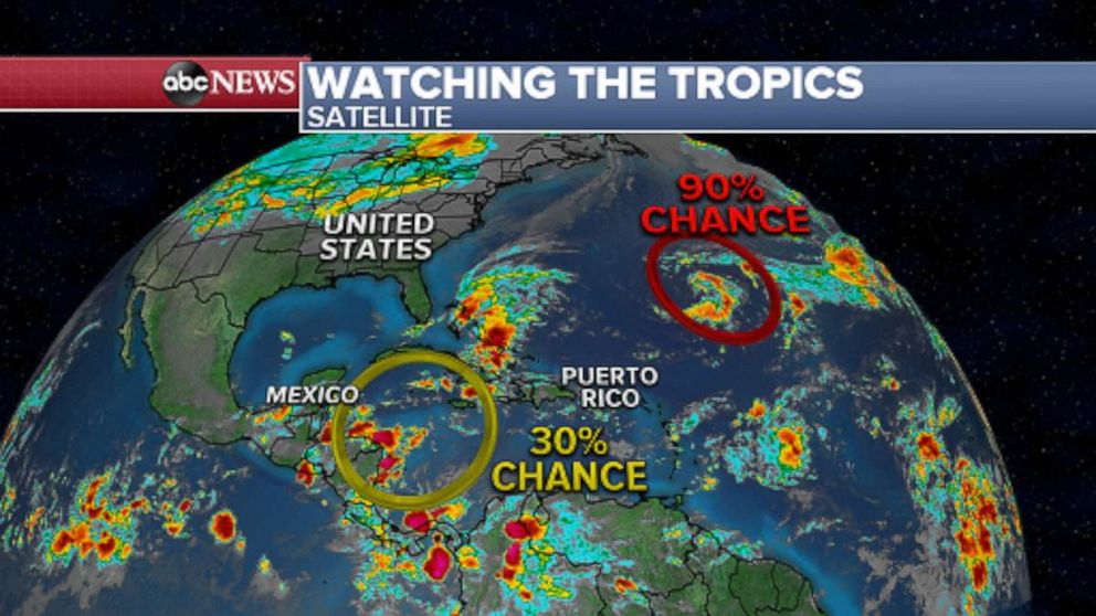
It’s still hurricane season so we’re keeping an eye on the western Atlantic where a disturbance has a 90% chance of development in the next five days.
A second disturbance is expected to develop in the western Caribbean in the next 5 days with a 30% chance of development.
Related Topics

Popular Reads
ABC News Live