Google Street View has vast unmapped spaces. These volunteers are trying to fill in the blanks.
"I see maps as a proxy for what we care about."
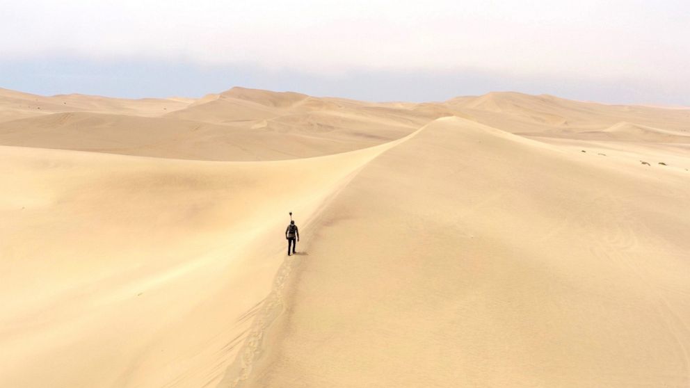
Some people have traversed thousands of miles with cameras strapped onto their backs, cars or even horses to share the streets and back alleys of their homes with the world through Google Street View.
Since Google Street View launched in 2007, 87 countries in all seven continents have been largely mapped out. In addition to helping with transportation logistics, Street View has evolved into a vast human experiment of sorts that has resulted in various unintended consequences -- from solving decades-old cold cases to allowing someone to catch a cheating partner.
Many people from all around also use it to virtually visit places they have never been, or revisit their hometowns and places they used to live.
When Zimbabwe native Tawanda Kanhema tried to visit his hometown, he said he was saddened to find that it was not yet on Google. The same happened for South Pacific islanders Tania Wolfgramm and Wikuki Kingi.
The three joined a growing number of volunteers who decided to make it their mission to put these places on the map.
'This is something that you really take for granted in other places'
"I see maps as a proxy for what we care about, when you look at places around the world that are not mapped there is a match also in terms of those communities in terms of global representation," Kanhema told ABC News.
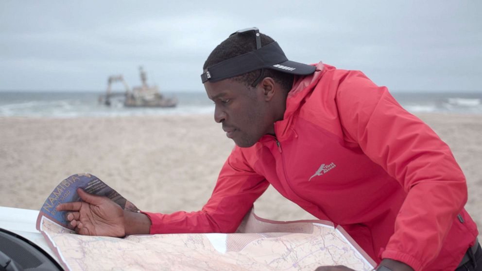
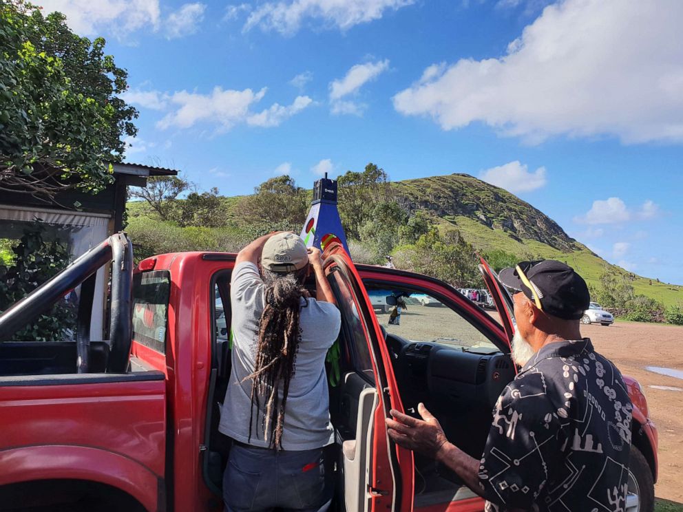
During a 2018 trip home, Kanhema said he visited six cities in Zimbabwe and landmarks such as Victoria Falls to virtually map them all online. He said he drove approximately 2,000 miles so that he could get the highways on there too.
"You will find that communities that are not on maps are more likely to lack basic infrastructure ... I saw maps as a sort of infrastructure," he said. "I wanted this to be about representing these communities but also providing basic services."
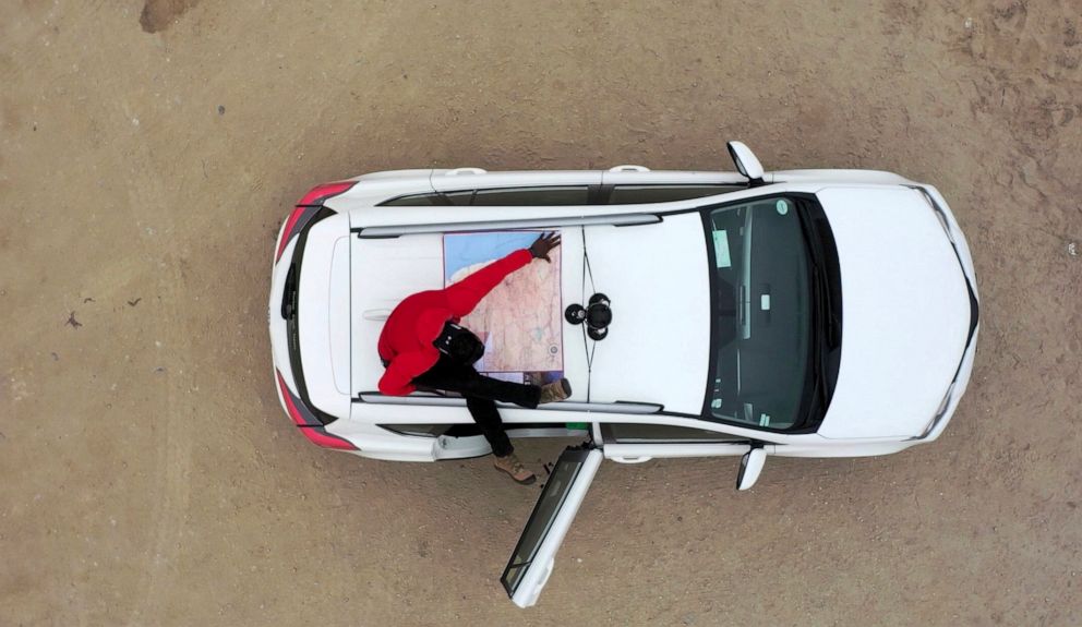
While Kanhema borrowed a camera from Google through its camera loan program, he self-funded the project.

He sees Google's camera loan program as a way of volunteers to help map out "places that would otherwise not get mapped."
"We are basically picking locations that you would think would be at the bottom of the list, when you think of mapping, and going to those places and just bringing those tools to the communities and helping them tell their own stories and improve their representation," he said.
"This is something that you really take for granted in other places but when you go to places that don’t have it you realize the impact that these can have," he added.
For the people of Zimbabwe, he said his project has been received very positively because it helps make maps and driving times more accurate.
It's a 'tool' for the diaspora community to 'reconnect'
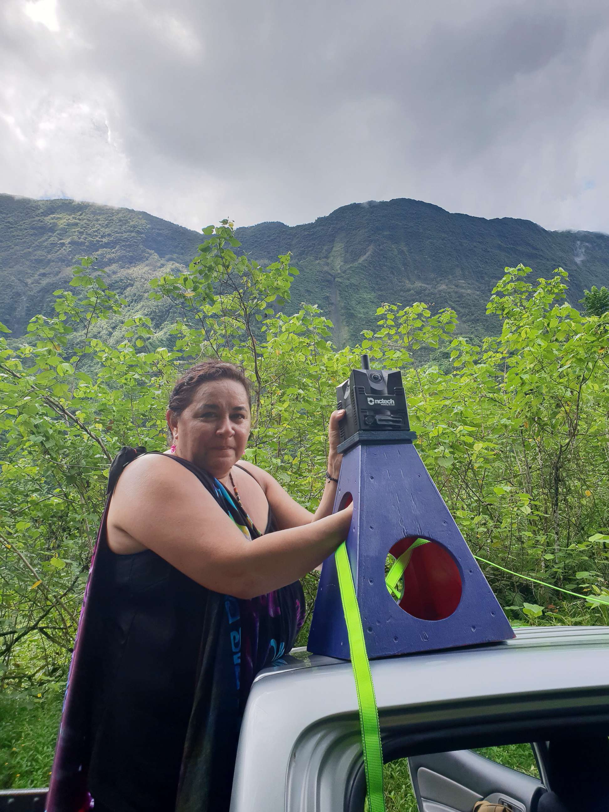
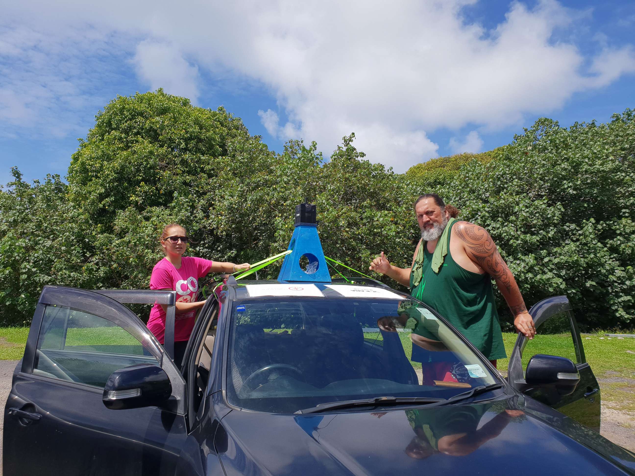
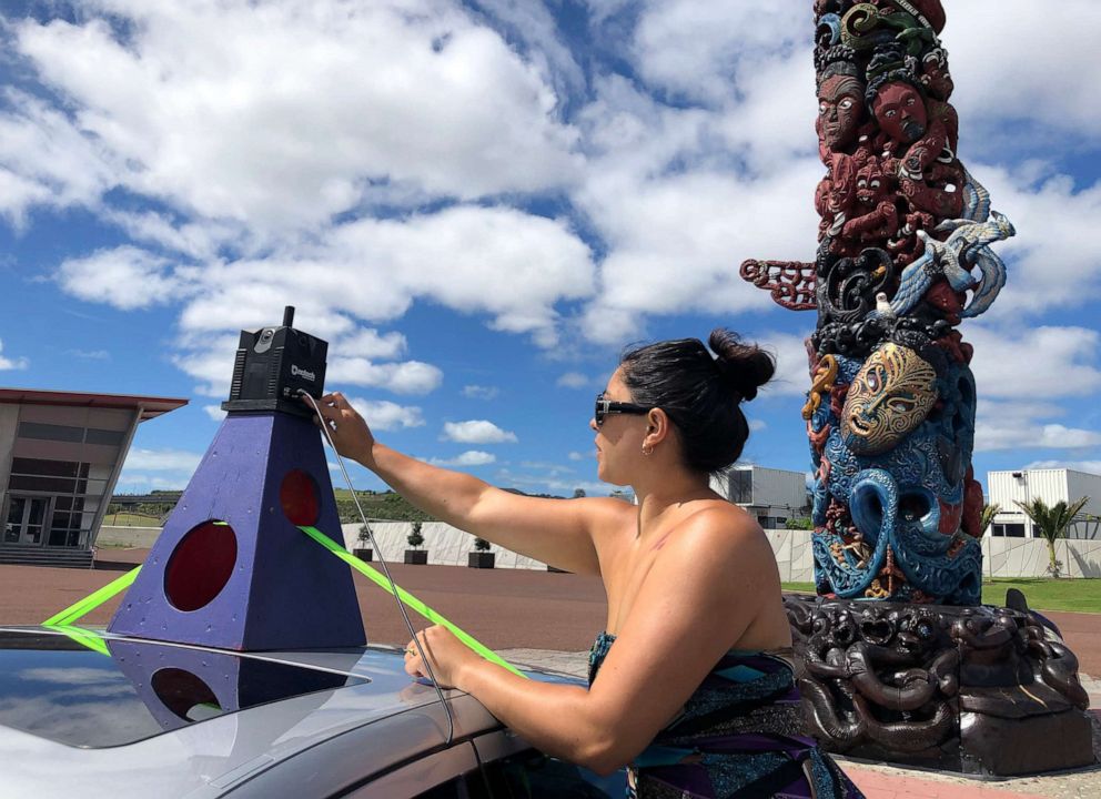
Tania Wolfgramm and Wikuki Kingi, a couple based in Tonga, have been mapping out their South Pacific communities since 2017 and sharing what they've captured with the world on Street View.
"We wanted to put our own islands into Street View, so we started with Tonga," Wolfgramm said. "It just brings the Pacific Islands into the world."
Kingi added, "The small, hard-to-reach places get left out largely around the world as a whole."
"Poor people are kind of left to their own devices, so technology is a way of sort of bridging the gap," he said. "So that's really what sort of got us going."
"Also in terms of the local economy, it's empowering small businesses to be able to show what they can offer," Kingi said.
The pair said they also see it as a service to the diaspora community who leaves the South Pacific every year.
"We came from small islands and now that a lot of our generation and the younger generation are now leaving and moving overseas, and never ever come home, and it's a tool for them to reconnect," he said.
Wolfgramm said there are about 100,000 people living in Tonga, but there are about 200,000 Tongans living overseas.
"Sometimes ... it's really hard for them to come home," she said. "And currently they don't have the luxury of seeing what their villages are like or islands or their homes or you know the beaches in Street View."
Street View allows people to connect from all around the world.
"Street View allows people to connect from all around the world," Wolfgramm added.
Wolfgramm said there was "no precedent" for the work they are doing.
"Google typically sent cars and they’d gone to big cities and things like that, they didn't have experience of doing really small countries in the middle of the Pacific," she said. "We were kind of learning together ourselves with Google, with the technology, with the camera people."
The couple estimates they've traveled approximately 1,000 miles capturing images for Street View.
The response from the community to seeing their home on the map has been "incredible," Wolfgramm said.
"It's been amazing, especially for our diaspora community living around the world," she added. "We've had millions of views."
"It adds to the national pride" to be able share their homes with the world, Tingi said,- and share with friends and family "where their ancestors came from, where they perhaps grew up, where their names come from."
You're opening up a whole new book of culture, it opened up a whole new world.
"You're opening up a whole new book of culture, it opened up a whole new world," he added. "You can't put a value to that."
Popular Reads
ABC News Live
