As April snow moves from Midwest to Northeast, severe weather heads to South again
The South could see more tornadoes this weekend.
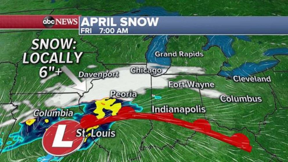
A quick-moving spring snowstorm is moving through the Midwest Friday morning and is on the way to the northeast. Already, there have been snowfall reports for as much as 8 inches along the Missouri and Iowa border Friday.
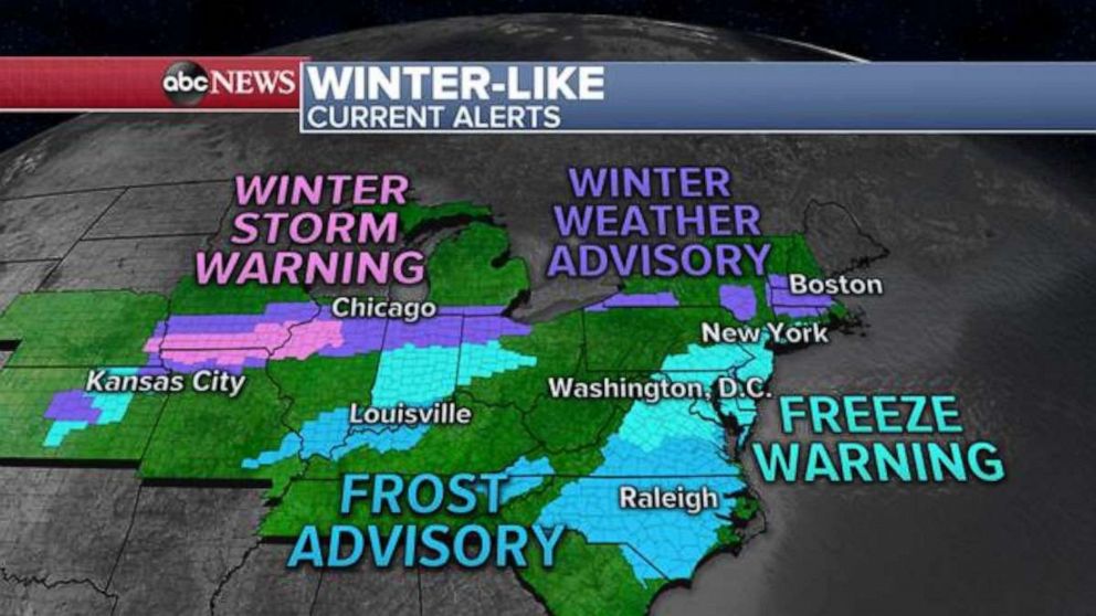
Winter storm warnings are still posted for parts of Iowa, Missouri and Illinois Friday morning. Winter weather advisories have been issued from Kansas City, Missouri, into the northeast, including the Boston metropolitan area.
A well-defined band of snow will move towards the northern half of Illinois, including Chicago, Friday morning. The highest snow totals will be near the Illinois, Iowa and Missouri border, where snow is falling at the coldest time of the day.
As the snow storm moves east, it will be harder for snow to accumulate, and the snow band will ultimately decrease in size.
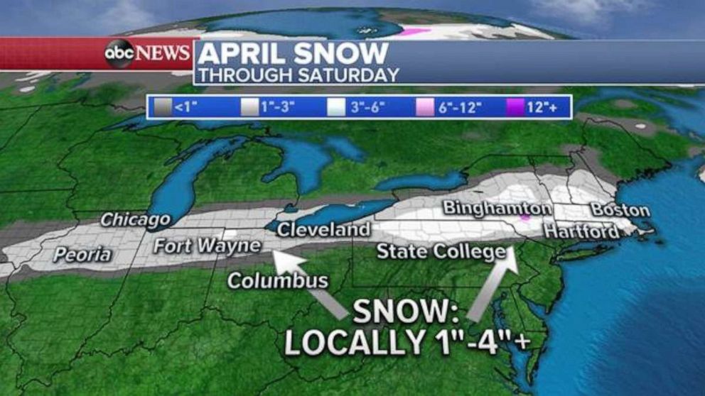
Once this storm reaches the northeast late Friday night and into early Saturday morning, there could be a couple locations, especially in the higher elevations of western Massachusetts and upstate New York, where some enhanced snowfall totals will be possible.
One to 4 inches of snow is expected in the area, with the lower end of that range being the more widespread snow total and the higher end of the range being more localized.
Any essential travel could be impacted by snow from Missouri to the Northeast over the next 24 hours. Additionally, given the time of year, it is more likely that road surfaces will remain mostly wet with slushy and slick spots.
April snow is not uncommon for the Midwest and Northeast, but it is somewhat notable when it does happen. Chicago, for example, recorded its latest trace of snow ever on May 22, 1917.
Unfortunately, attention is immediately turning to the next severe weather threat. Another storm system is moving into California Friday morning with only a couple of showers for parts of the region. However, part of this system will move through the southern Rockies on Saturday and by Sunday when it reaches the southern U.S., it will become a little more organized and begin to interact with the warm air from the Gulf of Mexico.
The result of this will be numerous severe thunderstorms that are forecast from Texas to South Carolina on Sunday. Already there is a large enhanced risk for much of this region and includes places like Jackson, Mississippi, Montgomery and Mobile, Alabama.
It was just last Sunday that a Tornado outbreak occurred in parts of this exact region. The forecast though for Sunday includes all of the ingredients that produce significant severe weather, but aspects of the timing, as well as the way some of these ingredients come together, is a little less clear at this time.
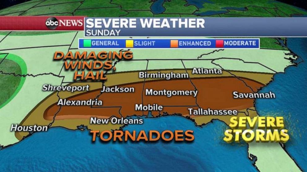
There is enough confidence to be concerned that the next significant severe weather episode will occur – and it will likely include all severe modes, including tornadoes, damaging winds and large hail.
Last weekend’s tornado outbreak yielded at least 105 tornadoes, including 21 in Alabama, 20 in Georgia, 16 in South Carolina and at least 12 in Mississippi. While storm surveys continue, we know that two of those Mississippi tornadoes included two EF4 tornadoes. – including the monster 2 ¼ mile-wide tornado that occurred in Bassfield. That tornado tracked 68 miles, with peak winds of 190 mph. While analysis is still ongoing with this tornado, the latest survey puts this very recent tornado as the third widest tornado on record for the U.S.
Related Topics

Popular Reads
ABC News Live