Critical fire danger continues in Southern California, Nor'easter to hit
There is also a winter storm watch for New England.
A Major Santa Ana wind event unfolded Thursday with wind gusts as high as 95 mph in Southern California. The highest wind gust of 95 mph was recorded in the San Diego county mountains, while in Chino Hills, Orange County winds gusted up to 79 mph and up to 49 mph in Silverado Canyon.
In the L.A. county mountains winds gusted to 85 mph.
As of Friday morning, fires are still burning in Southern California.
The Bond Fire in Orange County has spread 6,400 acres and is 10% contained. The California Department of Transportation said all roads are reopened except for Santiago Canyon Road and evacuation orders have been lifted in Lake Forest, North of Alton Parkway, East of the 241.
The Airport Fire in Corona, which broke out on Tuesday, has spread 105 acres and is 0% contained.

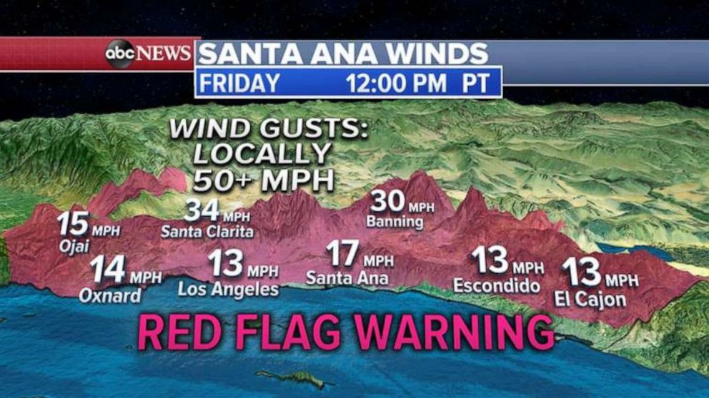
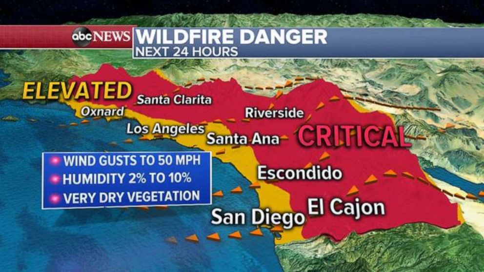
Critical fire weather conditions have been issued for Friday from Ventura County to San Diego County and are expected to continue into Saturday.
Over the next 48 hours, relative humidity will be as low as 2% and winds could gust over 50 mph.
A red flag warning has been issued for Friday and Saturday.
Meanwhile, in the East, a first of the season true Nor'easter will develop Friday night and move through the Northeast Saturday morning and afternoon, bringing heavy rain and gusty winds along I-95 corridor and heavy snow in New England.
Rain will fall from Washington, D.C. to New York City Friday afternoon and will get heavy Friday night into Saturday morning. The rain will spread into coastal New England including Boston Saturday morning. Some flooding is possible.
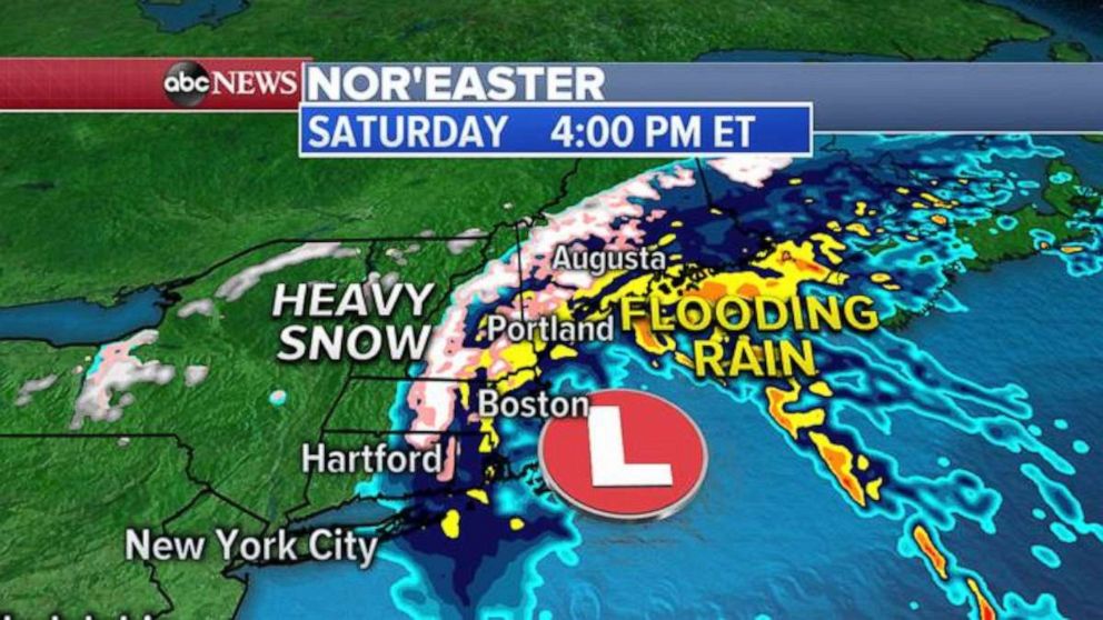
By Saturday afternoon, as the cold air wraps around the strengthening Nor'easter, rain will likely turn to snow from Massachusetts to Maine. A winter storm watch has been posted for Massachusetts, Vermont, New Hampshire and Maine.
Up to a foot of snow may fall in New England and 2-4 inches of rain could fall from the Mid-Atlantic to coastal New England.
Gusty winds of 30 to 40 mph are possible in the coastal areas. In Cape Cod, winds could reach up to 55 mph. A high wind watch has been issued in the area.
Related Topics

Popular Reads
ABC News Live