Dangerous heat continues across US, 26 million people at risk for potential severe weather today
A heat wave is building across much of the eastern half of the country today.
There were 82 reports of severe weather on Saturday including two reported tornadoes.
The two reported tornadoes occurred in Washington County, Minnesota, and Pierce County, Wisconsin.
Some tree damage was reported from Pierce County, Wisconsin, where a tornado was reported.
There were three reports of egg-sized hail including one report of baseball-sized hail in St. Louis County, Minnesota.
A wind gust of 76 mph was also reported at the Standard Rock Lighthouse in Michigan.
A heat wave is continuing to build across much of the eastern half of the country today.
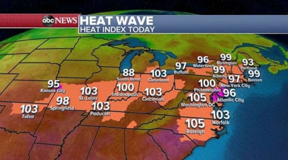
The dangerous and persistent heat has prompted alerts across 22 states this morning including Heat Advisories and Excessive Heat Warnings.
Heat Index Values, or the “Feels-Like Temperature,” are expecting to climb into the triple digits for much of the southern Midwest and southern states today.
Meanwhile, in the northeastern states, Heat Indexes will approach near triple digit values with some places like Philadelphia expected to hit a feels-like temperature of 100 degrees by this afternoon. The heat is not going anywhere.
The dangerous heat should remain in place across the eastern U.S. through at least midweek with New York City potentially hitting triple digit Heat Index Values by Tuesday.
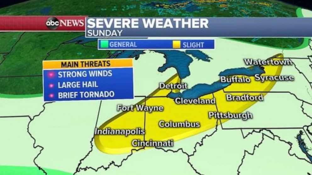
Over 26 million people are at risk for severe weather today in two separate parts of the country.
There is a “slight risk” for severe storms today from Indiana to upstate New York and the main threats here will be strong wind and potentially large hail, along with heavy downpours that may cause localized flooding.
A brief spin up tornado also cannot be ruled out, but conditions don’t look too favorable for a tornado threat.
There is also a “slight risk” of severe storms for later in the day across Midwest from Kansas north to South Dakota where the main threats in this area will be strong winds and damaging hail, along with an isolated tornado.
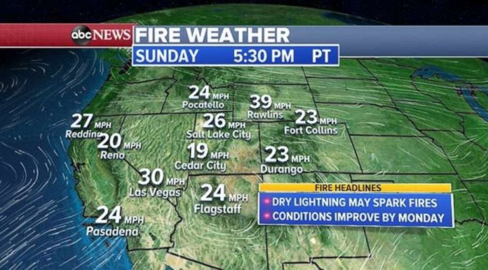
Fire weather is improving as we finish off the weekend, however, there is an area of weak concern from northern California to southwestern Wyoming.
Midlevel moisture is moving into the basin and may lead to some isolated storms.
Since surface conditions have been rather dry and windy, there is a decent amount of tinder that may ignite a fire if struck by dry lightning associated with the potential isolated storms.
Wind gusts this afternoon may reach 30 mph but will calm down overnight into Monday coupled with increasing relative humidity values which will further dampen the fire threat for the start of the work week.
Related Topics

Popular Reads
ABC News Live