Eastern flooding continues as Plains see more severe storms
The eastern part of the United States may see more flooding Wednesday.
Evacuations are in effect this morning in McDowell County, North Carolina, which is experiencing its worst flash flood emergency since September 2004 after Hurricanes Frances and Ivan.
Some areas saw as much as half a foot of rain over the last 24 hours, on top of soggy conditions that have persisted for weeks.
This rainfall isn't from Alberto but rather a moist, tropical flow coming up from the Gulf of Mexico and Caribbean.
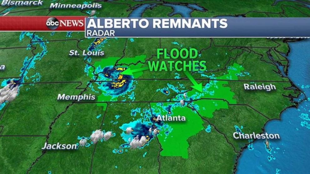
But as much as 10 inches fell in Northern Alabama on Tuesday because of Alberto, remnants of which are moving over the Tennessee and Ohio valleys.
Remnants of Alberto will make their way toward the Great Lakes this afternoon and evening, bringing heavy rain to Chicago, Milwaukee and Grand Rapids, Michigan.
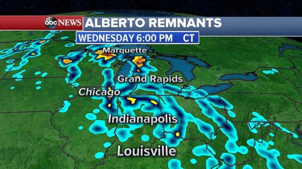
Rainfall totals are expected to be the heaviest from the Ohio Valley and into the Great Lakes, with some regions receiving more than 3 inches.
After today, whatever's left of Alberto likely will migrate north to Canada.
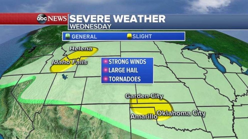
Six tornadoes reported on Tuesday were among at least 180 reports of damaging storms from Minnesota to Texas. Grapefruit-sized hail was reported in Kansas as winds topped 80 mph in Oklahoma.
Similar conditions are expected to persist today from the Rockies into the southern Plains.
Related Topics

Popular Reads
ABC News Live