Flash flood warnings continue for parts of Missouri, Illinois
Severe weather could bring damaging winds and hail.
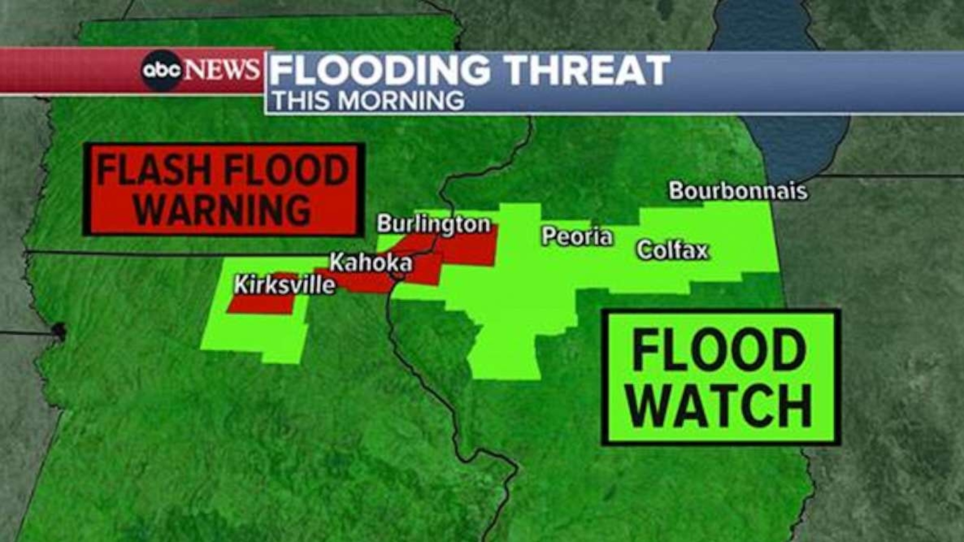
Flash flood warnings continue Saturday for parts of Missouri and Illinois, as severe weather is forecast across parts of the U.S. over the next three days.
More than six inches of rain fell overnight, leading to flash flooding in northeastern Missouri, with water rescues needed for civilians and law enforcement in the Kahoka area.

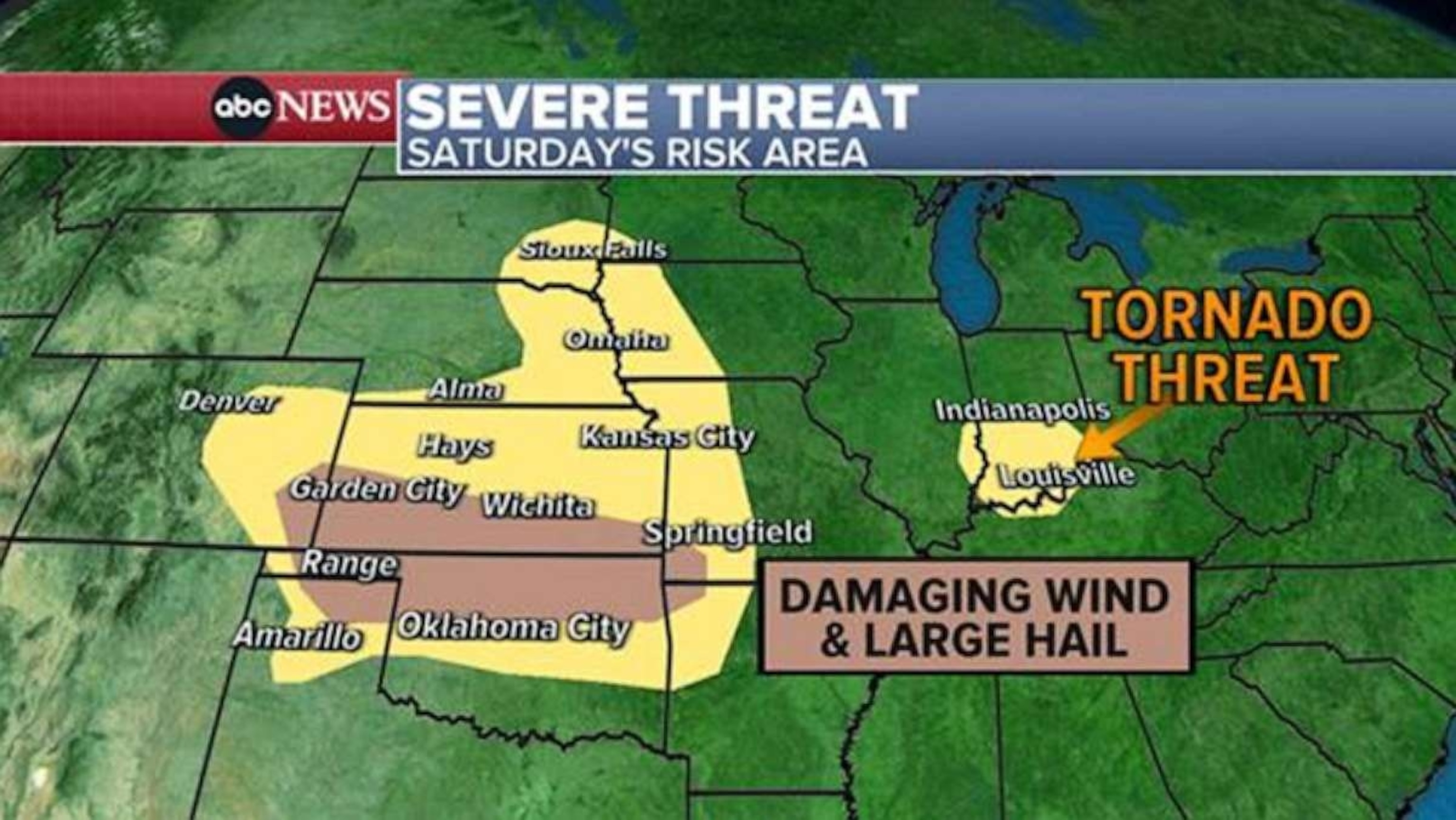
Saturday's storm threat extends from southeastern Colorado to southwestern Missouri where an enhanced risk is in place, mainly for damaging wind. Meanwhile, a chance for a tornado or two is likely in Indiana from Indianapolis to Evansville. Two people were reportedly displaced from their homes with minor injuries due to wind damage in Baring, Missouri, and there was also damage to railroad equipment, powerlines and several homes.
On Friday, there were three reported tornadoes in Missouri, with damage reported to homes near Knoxville and Russellville in Ray County. Power lines were reportedly brought down near Malta Bend in Saline County.

On Sunday, the weather pattern moves to an area from eastern Missouri to western Virginia and North Carolina where again the main threat will be damaging wind. On Monday, the threat for severe weather reaches the East where much of Appalachia will be under the threat for damaging wind and large hail, from Alabama to New York.
Severe heat

Worldwide, the last 32 days have been Earth’s hottest days on record based on preliminary analysis. Since crossing into new record territory on July 3, global temperature has yet to go back below that level.
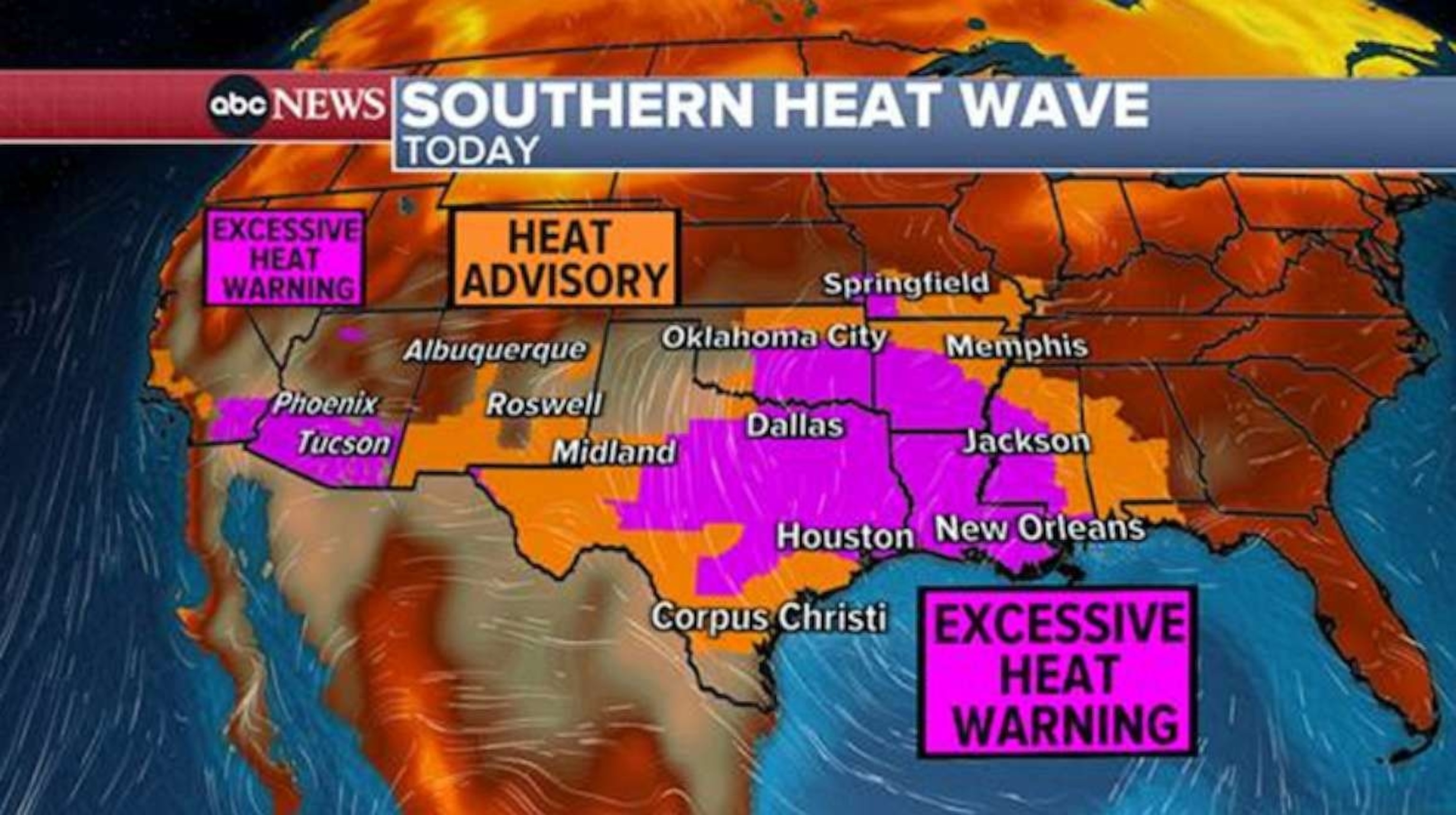
Millions of Americans are under alert for dangerous heat on Saturday, with no end in sight for places in Texas and surrounding areas. Records continue to be possible this weekend in Houston, Austin, Dallas, San Antonio, Albuquerque, Phoenix and Tucson.
The heat index Saturday is reaching well into the 100s from Florida to Texas to Missouri and even the 110s are possible in multiple states.


