Flash flooding and heat in the Northeast, heat wave and wildfires in the West
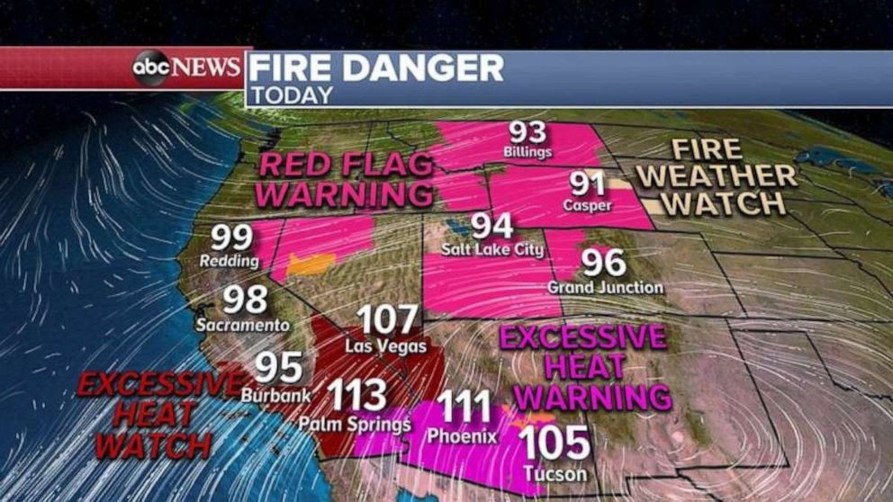
Most western states from California to Montana are now on alert for fire danger.
The Northeast is expected to have another hot and humid day with flash flooding possible.
A Heat Advisory has been issued from New York City to Hartford, Providence and Boston with temperatures near 90 degrees and, with humidity, it will feel like its 90 to 100 for most of I-95 corridor.
Thankfully much cooler and drier air is moving into the Northeast tomorrow and into the weekend.
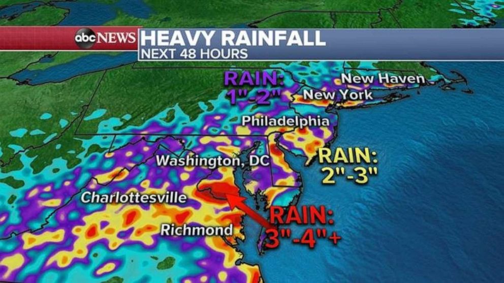
In addition to the heat, a flash flood watch has been issued from Virginia to New York including Washington, D.C. and Philadelphia.
Already this morning, areas just southwest of D.C. have seen 2 to 4 inches of rain with flash flooding reported there.
As a very slow moving cold front stalls in the area, more flash flooding is expected in the Mid-Atlantic states and some areas could see up to 4 inches of rain in a short period of time.

Meanwhile in the West, it’s very dry, windy and extremely hot.
The Grizzly Creek Fire continues to burn in western Colorado and Interstate 70 is still shut down after several communities in the area had to be evacuated on Tuesday.
The wildfire is now up to 3,200 acres and no containment with 211 personal fighting the fire.
Also, a brush fire broke out outside of Los Angeles yesterday, near Chatsworth, right next to freeway 118.
Up to 150 personal were fighting the fire and it was finally under control by the evening hours.
There is bad news for wildfire fighting in the west as more dry, gusty winds are now forecast.
Most of the western states from California to Montana are now on alerts for either fire danger, extreme heat or gusty winds.
Temperatures are expected to hit close to 120 by the end of the week in the Southwest from southern California to southern Arizona.

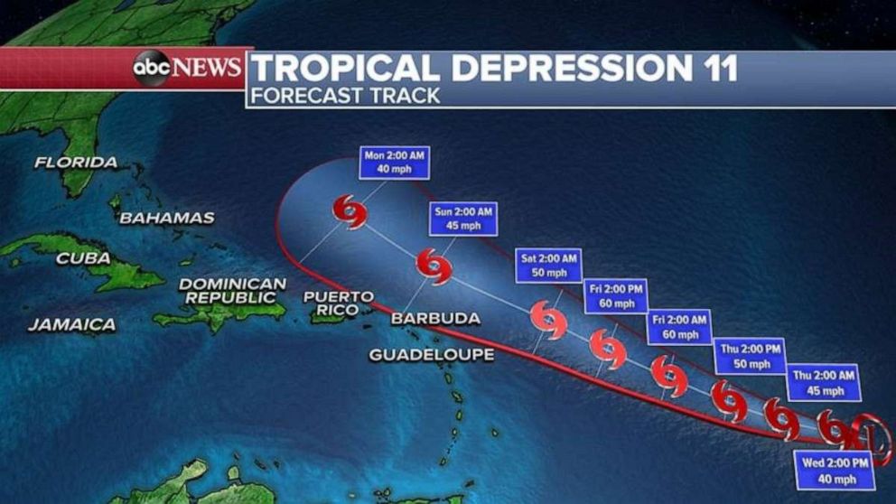
Elsewhere, Tropical Depression 11 could become Josephine later today which would make it the earliest “J” named storm in recorded history in the Atlantic Ocean.
At this time, it is expected to strengthen with winds of 60 mph by Friday morning, but the good news is that it looks like it will miss the Caribbean islands, including Puerto Rico!
After that, conditions are expected to become unfavorable and the system is expected to weaken and possibly recurve and miss the U.S. completely.
It is still worth watching, however, since this has been a very active year in the Atlantic Ocean.


