Flooded Plains, Midwest expecting more rain while much of country warms up
The Missouri and Mississippi rivers have both experienced flooding.
As rivers continue to rise in the central U.S., more rain is on the way as a series of storms move across the country from West to East.
A large storm system will begin to bring more rain to the West Coast and heavy snow to the mountains on Wednesday morning. Gusty winds of 50 to 65 mph are possible.
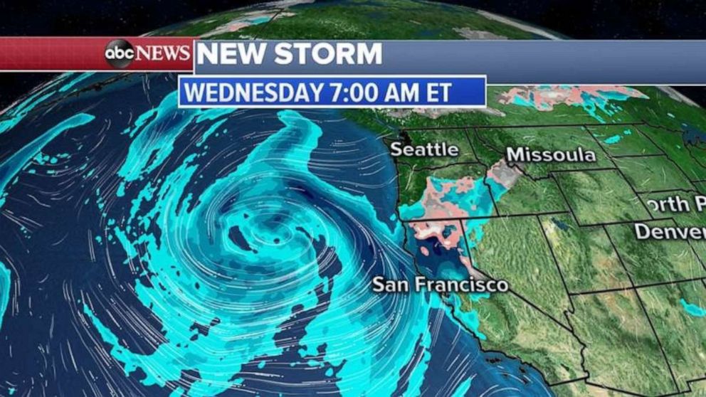
By Thursday, part of that storm will bring rain to the flooded areas on Missouri and Mississippi rivers, while more rain and snow will move onto the West Coast.
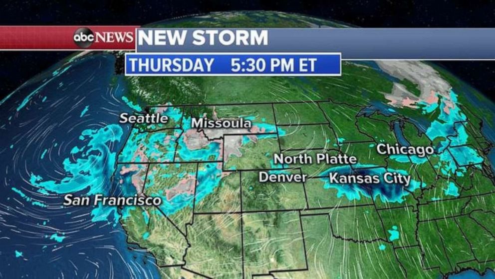
The core of the western storm will move into the flooded areas of Midwest by Friday afternoon and evening, bringing heavy rain from Nebraska to Iowa and Missouri up to Chicago.
There is a good chance that the back side of this storm could be cold enough for snow in the western Plains and parts of the Midwest.
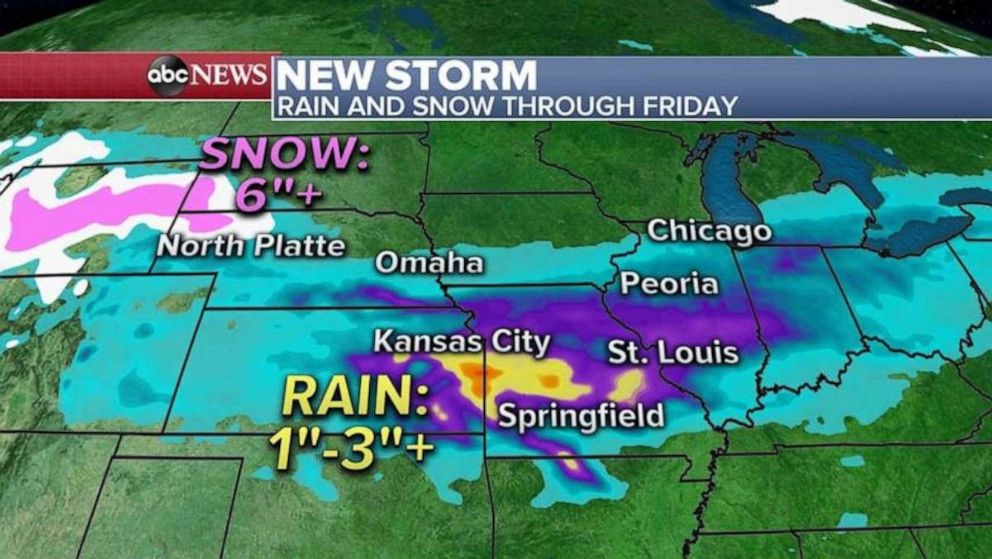
At this moment, the forecast shows for the heaviest rain to fall from Kansas to Missouri and into Illinois, where locally more than 3 inches of rain could accumulate.
Major warmup from Denver to NYC
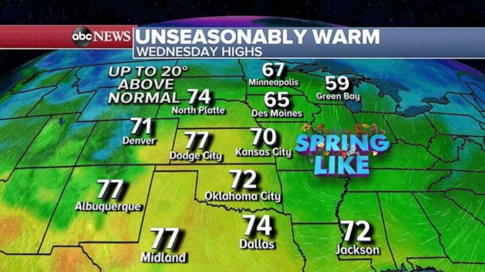
Ahead of the storm, a major spring warmup is on the way for the central U.S. from Denver to Kansas City, Missouri, and north to the Twin Cities. Highs will reach close to 70 degrees, with some areas approaching 80 in central Kansas.
These temperatures are 15 to 25 degrees above normal for late March.
Such rapid warmup is not a good news for the snowmelt in the Upper Midwest, as rivers will rise even faster in the Dakotas, Minnesota, Iowa and Wisconsin.
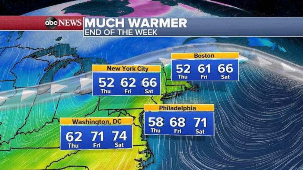
The major warmup moves east as the western storm pushes in that direction. Temperatures could approach 70 degrees by the end of the week from Washington, D.C. to Boston. These temperatures are almost 20 degrees above normal.
