As heat wave ends, severe storms roll into Mid-Atlantic, Northeast
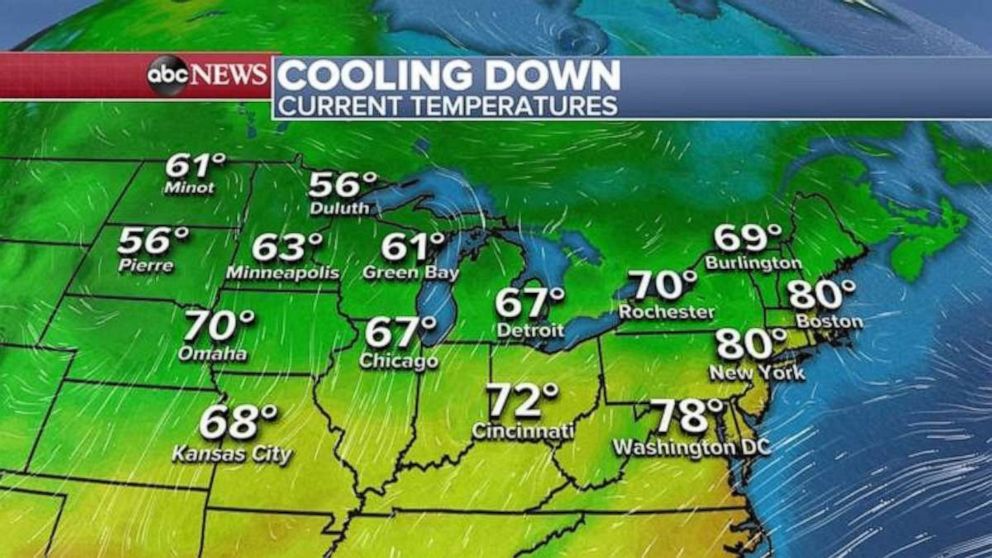
Temperatures will be cooler in the Midwest and Northeast on Monday.
The heat wave has ended in the Midwest and is ending Monday morning in the Northeast as cooler air moves in from the west.
Some of the hottest temperatures this weekend included 100 degrees Sunday at New York City's LaGuardia Airport, which tied a record; 99 degrees in Bridgeport, Connecticut, which broke Sunday's record; and 97 degrees Saturday in Manchester, New Hampshire, also a record.
A slow-moving frontal boundary continues to bring cooler weather to the Great Lakes and Midwest on Monday morning, where the temperature in Chicago is in the 60s -- the coolest it has felt in the last 10 days.
Strong storms are bringing heavy rain, flooding and damaging winds along this frontal boundary.
Over the weekend, hundreds of thousands of people were left without power in the Great Lakes, where winds gusted to 86 mph in Wisconsin on Saturday. There were five reported tornadoes in Wisconsin, as well.
In western Michigan, up to 13.5 inches of rain fell, which could be a state record if verified.
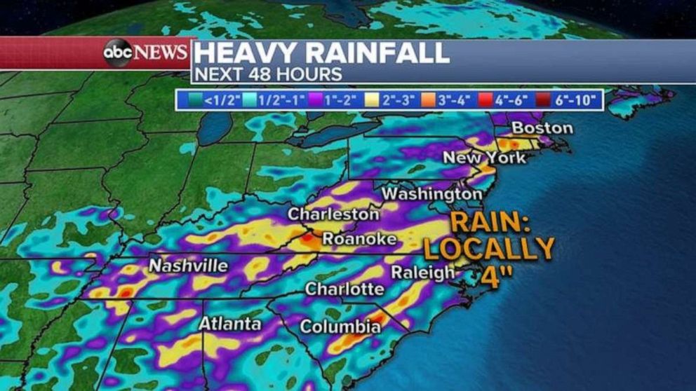
Flood alerts have been issued Monday morning for 10 states from Tennessee to New York due to heavy rain expected Monday afternoon and evening.
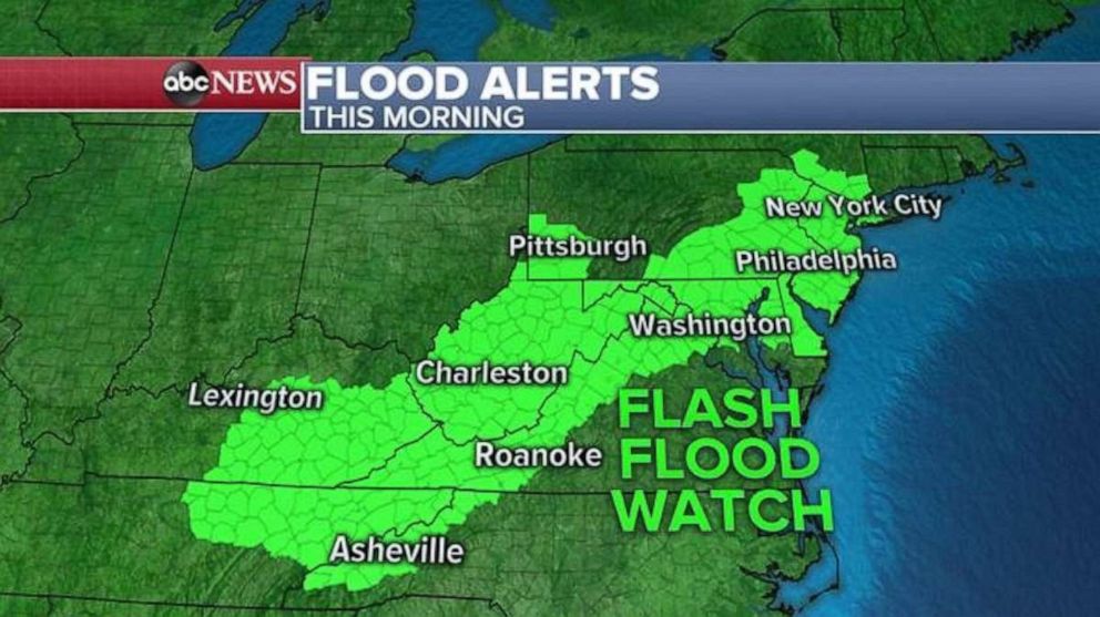
Some areas could see up to 4 inches of rain in short period of time, which could cause flash flooding.
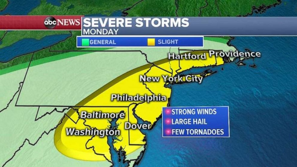
The severe weather forecast Monday afternoon and evening in the Mid-Atlantic and Northeast includes damaging winds, hail and even a small chance for tornadoes from Washington, D.C., to New York City and into Providence, Rhode Island.
Related Topics

Popular Reads
ABC News Live