Heavy rain, flooding on the way for Northeast
The storm will cause a washout for the Northeast on Tuesday.
— -- Heavy snow and winds were subsiding in the upper Midwest on Tuesday morning as the weather/blizzard.htm" id="ramplink_blizzard_" target="_blank">blizzard that dumped over a foot of snow in parts came to an end. But the storm is currently moving into southern Canada and will bring different impacts to the Northeast.
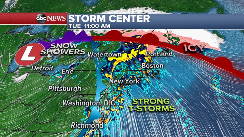
The storm is moving east on Tuesday morning and bringing heavy rain and strong thunderstorms to much of the East Coast. Strong thunderstorms have already brought some large hail to parts of Ohio this morning. A wintry mix, including some freezing rain, will be possible Tuesday morning in parts of northern New England.
Given the chance for very heavy rain and complications from ice jams, flood watches have been posted for parts of the Northeast, including the suburbs of Albany, New York; Hartford, Connecticut; Boston and the city of Buffalo, New York. Flooding is already being reported in the Buffalo area due to ice jam-related flooding. Winter weather advisories have been issued where freezing rain and light snow could be an issue this morning.
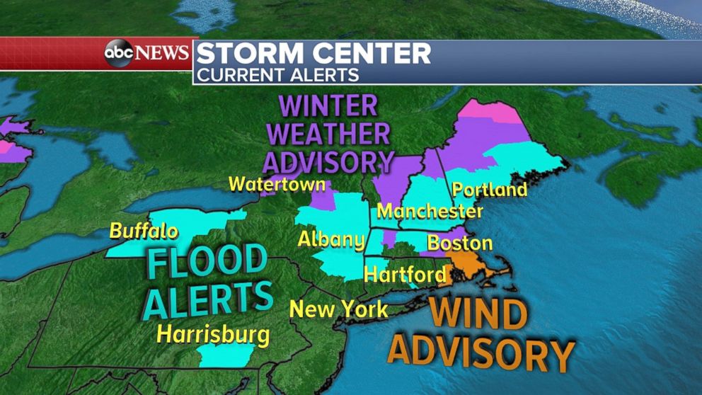
As the storm moves east we are watching the potential for strong to severe thunderstorms in parts of the mid-Atlantic and Northeast. The risk is mainly for damaging winds, especially from North Carolina to New Jersey. A tornado cannot be ruled out in this region either. Strong winds are also possible in parts of southern New England and especially Rhode Island and southeast Massachusetts.
The heaviest of the rain will arrive around mid to late morning from Philadelphia to Boston.
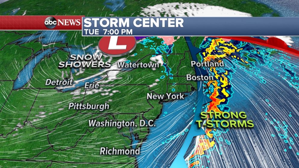
Conditions will start drying out and cooling down later in the evening. By 7 p.m., the line of storms is expected to be moved out to the Atlantic Ocean.
Temperatures set to drop ... then rise
Ahead of the front we are seeing very mild conditions across the mid-Atlantic and Northeast. Temperatures in the mid 50s on Tuesday in New York, and near 60 in Philadelphia and Washington, D.C. However, as soon as the front crosses, temperatures will begin to cool down.
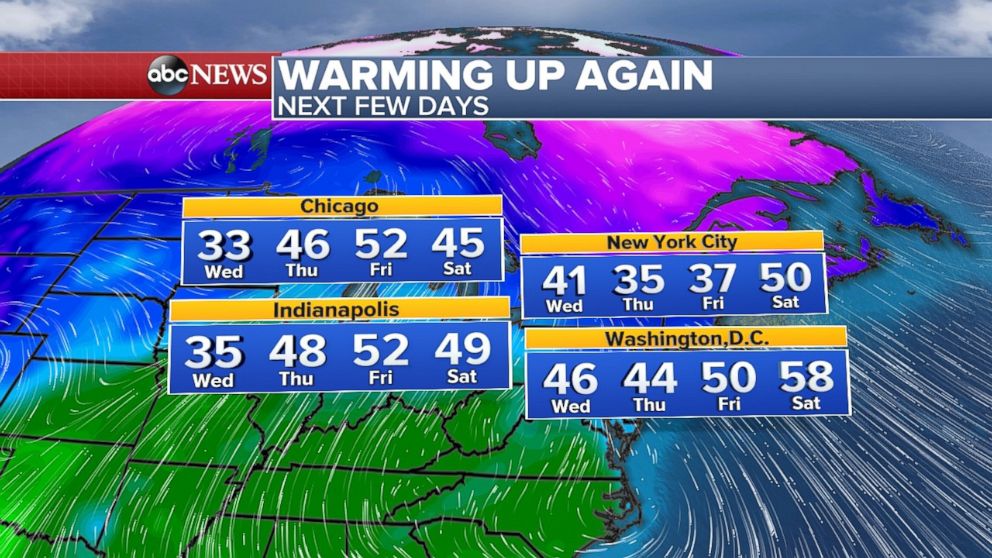
It will feel noticeably cooler by the evening rush Tuesday on the I-95 corridor, and if you are going out for a late dinner, you should bundle up. Nearly a 20-degree temperature change is coming. On Wednesday morning it will be 38 degrees in New York City, right around average for late January.
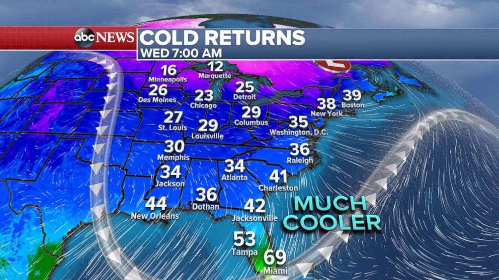
The good news is the colder weather is going to be short-lived. Another period of mild weather is already in sight, and temperatures will be warming above average as we head into the end of the week and this weekend.
Outside of a series of storms in the northwest U.S., the weather pattern is about to quiet down temporarily with much of the rest of the country seeing drier conditions.
