Severe weather outbreak expected from Texas to Ohio, bringing tornadoes, hail, flash flooding

Memphis, Nashville, Louisville, Cincinnati and Indianapolis are most at risk.

April 3, 2018, 3:44 PM

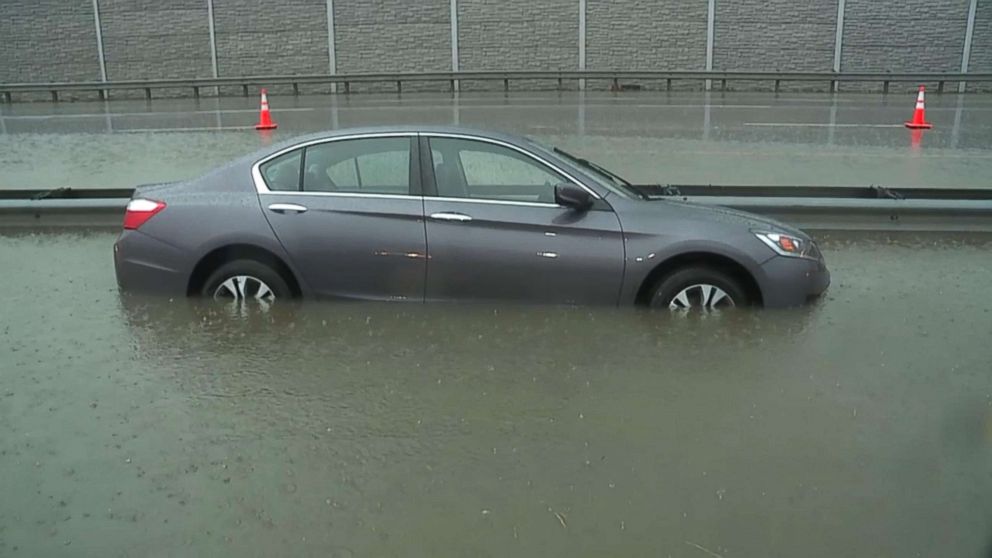
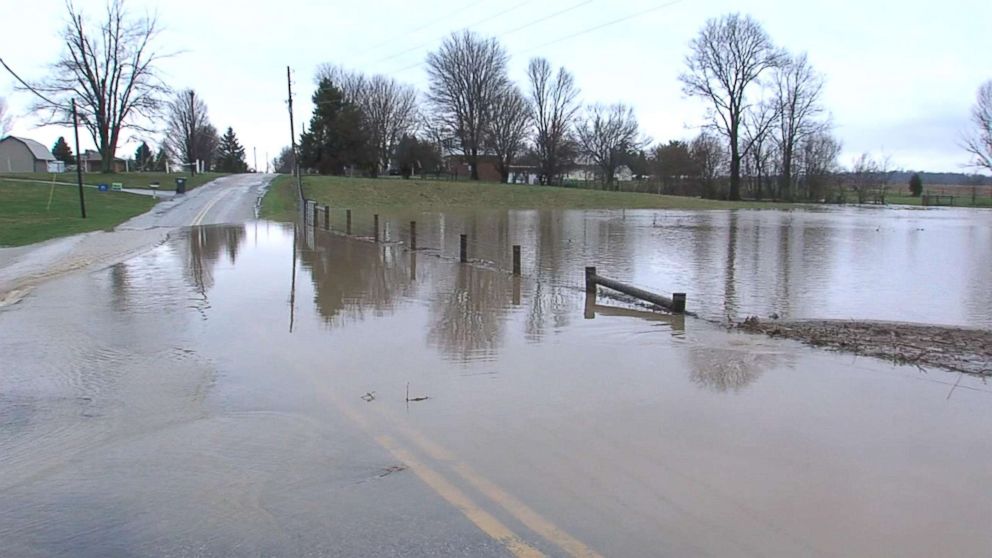
From Houston and New Orleans, up to Indianapolis and Cincinnati, 50 million Americans are at risk for severe weather today, including flash flooding, damaging winds, tornadoes and large hail.

The rain is already underway, with flash flood watches in effect from Indianapolis to Pittsburgh.

PHOTO: With near-record rainfall Tuesday morning, April 3, 2018, while still dealing with melting snow from the previous day, Indianapolis is seeing flooding with road closures and traffic accidents.
Near-record rainfall Tuesday morning, April 3, 2018, while still dealing with melting snow from the previous day, in causing flooding and road closures in Indianapolis.
PHOTO: Near-record rainfall Tuesday morning, April 3, 2018, while still dealing with melting snow from the previous day, in causing flooding and road closures in Indianapolis.
Near-record rainfall Tuesday morning, April 3, 2018, while still dealing with melting snow from the previous day, in causing flooding and road closures in Indianapolis.
Map showing areas where severe storms are predicted for Tuesday night, April 3, 2018.

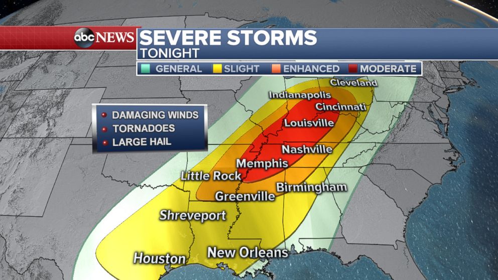
Memphis, Nashville, Evansville, Louisville, Cincinnati and Indianapolis are most at risk for winds and tornadoes from this afternoon until about midnight.

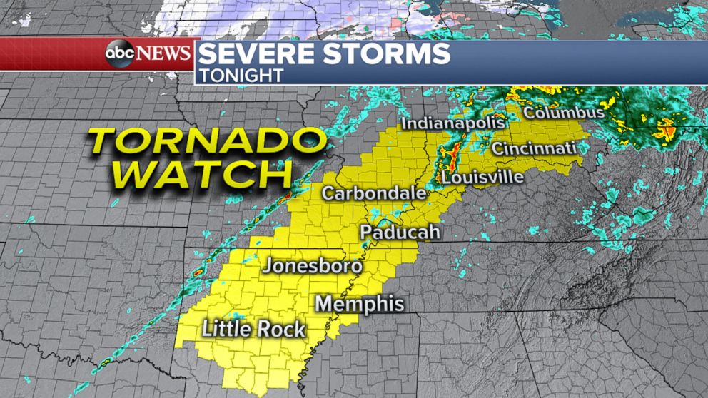
Tornado watches are extending across Arkansas, Tennessee, Missouri, Illinois, Kentucky, Indiana and Ohio through 8 p.m. Winds may reach up to 70 mph.

Map showing areas where tornado watches are in effect for Tuesday night, April 3, 2018.
Map showing areas where storms are predicted for Tuesday night, April 3, 2018.

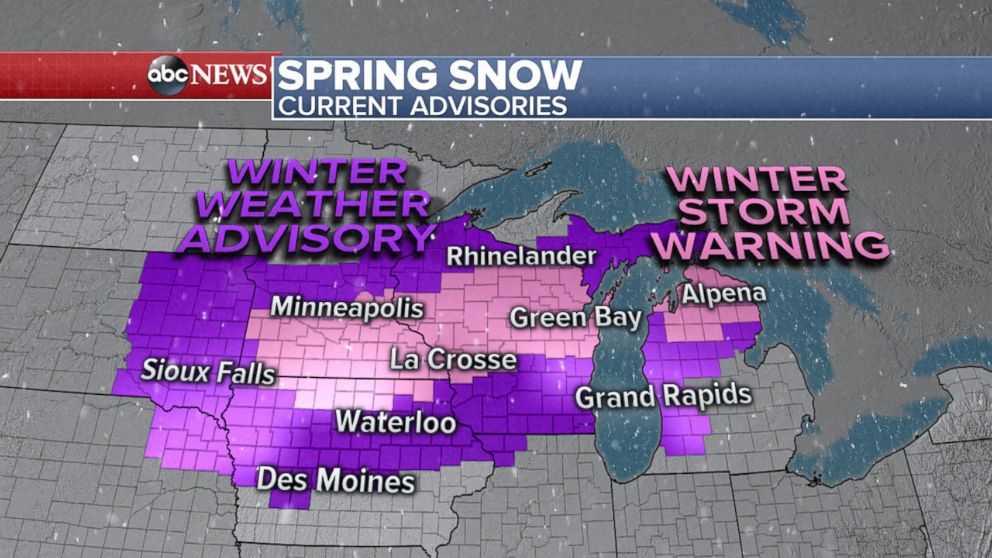
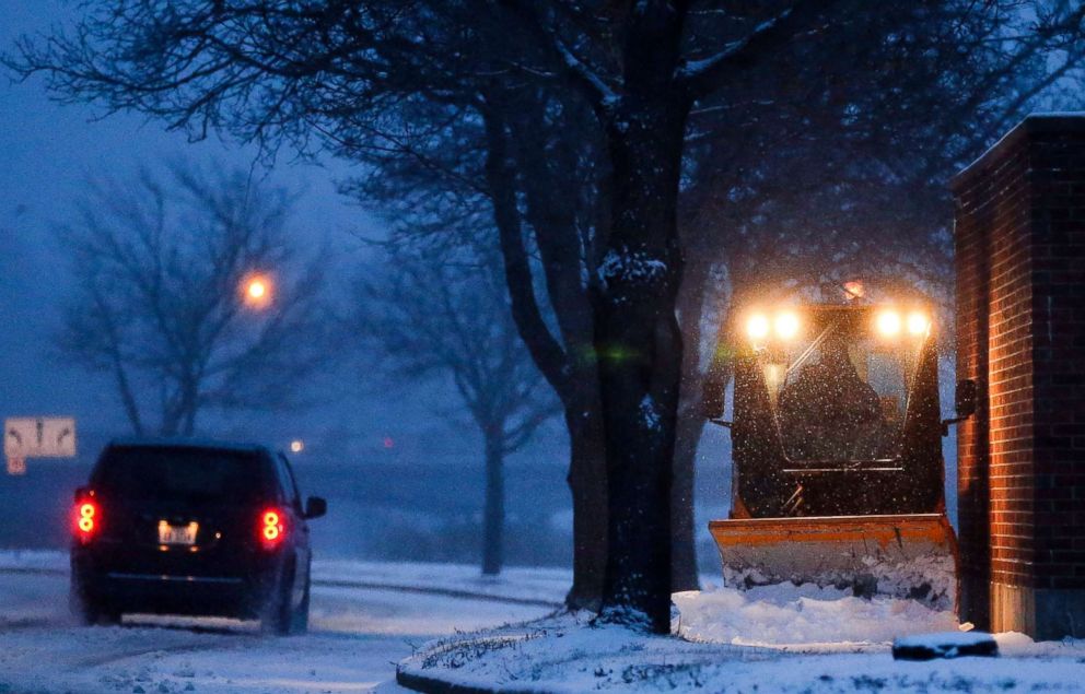
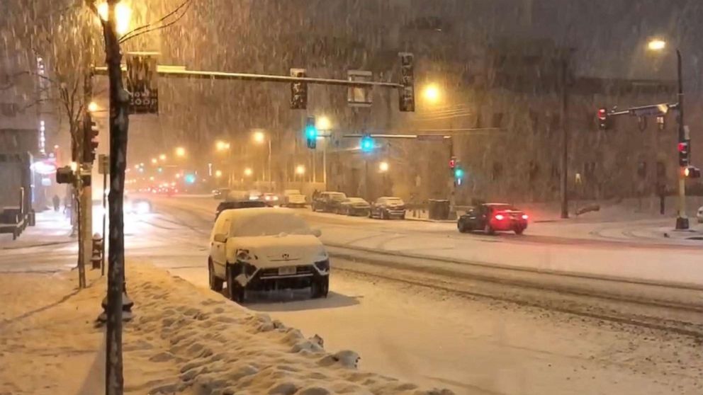
Meanwhile, Minneapolis to Green Bay to northern Michigan are under winter storm warnings as some areas could see up to 1 foot of snow.

Map showing areas where winter weather warnings and advisories are in effect for Tuesday night, April 3, 2018.
PHOTO: A sidewalk along West Silver Lake Drive Northeast is cleared of snow, Tuesday morning, April 3, 2018, in Rochester, Minn.
A sidewalk along West Silver Lake Drive Northeast is cleared of snow, Tuesday morning, April 3, 2018, in Rochester, Minn.
PHOTO: Snow falls Tuesday morning, April 3, 2018, in downtown Rochester, Minn.
Snow falls Tuesday morning, April 3, 2018, in downtown Rochester, Minn.
PHOTO: The storm system is strengthening in the Great Plains and spreading heavy snow from the Dakotas into Iowa and Minnesota early Tuesday morning, April 3, 2018.
The storm system is strengthening in the Great Plains and spreading heavy snow from the Dakotas into Iowa and Minnesota early Tuesday morning, April 3, 2018.

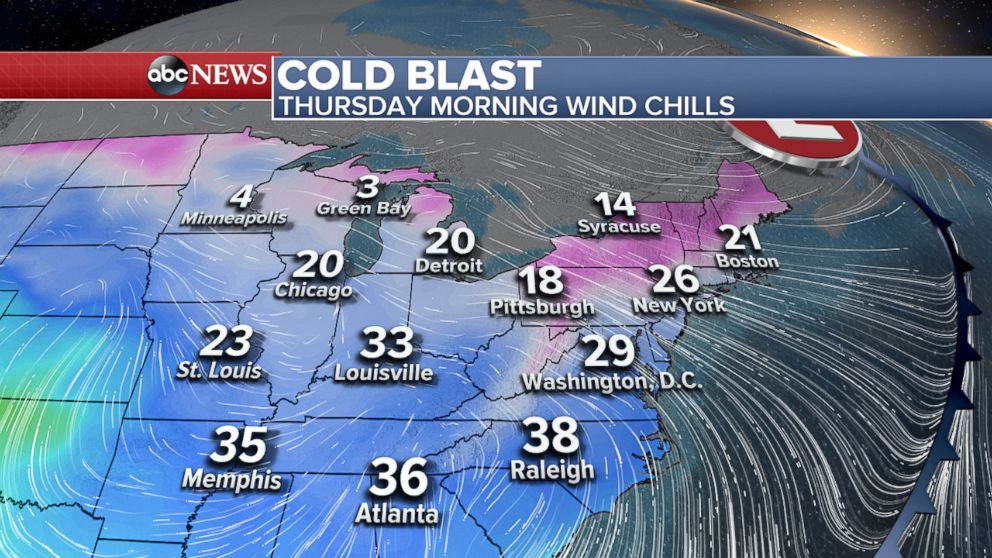
By Wednesday, the snow will be done, and on Thursday, a cold blast will head to the Midwest and East Coast.

Map showing areas where storms are predicted for Wednesday afternoon, April 4, 2018.

The Thursday morning wind chills may reach 3 degrees in Green Bay, 20 degrees in Chicago and 26 degrees in New York.

Even the South will feel the cold. Wind chills may reach 35 degrees in Memphis, 36 in Atlanta and 38 in Raleigh.

Map showing wind chill temperatures are predicted for Thursday morning, April 5, 2018.

Related Topics