Holiday weekend storm brings flooding, car crashes and toppled Christmas trees
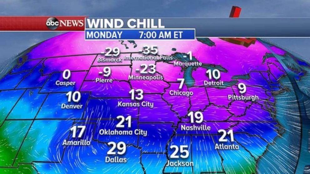
Wind chills will plunge after a front moves through this weekend.
— -- A storm system stretching from the Deep South to New England brought flooding to Tennessee, wind gusts that toppled Nashville's 30-foot-high official Christmas tree, and snow and ice that led to 30 crashes on an interstate in Massachusetts.
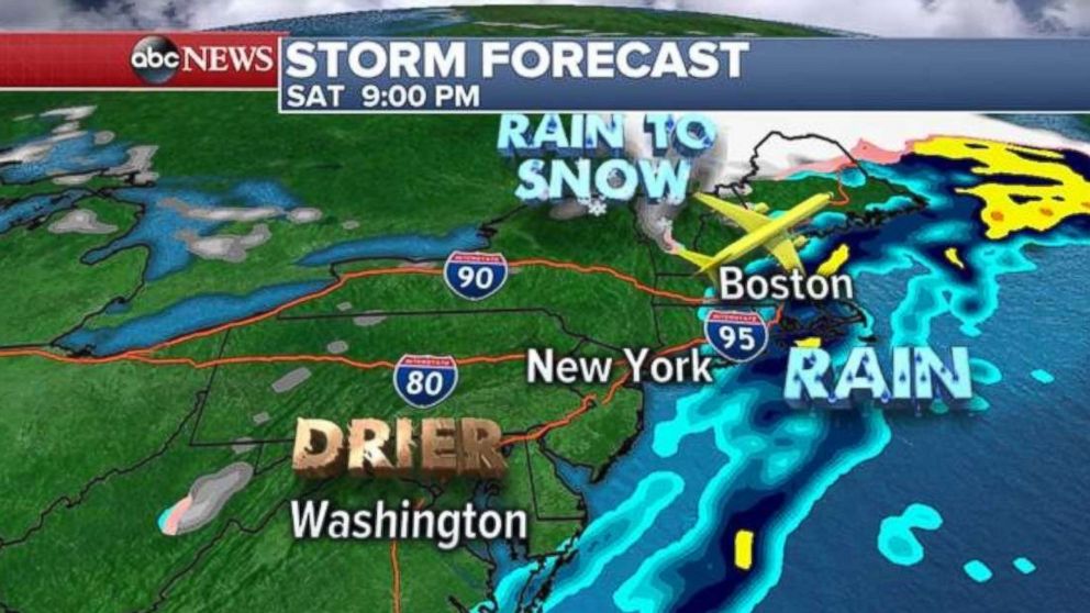
Through Saturday, heavy rain will move through much of the busy I-95 corridor from Richmond, Virginia, up to New York City and Boston. Airports delays will be possible in New York City and Boston.
The storm system is then expected to move off the Northeast coast after Saturday evening.
No serious injuries were reported in the 30 crashes along I-95 in Massachusetts, and the portion of the highway that had been temporarily closed was reopened by midmorning Saturday.
Further south in Nashville, the city's Christmas tree was found toppled over Saturday after wind and rain pounded the Tennessee capital. Winds in the Nashville area were gusting 30 to 35 miles per hour overnight.

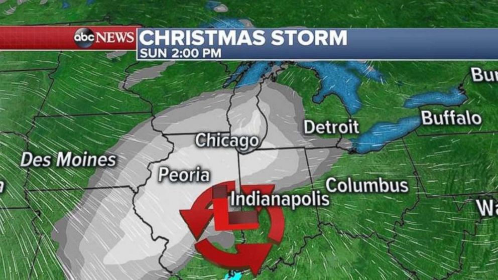
While the Northeast begins to dry out and cool off Saturday night into Sunday, a new storm system will already be developing in the Rockies with more snow on the way.
As the storm moves east from the Rockies into the Midwest, it will bring snow from Denver to Chicago. The heaviest snow will fall south of Chicago where up to 4 inches of new snow could accumulate during the day on Sunday.
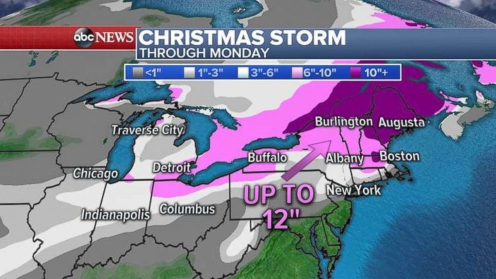
On Sunday night, the storm system will move into the Northeast and redevelop off the Northeast coast, bringing a quick hit of heavy snow to the inland Northeast.
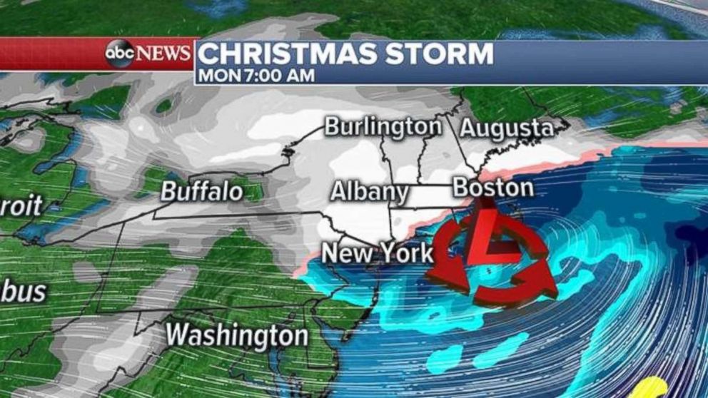
At this point, Philadelphia, New York City and Boston will see a mix of rain and snow, possibly changing to all snow by Christmas morning. A light coating of snow is possible in areas along the I-95 corridor.
Cold blast
Behind the winter storm, a blast of arctic air will invade most of the eastern half of the United States from the Rockies to the Northeast. The wind chills on Christmas morning in the central U.S. will plunge into the teens and 20s, with single digits and sub-zero wind chills further north.
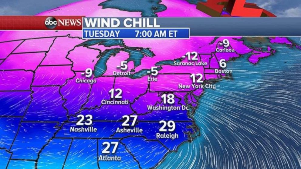
The cold air mass will swing east into the Northeast and the Southeast with wind chills for the day after Christmas into the 20s for Atlanta and Raleigh and teens and single digits from Washington, D.C. to Boston.
FedEx said its express service experienced "substantial" disruptions at its Memphis hub on Friday night, due to severe wind shear from the storm. But the company's spokesman told ABC News, "We expect to make our deliveries despite flight delays caused by strong storms that swept across the country overnight."
ABC News' Morgan Winsor and Chris Barry contributed to this report.
Related Topics

Popular Reads
ABC News Live