Siberian Express Expected to Send Temperatures Plummeting
The Siberian Express Plummets Temperatures this Weekend
— -- After the warmest December on record in United States, parts of the Northern Plains and Midwest are expected to get hit with the coldest air they have seen in two years.
In the Minneapolis-St. Paul metropolitan area, the actual air temperature could stay below zero from Friday night through the the early afternoon hours on Monday; that is almost 60 consecutive hours of negative numbers. Temperatures could be the coldest for the Twin Cities since January 2014.
The Siberian Express, an arctic air mass of Siberian origins, will grip a large chunk of the Upper Midwest, and is expected to send temperatures plummeting to 20 degrees below zero in some areas. Dangerous wind chills could reach 40 degrees below zero, which can be life-threatening for those outdoors for an extended period of time.
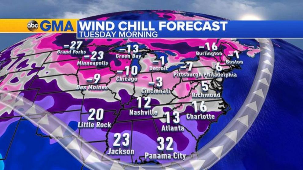
In the Northeast, a coastal storm will move through this weekend bringing rain to the I-95 corridor from Washington, D.C. to Boston, with locally heavy snow in Northern New England. It will be too mild for any snow in the big cities along the coast, but it doesn't stay warm for long. The cold air from the Midwest will moderate a bit and move into the Northeast by Sunday. The coldest morning across the East is expected on Tuesday when the wind chill in Boston could drop below zero and reach single digits from New York City to Washington, D.C.
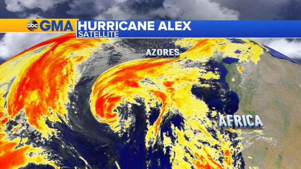
While the Unites States is bracing for this arctic intrusion, parts of the Atlantic Ocean are still in the tropical mode. Hurricane Alex formed southwest of the Azores on Thursday Jan. 14, making it the first hurricane to form in the month of January in nearly 80 years. Typically, Atlantic Hurricane season runs from June 1 to Nov. 30, but this year we already have our first named storm of the 2016 season.
What is interesting about this storm is how it formed and the environment it formed in. Usually, for a tropical system to develop into a hurricane, the water temperature of the ocean has to be 80 degrees or above, but Alex became a hurricane in water temperatures that were near 70 degrees. After comparing upper and lower atmospheric temperatures, it turns out that the combination of unusually cold air aloft and above normal ocean temperatures contributed to the formation.
Per National Hurricane Center, “It is very unusual to have a hurricane over waters that are near 20 deg C (68F), but the upper-tropospheric temperatures are estimated to be around -60 deg C (16F), which is significantly colder than the tropical mean. The resulting instability is likely the main factor contributing to the tropical transition and intensification of Alex.”
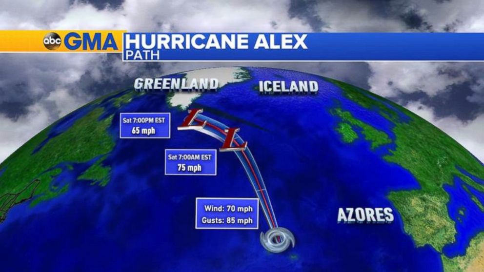
Alex will no longer be any threat to land, aside from residual rain squalls in the Azores as outer bands of Alex pass through on Friday. By Saturday Alex is forecasted to transition into an extra tropical storm as it speeds toward Greenland. The tropical air associated with Alex with bring unusually warm air to the northern latitudes of Greenland, which is usually not seen this time of the year.

Popular Reads
ABC News Live