Spring snow hits Midwest as Plains prepare for severe weather
Chicago received its latest accumulating snow since May 6, 1989.
A quick-moving storm system moved through the Midwest on Saturday bringing spring snow to parts of the region.
As of early Sunday morning, Chicago O’Hare International Airport had received 2.5 inches, the latest accumulating snow since May 6, 1989. Rockford, Illinois, recorded 3.7 inches, its latest accumulating snow since April 30, 1994. Snowfall totals reached as high as 6 inches in western Illinois.
The storm brought some light snow to parts of Michigan overnight, but precipitation was moving into the Northeast early Sunday. Mainly rain was falling from Ohio to western New Jersey, however, some snow is mixing in across parts of western New York state and northern Pennsylvania.
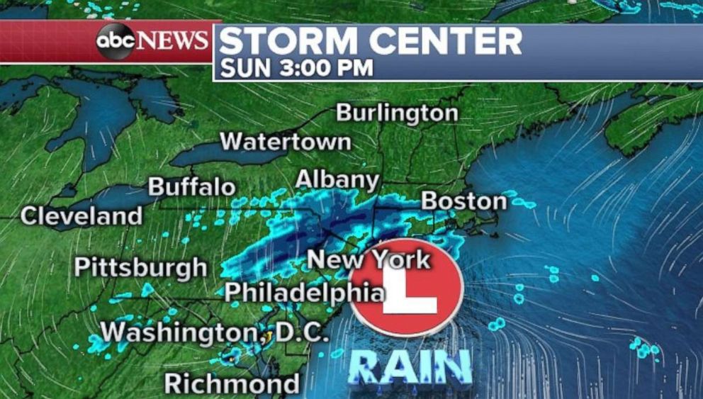
As the storm quickly moves through the Northeast, some occasional mixing will continue for parts Pennsylvania and western New York before it changes to all rain during the morning hours. The storm is not very organized and will struggle to hold together. Therefore, any snow accumulation should be kept to a minimum and rainfall should be little more than a nuisance.
Severe weather, flooding coming for central US
The weather is going to turn quite active in the central U.S. over the next few days, with a complex series of storm systems set to move into the region.
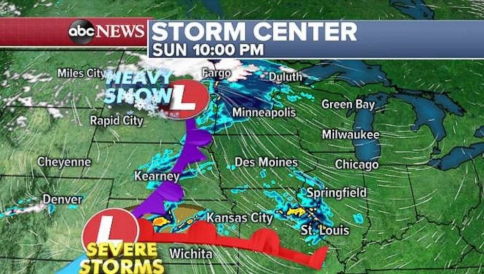
The first storm system will develop Sunday and bring some heavy snow to parts of the northern Rockies, where blizzard conditions are possible in parts of Montana. The storm will also bring snow to parts of North Dakota and northern Minnesota Sunday evening. Meanwhile, on the warmer side of the storm, some strong to severe storms will span parts of Kansas, where damaging winds, large hail and brief tornadoes are possible Sunday night.
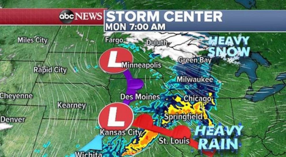
This storm will quickly blossom in terms of precipitation on Monday morning with heavy rain and some strong thunderstorms from Missouri to Indiana. Flash flooding is possible in areas that receive 1 to 2 inch per hour rainfall rates. Meanwhile, more snow is possible in the northern Great Lakes. This storm will move off to the east during the day on Monday, but bringing little impact to the Ohio Valley and East Coast.
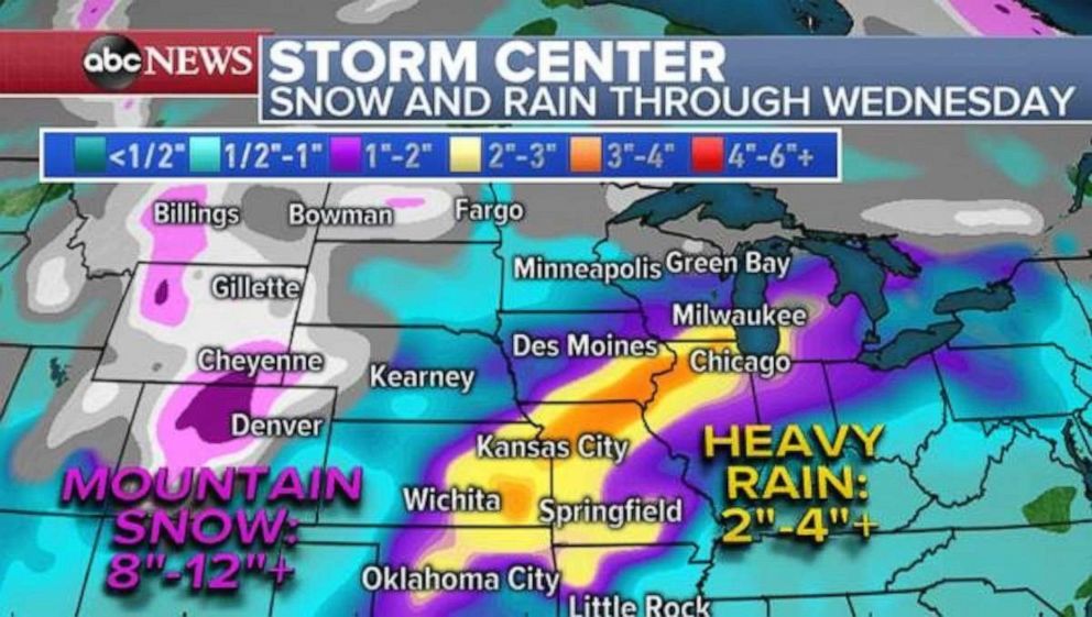
However, another potent and complex storm system will emerge in the Rockies on Monday night and Tuesday. The first impact will be snow across the Rockies, with over 1 foot of snow possible in the mountains west of Cheyenne, Wyoming, and Denver. The system will spread heavy rain across much of the Central Plains on Tuesday before becoming a more organized and pronounced storm by Tuesday night. Heavy rain will overtake much of the Upper Midwest, while on the warmer side of the storm, severe storms will develop from Texas to Missouri.
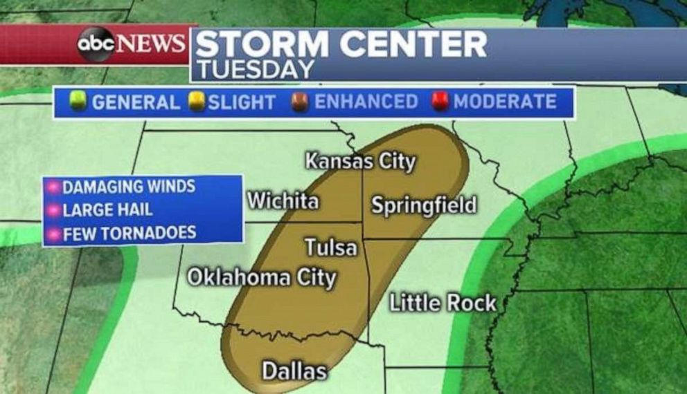
There is a slight risk for severe storms Tuesday from Dallas to Kansas City, also including Oklahoma City and Tulsa. Damaging winds, large hail and a few tornadoes are possible. While it is too early to determine the specific impacts of this possible severe weather, it is worth noting that this threat has some potential to be worrisome. This is the time of year the risk for significant severe weather moves out of the Deep South, and into the Great Plains.
Rounds of heavy rain in the central U.S. through Wednesday will also likely bring over 4 inches of rain, and therefore the risk of flash flooding will increase, especially across parts of eastern Kansas to western Illinois.
