Storm system that brought snow to Pacific Northwest to move winter weather eastward
A 1,000-mile stretch from Chicago to New Orleans may see extreme weather.
Winter-like weather is continuing as the storm system that brought snow to the Pacific Northwest moves east, trailing blizzard conditions with it.
Blizzard conditions were recorded Tuesday in areas near Grand Forks and Bismarck in North Dakota and Montana, after a snowstorm halted traffic and caused widespread power outages in Portland on Monday, which is an unusual occurrence for the city, Oregon state climatologist Larry O'Neill told ABC Portland affiliate KATU, adding that it is likely a sign of climate change.
Now, the massive spring storm is continuing to move east with tornados, hail and damaging winds -- along with more snow in some places that have already been dumped on by frozen precipitation.
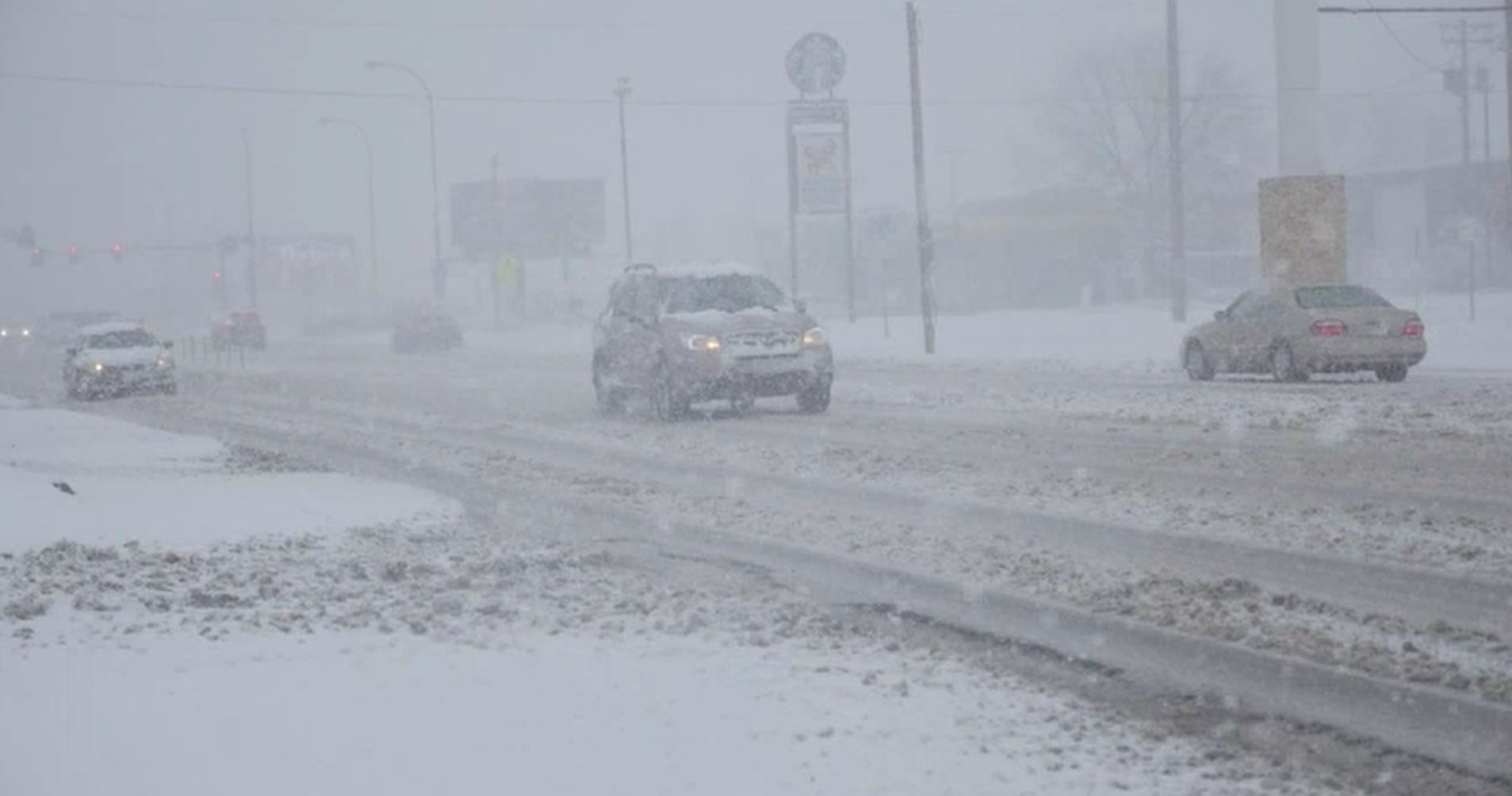
Blizzard conditions will continue in the upper Midwest. North and South Dakota are still expected to get walloped with blizzard conditions after receiving up to 10 inches. Montana has recorded nearly 4 feet of snow so far.
Elsewhere, the severe weather will extend for about 1,00 miles from Chicago to New Orleans.
The volatile climate also extended to the dry Southwest, where the McBride Fire continues to rage in New Mexico. So far, more than 150 structures have been destroyed near Ruidoso, New Mexico, which has prompted evacuations in the area. That fire is 0% contained and had burned through more than 4,000 acres by Wednesday afternoon.
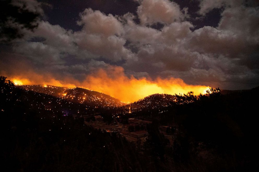
The extreme fire danger is extending from western Texas to New Mexico and into Colorado, where humidity could be as low as 2% and winds gusting up to 70 mph. Red flag warnings have been issued in six states from Nebraska to the Mexican border in Texas for critical to extreme fire conditions.
The biggest threat for strong tornadoes Wednesday are from Indianapolis to St, Louis, Louisville, Memphis, Little Rock and down to Jackson, Mississippi. Half of the states in the continental U.S. are currently under threat of heavy snow, blizzard, fire danger, strong winds and flooding.
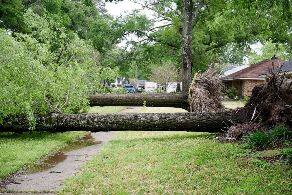
Earlier in the week, the severe weather was so bad that at one point, power had been knocked out for 140,000 customers in Texas and Louisiana alone due to a line of tornados that rocked the regions. A tornado watch has been issued Wednesday for portions of Texas, Louisiana, Arkansas, Missouri and southern Illinois through Wednesday afternoon -- a continuation of record-breaking tornado activity recorded in the U.S. last month. Memphis to Little Rock were in the bullseye of the tornado activity on Wednesday.
ABC News' Melissa Griffin contributed to this report.
Related Topics

Popular Reads
ABC News Live