Above average temps for Northeast and Midwest, while Northwest braces for more snow
The Northwest, meanwhile, is bracing for more snow.
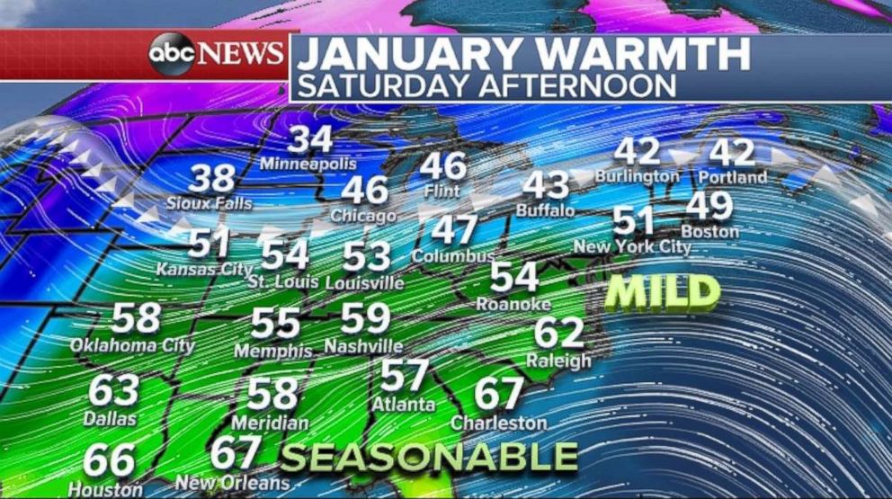
— -- There's good news for residents of the eastern half of the country seeking a bit of a respite from winter-like weather: Saturday's temperatures will be mild, if not above average.
Temperatures in the Midwest and Northeast will be nearly 10 to 20 degrees above their average temperature. Temperatures nearing 50 degrees are possible Saturday in New York City, Boston, and Chicago. Across the South, Saturday's temperatures will be seasonably warm with temperatures nearing or in the 60s. Sunday looks to be mild as well, but for the Northeast only.
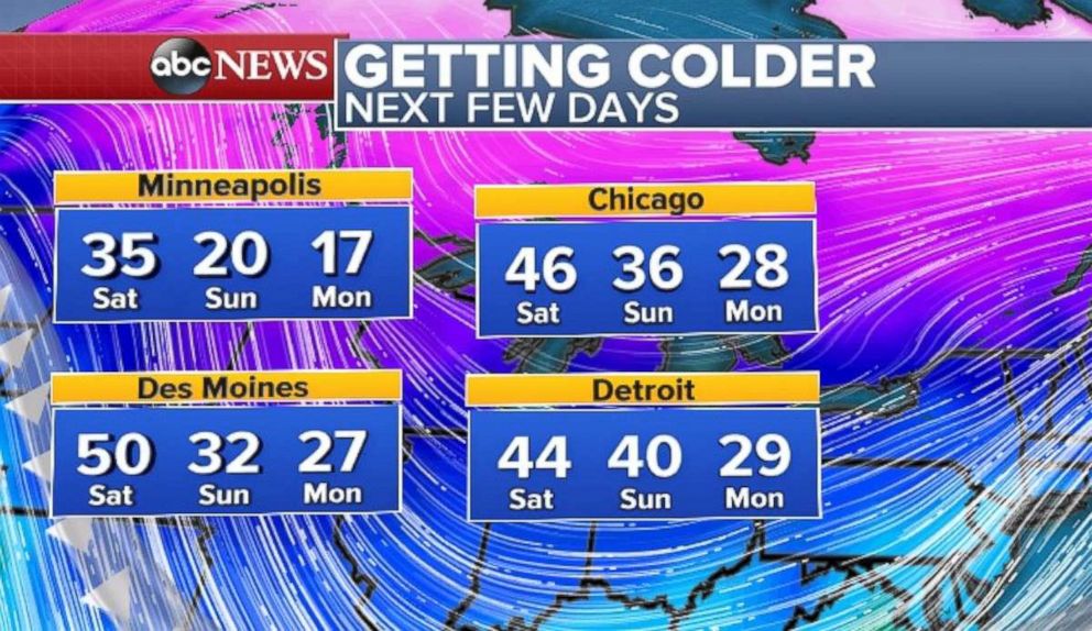
Some changes are lurking, though, for the Central U.S., as early as Sunday. Colder air will soon make a comeback, and temperatures will be dropping 10 to 15 degrees in the Upper Midwest by Sunday. By Monday, many cities -- including Chicago, Des Moines and Minneapolis -- will be nearly 20 to 25 degrees colder than they will be on Saturday afternoon.
Some of this cold air will start expanding eastward nexy week, with a couple of waves of cold air that should bring most of the Central and Northeast U.S. to a more seasonably cold pattern.
Given the mild weather, there remains a risk of new ice jams, and existing ones could get complicated.
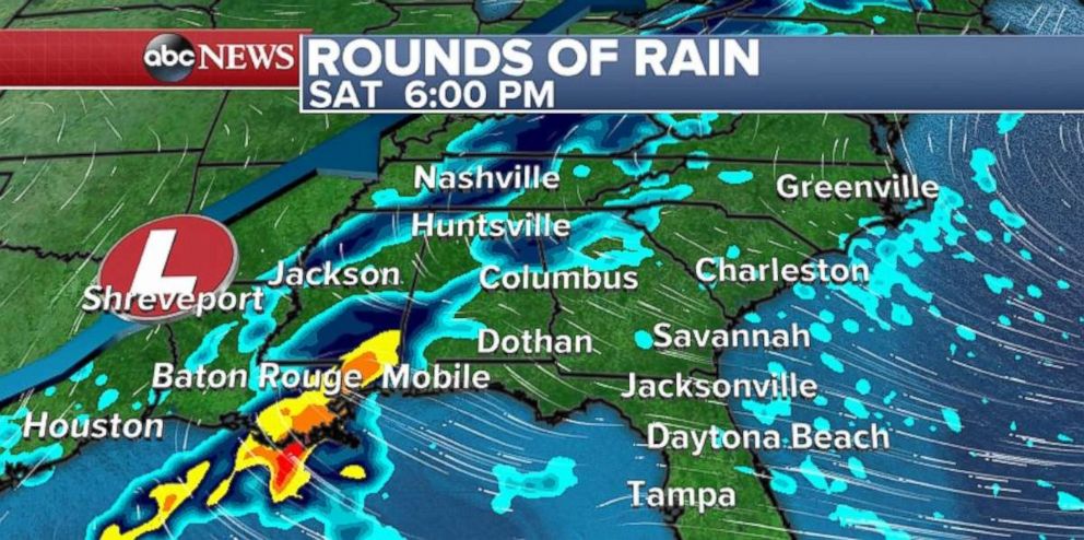
As a cold front swings across the Central U.S. late Saturday and into Sunday, a new disturbance will develop in the Gulf Coast states.
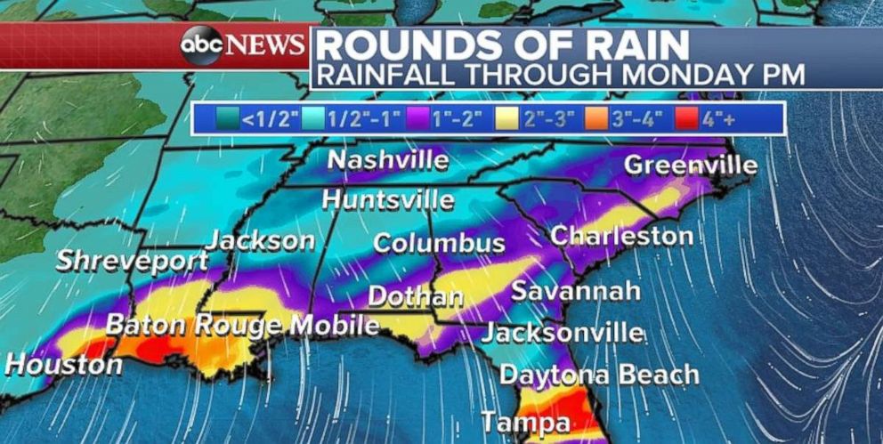
It will bring heavy rain from Texas to Florida over the weekend. There is a chance for some isolated flash flooding in the heaviest bands of rain across the region -- especially southern Louisiana on Saturday. A flash flood watch has been posted for parts of Louisiana.
Most of Florida and the southeast will appreciate the rain as those areas are running a little dry compared to average.
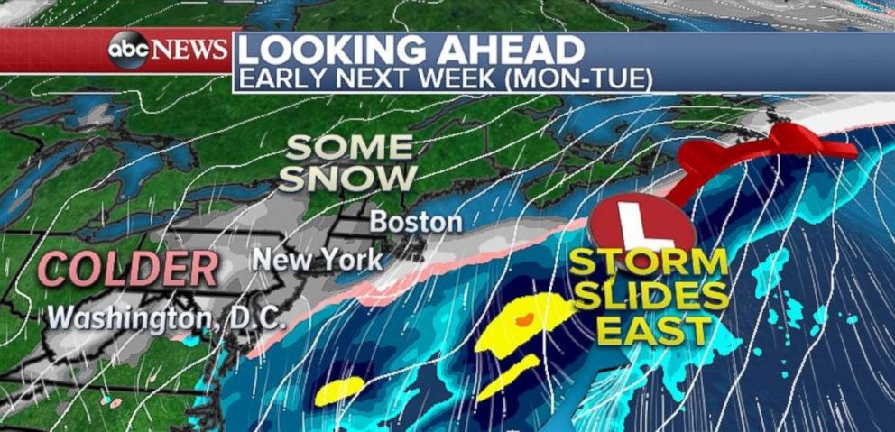
A few different ingredients, including a new push of colder air, will come together early next week to develop a coastal storm. At this point, it remains unclear, what, if any the impacts of this storm will be. While confidence is increasing in at least some chances for wintry weather in the Northeast early next week, the magnitude of the impact remains uncertain. As of Saturday morning, the forecast looks to only bring light precipitation to the region.
Forecast guidance shows the main storm developing off the coast of the Carolinas on Monday. The storm will quickly track north and east. There remains a chance that parts of southeast New England receive some direct wintry impact from this system. In addition, as some cold air interacts with the storm, some snow potentially could develop well away from the center of the storm, which could bring some snow to parts of the Northeast including the major I-95 cities.
For now, it looks likely that at least a period of some light snow is possible Monday and Tuesday in the Northeast. The forecast could change and is worth watching over this weekend.
Across the Northwest, more snow is likely for the mountains of Oregon and Washington Saturday. Another storm is on its way to the region, but the heaviest of the precipitation will be confined to northwest Washington. At the point the greatest impacts from these storms will be enhanced snowfall for the Washington Mountains. As more of the region received rain and some milder temperatures early next week, the threat for isolated landslides will increase.
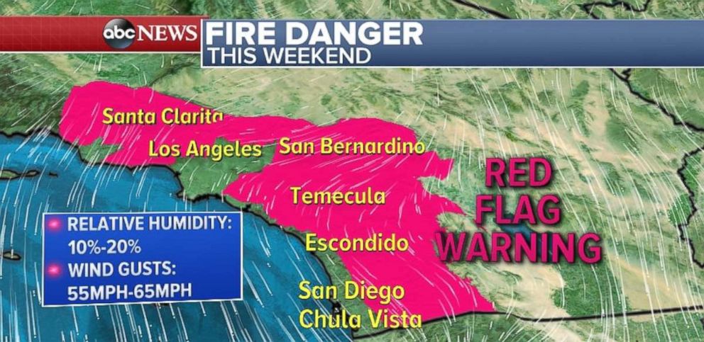
Further South, Santa Ana winds will develop today across Southern California and last through the weekend. Relative humidity values will be as low as 10 percent in the region. Winds could gust to over 55 mph in some of the hillsides.
Therefore, there is a critical fire risk for most of the Southern California region including the hills surrounding Los Angeles and San Diego.


