Bitter blast of cold air dominating Midwest and Northeast ahead of new year
New Year's Eve across much of the country will be very cold.
— -- Another blast of even more frigid cold air is on the way for the Midwest and eastern U.S. after a week of already brutally cold temperatures for the eastern half of the nation.
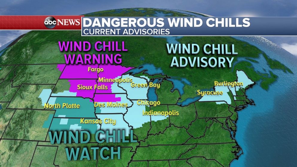
Wind chill warnings, advisories and watches have been issued for a large portion of the nation, including a stretch of the central Plains and Midwest. Wind chills in northern Minnesota and North Dakota Saturday morning could be as low as minus 50 degrees.
The core of this cold air will slide south and east on Sunday spreading into the Northeast and Southeast.
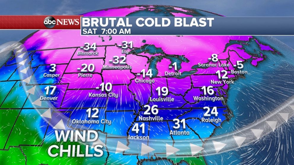
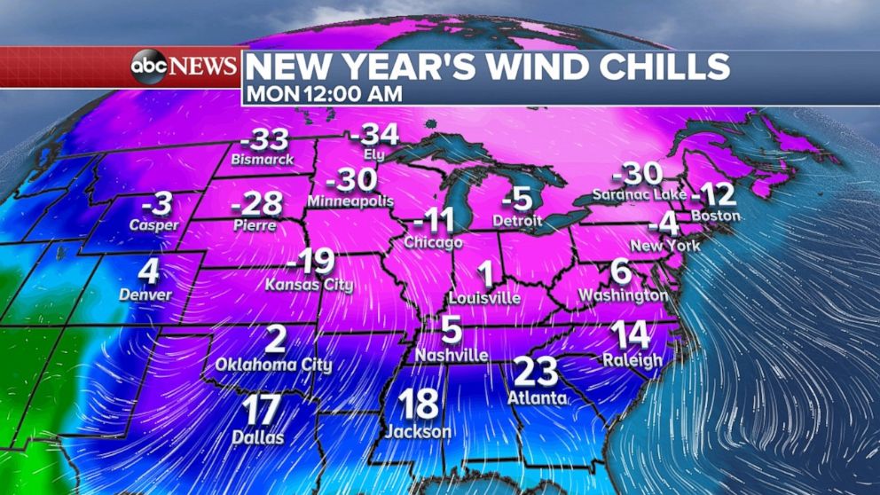
As we ring in 2018, it will feel very cold for a majority of the country. It will feel like single digits all the way into the Tennessee Valley and minus 30 in the upper Midwest and Northern Plains.
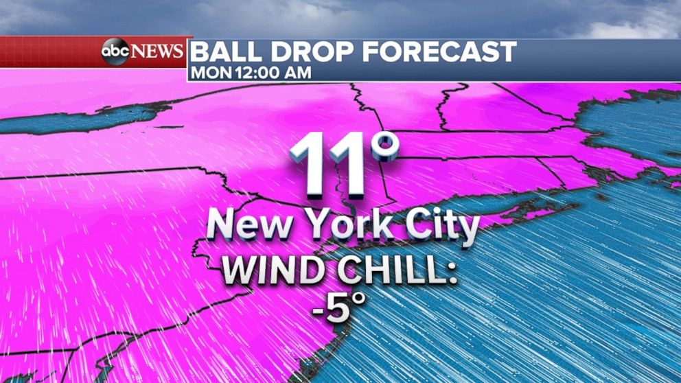
Some locations will see the coldest New Year’s Eve in nearly 50 years. It will feel like the single digits nearly the entire day on New Year’s Eve. The temperature is forecast to be 11 degrees in Times Square at midnight. The wind chill will be minus 5, making it one of the coldest New Year’s Eves on record for New York City. The coldest temperature observed during the ball drop in Times Square was 1 degree, with a wind chill of minus 18, in 1917.
Should the temperature be 11 degrees at the time of the ball drop, it will tie for the second-coldest all-time -- set in 1962.
There is also an area of light snow moving out of the Midwest on Saturday morning, and across the Appalachians and toward the Northeast. As of Saturday early morning, light snow was falling across parts of Ohio, Pennsylvania, Maryland and Virginia. This snow will move off the coast and bring some light accumulation to parts of New Jersey, Long Island and extreme southeast New England during the day. Locally 1 to 2 inches of snowfall can be expected.
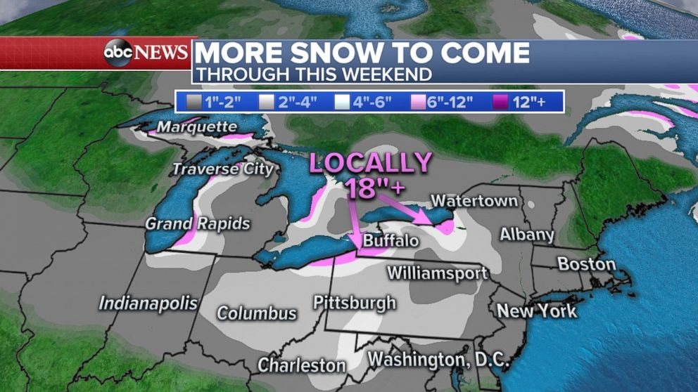
Another round of lake effect snow is getting underway as well with potential for more than another foot of snow in hard-hit areas like Erie, Pennsylvania. The heavy lake effect snow will begin on Saturday morning and continue through Saturday night. Locally up to 18 inches of additional snow is expected this weekend. Erie’s snow emergency is expected to remain in effect until Jan. 1.
Snow coming to Northwest
A round of freezing rain brought ice to parts of Washington state Friday. The ice caused numerous power outages, including 20,000 reported to be without power in Northwest Washington on Friday night due to downed power lines. There were 86 crashes reported in north-central Washington due to icy roads.
A storm system moving across the northwest U.S. is bringing more heavy snow to the northern Rockies Saturday. Locally over 1 foot of additional snow is likely.
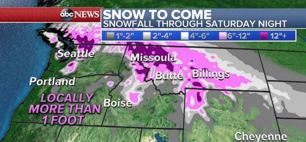
A drier day is ahead for the northwest on Sunday.
Cold, but clear travel
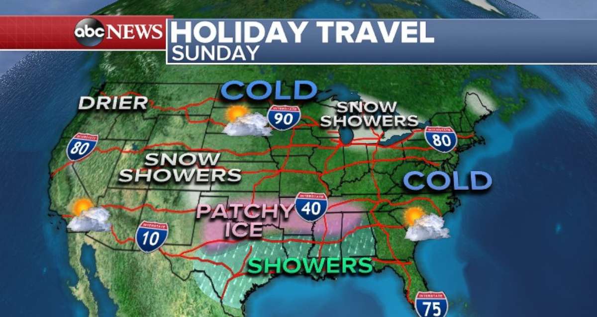
The main travel story for Sunday will be the cold air dominating much of the nation.
We will also be watching a disturbance moving through the south that could bring some patchy ice from Texas to Alabama. We do not expect accumulations to be significant, but it could cause localized travel issues.
Related Topics

Popular Reads
ABC News Live