Buffalo's deadly blizzard by the numbers: What made the storm so historic
At least 39 people have died due to the storm in Erie County, officials said.
It was a once-in-a-generation event.
The major winter storm that impacted parts of the U.S. last week devastated Western New York. The Buffalo region, which is no stranger to snow, was walloped with prolonged whiteout conditions and freezing temperatures that contributed to dozens of fatalities.
New York Gov. Kathy Hochul has called the Christmas weekend storm the "blizzard of the century."
"This will go down in history as the most devastating storm in Buffalo's long storied history of having battled … many, many major storms," Hochul, a Buffalo native, said during a Christmas morning news conference.
Heather Kenyon, a meteorologist with the National Weather Service's Buffalo office, told ABC News it ranks as the "worst snow event I witnessed in this area."
"We knew that this was going to be a significant high-impact storm," Kenyon said. "We saw the combination of lake-effect snow and very strong winds, and so we were expecting blizzard conditions and really messaged that this was going to be a once-in-a-generation-type storm."

The winter storm saw rain followed by plummeting temperatures, heavy lake-effect snow and high winds -- dangerous conditions that developed very quickly on Dec. 23 across Western New York.
"It was a very strong cold front plowing through the area -- temperatures plummeting, snow starting, winds gusting," Kenyon said. "That quick onset I think caught a lot of people off-guard."

Here's a closer look at the blizzard by the numbers:
Minus 30-degree wind chills
The strong low-pressure area that moved across the country last week brought extremely cold air to the Buffalo region. Temperatures started plunging on Dec. 23, when sub-zero and single-temperatures combined with high winds for "dangerous wind chills," the National Weather Service said. Wind chills -- what the temperature outside feels like -- were between minus 10 and minus 30 degrees for several days.
In those conditions, exposed skin can be affected in minutes, with frostbite and hypothermia as serious concerns, officials warned during the storm.
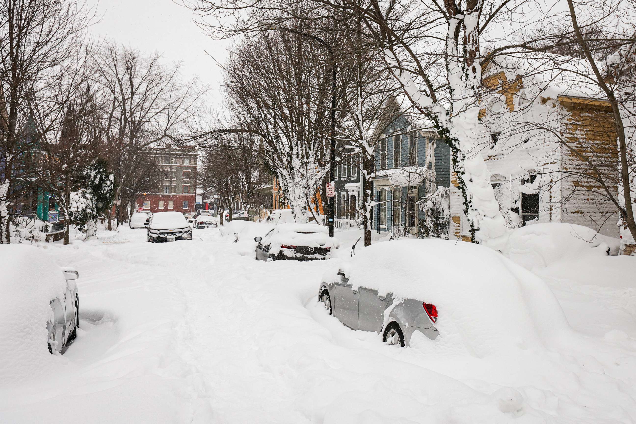
51.9 inches of snow
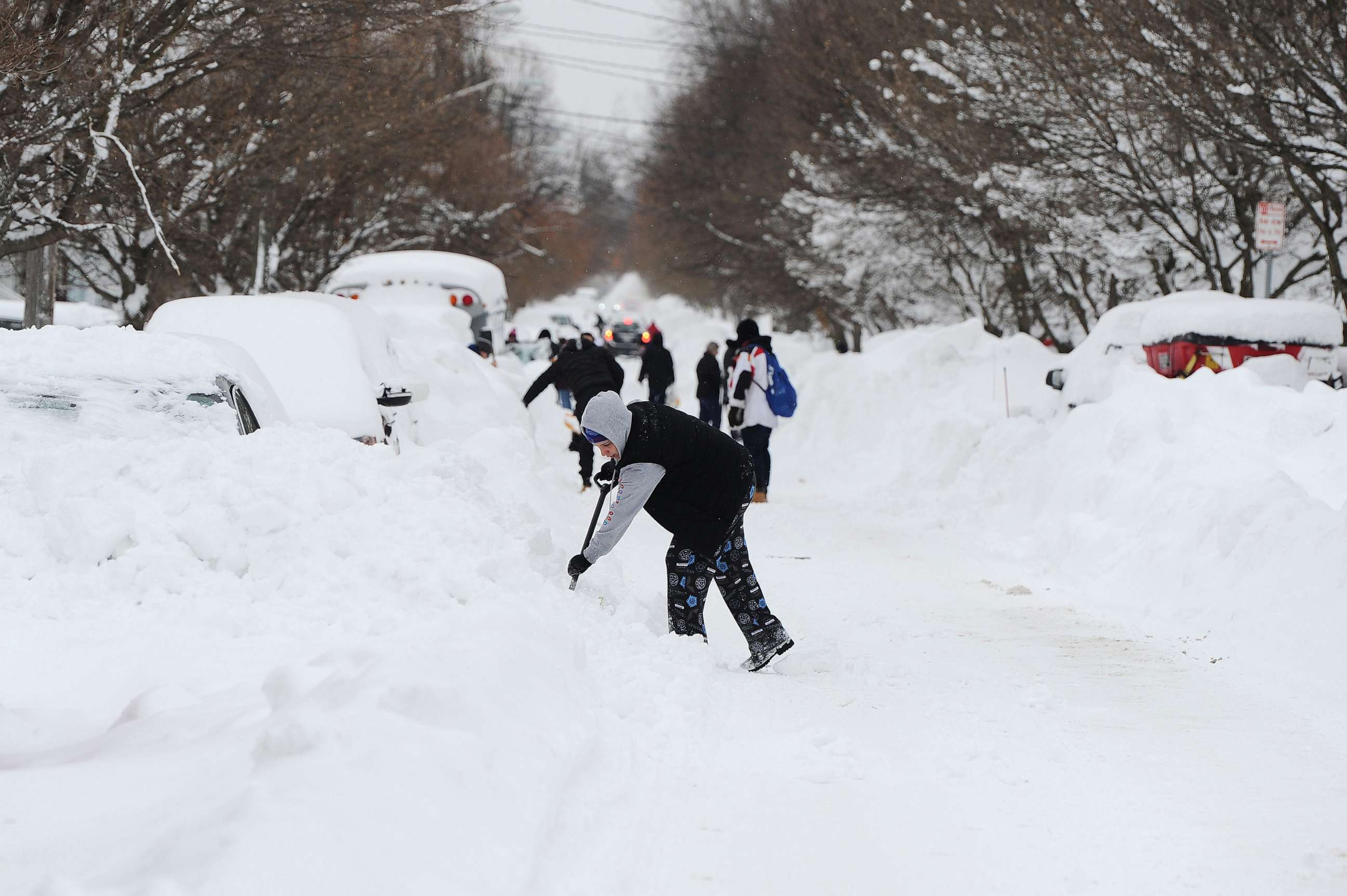
As the cold air moved over the warmer waters of the Great Lakes, it caused lake-effect snow.
Over 4 feet of snow accumulated in parts of Erie County over the course of five days ending Dec. 27. The highest total snowfall was reported at the Buffalo Airport, with 51.9 inches.
Record daily snowfall was recorded on Dec. 23 in Buffalo, with 22.3 inches.
Buffalo is significantly outpacing its typical seasonal snowfall. It has recorded over 100 inches so far this season, nearly 70 inches more than the normal amount for this time of year and several inches more than what it averages the entire season.
Nearly 80 mph winds
Meteorologists were expecting wind gusts up to 70 mph during the blizzard, "which were reached," Kenyon said.
A 79 mph wind gust was recorded in Lackawanna and 72 mph at the Buffalo airport on Dec. 23, according to the National Weather Service.
"This storm was so significant because it brought those strong winds, which we don't often see with the lake-effect snow," Kenyon said. "Those strong winds just produced impossible travel and drifting snow where we're getting this drift where people can't even open their front door."

Though the region is prone to lake-effect snow, blizzard warnings are not often issued, Kenyon said. Other areas in the Great Lakes region got lake-effect snow with the storm system, but not the high winds, she said.
The combination of lake-effect snow and high winds was "why it was so bad for us," Kenyon said.
Zero visibility
The high winds during the snowstorm often made for zero visibility in the lake-effect band, making travel impossible in the Buffalo metro area as many were gearing up for the holiday weekend or trying to head home from work. A travel advisory was soon upgraded to a ban on traveling the morning of Dec. 23.
Cars got stranded as roadways became impassable. The storm marked the first time in history that the Buffalo Fire Department couldn't respond to any calls, officials said.

At least 39 fatalities
At least 39 people have died due to the storm in Erie County, which includes the city of Buffalo, officials said, making it the deadliest in the region since the blizzard of 1977.
Many people died after getting stranded outside or in their cars, while others were found dead in their homes amid frigid conditions, officials said.
Nearly half of those who died -- 17 -- were found outside, 11 were in a house and four in a car. Others died due to snow-clearing cardiac events, while three were the result of a delayed EMS response, officials said.
Related Topics

Popular Reads
ABC News Live