Heavy snow expected in Dakotas, fire danger increases in West
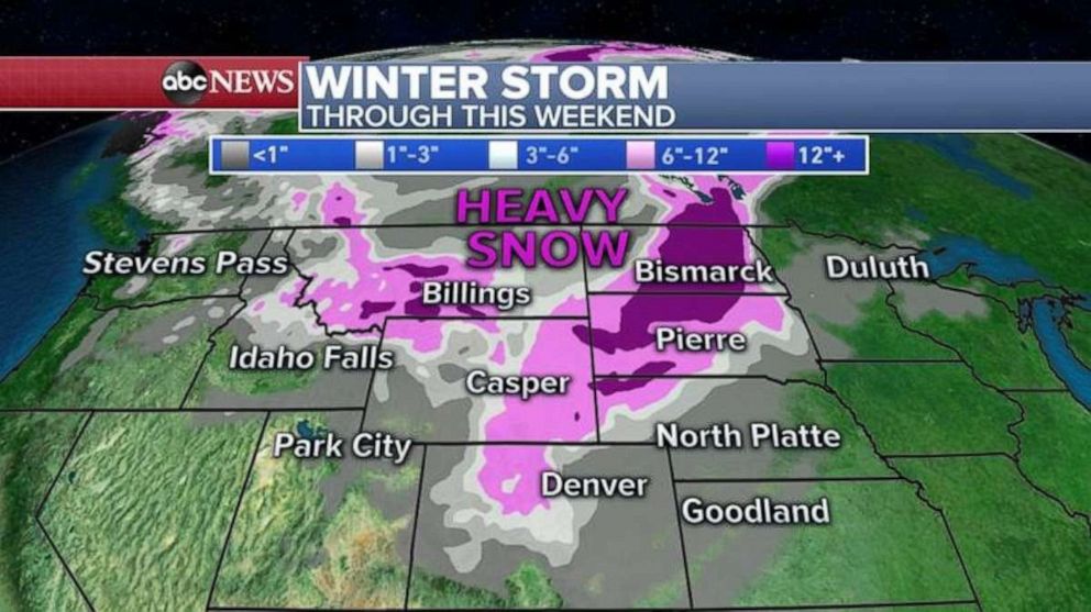
Snow accumulations could be more than a foot in the Dakotas.
The coldest air of the season will sweep through a huge part of the country from the Rockies into the Midwest and the Gulf Coast by the end of this week with the first snow of the season possible from Colorado to Minnesota.
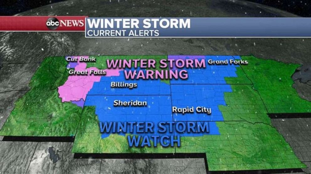
7 states from the Rockies into the northern Plains are under Winter Storm Warnings and Watches for the developing storm.

Today, the storm system that will bring the coldest air of the season will move into the northern Rockies with gusty winds, crashing temperatures and developing heavy snow.
By Thursday morning, the cold front will move through the Denver metro area, dropping temperatures more than 60 degrees in just a matter of 24 to 36 hours.
With the cold air, the first snow of the season could occur in Denver, Colorado with some possible accumulation.
Late Thursday, the rain will change to snow in the Dakotas with heavy snow expected there. This could be some of the biggest snow this early in the season that the Dakotas have ever seen in recorded history.

Snow accumulations could be more than a foot from the Rockies all the way to the Dakotas through this weekend.
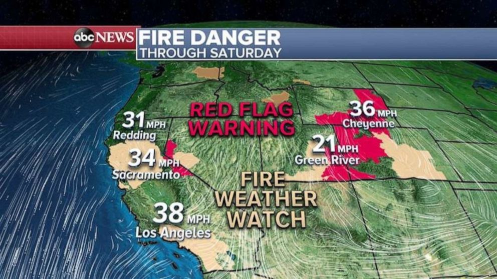
As the cold front moves into the Rockies, it will bring very windy conditions to the area today and tomorrow, increasing fire danger.
Elsewhere, numerous states from California to Wyoming are under Red Flag Warnings and Fire Weather Watch for gusty winds near 60 mph and very dry conditions.
Late Wednesday into Saturday, as the cold air gets pushed down the mountains, a strong Santa Ana winds event is forecast to develop for southern California from San Diego to L.A. significantly raising the fire danger risk in the areas affected.


