Record flooding in the Midwest as East Coast continues to heat up
Areas of Michigan saw historic rainfall and devastating flooding.
A stationary front produced torrential rainfall in the Great Lakes and Midwest over the weekend with up to 7 inches of rain falling Sunday in Michigan’s Upper Peninsula.
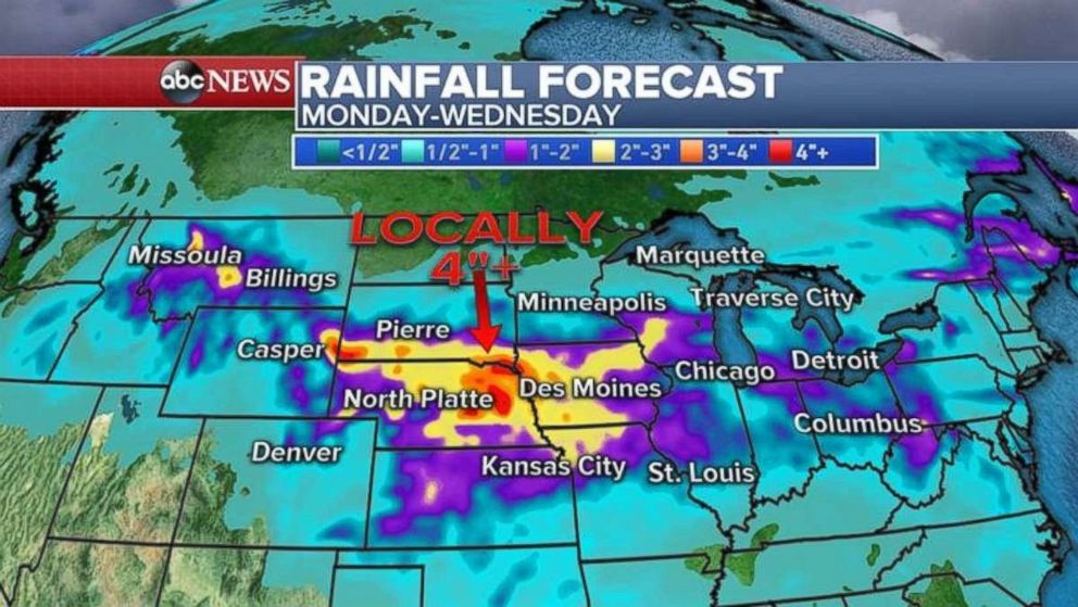
Flood and flash flood watches continue from Wisconsin to Montana Monday with more rainfall to come.
The heaviest rainfall over the next few days will be from southern Wisconsin to Montana, where, in some areas, an additional 2 to 4 inches of rain is possible. The hard-hit Upper Peninsula of Michigan will see a break, though.

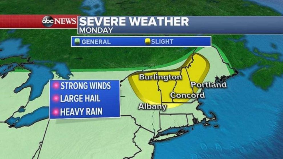
The biggest threat for severe weather Monday is in New England as the same storm system that brought all the flooding and severe weather to the Midwest and the Great Lakes moves east.
The biggest threat in the Northeast Monday will be damaging winds of more than 60 mph, some hail and flash flooding.

Heat up moves East
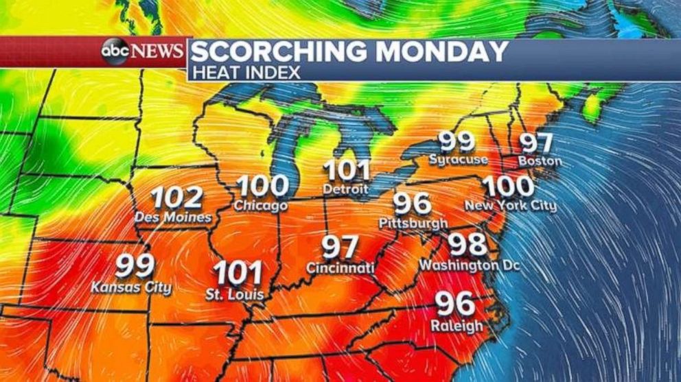
There are 18 states from Kansas to Maine under heat advisory or warnings on Monday.
Several cities in the Midwest broke record highs Sunday, including Waukegan, Illinois, at 93 degrees and La Crosse, Wisconsin, at 98 degrees.
The heat expands into the Northeast and East Coast with temperatures approaching possible record highs in major cities. The forecast will be for close-to-record highs Monday in Boston at 92 degrees (record: 94), Hartford at 92 (record: 95), New York City at 92 (record: 95) and Philadelphia at 92 (record: 96).
With the humidity, it will feel like nearly 100 degrees from Kansas City to Chicago to New York City.

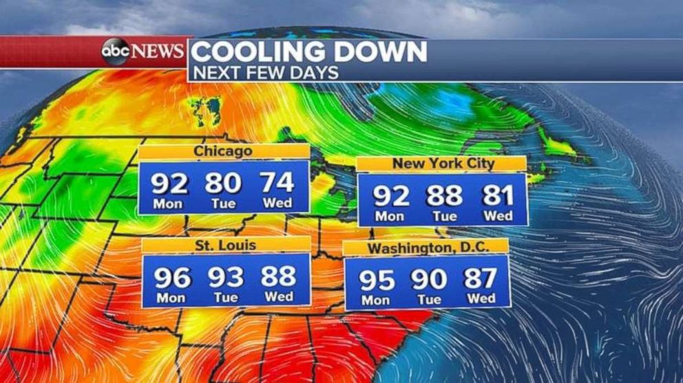
But there is some good news, as Monday will be the last really hot day from Chicago to New York City. Temperatures will cool down by Tuesday with even cooler readings on Wednesday. Highs will be in the 70s in Chicago and near 80 in New York City on Wednesday.


