Next round of severe weather could bring damaging wind, hail from Texas to North Carolina
Severe weather is possible for a large area of the southern U.S. on Sunday.
A storm system that brought damaging winds and large hail from Texas to Mississippi on Saturday will interact with a developing storm to bring the next round of severe weather to some of the same spots on Sunday. It will also expand north and east into the Ohio River Valley and the Mid-Atlantic.
Hail the size of grapefruits or softballs fell on Saturday in Cherokee and Houston counties in Texas. While no tornadoes were officially reported, strong and damaging winds were reported in parts of the region. The storms also brought torrential rain, with 5.42 inches falling in Taylor, Texas, just outside of Austin.
The system was moving into parts of the Midwest on Sunday morning and bringing some rain and scattered thunderstorms.
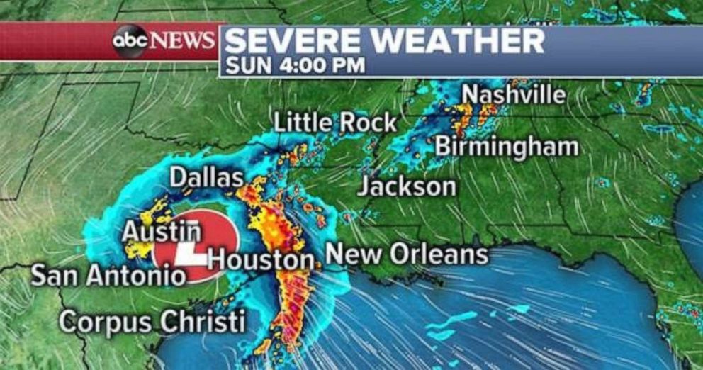
There is a severe thunderstorm Watch until 9 a.m. CDT in southern Texas as the next storm moves into the region. Models are showing a well-organized system moving through Texas Sunday afternoon and into Louisiana and Arkansas at night.

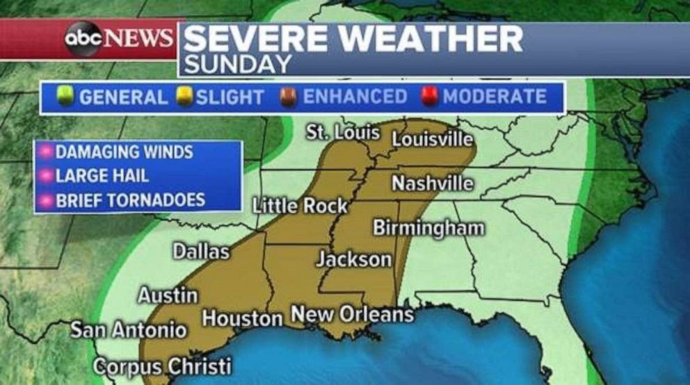
The combination of Saturday’s storm system moving into the Midwest and the new storm system moving into the South will bring a risk for severe weather on Sunday from Texas to Kentucky. Torrential rain, damaging winds, large hail and some brief tornadoes are possible with the system. Houston; New Orleans; Little Rock, Arkansas; Nashville, Tennessee; and Louisville, Kentucky, are all at risk for severe weather Sunday.
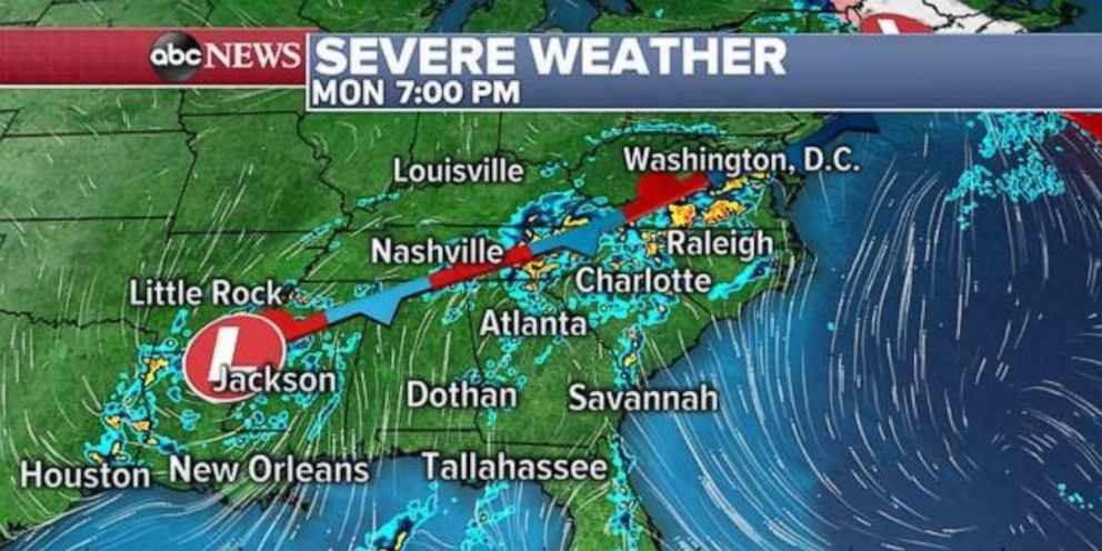
On Monday, the storm system in the South will begin to catch up with a trailing cold front from the Midwest storm system and bring gusty thunderstorms to much of the southeast U.S.
However, the storms could become locally severe in the Carolinas, where damaging winds, large hail and brief tornadoes are possible on Monday.
The combination of these two storms over the next two days will bring a good deal of rain from Texas to the Carolinas. Many areas will receive 2 to 3 inches by Monday night. However, there is an increasing concern for over 4 inches of rain in parts of eastern Texas, Louisiana, Arkansas and Mississippi.
The heavy rain, possibly in a very short time period, could lead to flash flooding over the next 48 hours.

Tracking spring warmth
Saturday was a mild day for much of the central and eastern United States. Kansas City, Missouri, had a high temperature of 77 degrees on Saturday, its warmest day since Oct. 8.
The mild air will make a push again Sunday into parts of the Midwest, Southeast and Mid-Atlantic. Temperatures from Kansas City to Atlanta will be about 10 degrees above average.
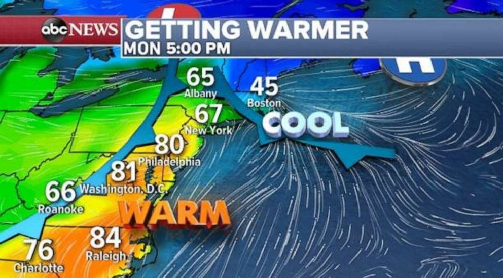
On Monday, the warm air will make its way to the Northeast and Mid-Atlantic, however, cool air off the Atlantic Ocean will keep New England pretty cold.
There will likely be a nearly 40-degree temperature difference between Boston and Philadelphia, with New York possibly on either side of the 70-degree mark.
Related Topics

Popular Reads
ABC News Live