Extremely critical fire conditions move into California
Dry winds from the north are beginning to move into the area this morning.
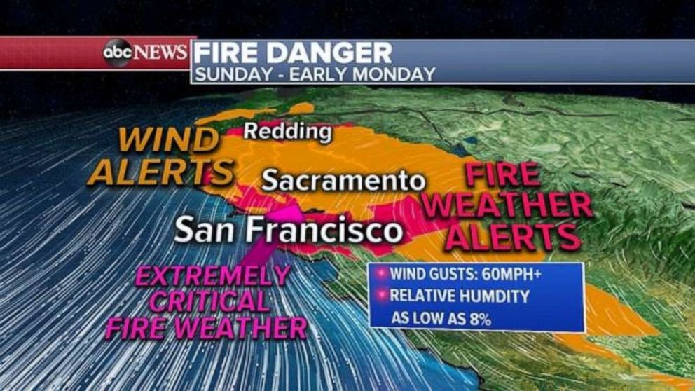
Extremely critical fire conditions are moving into Northern California this morning.
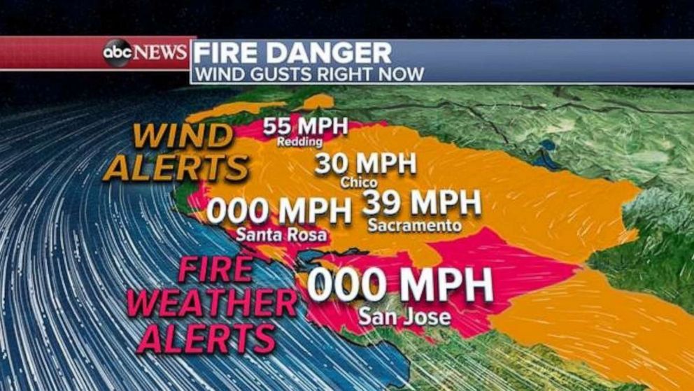
Unfortunately, dry winds from the north are beginning to pick up, with gusts over 80 mph being reported in Sonoma County, with winds in Chico and Sacramento now gusting near or above 30 mph.
While winds remain calm in the immediate Bay Area, winds are anticipated to pick up there as well this morning.
In response to the dry gusty winds that are slowly moving into the region, the National Weather Service is reporting that GOES-17 Satellite Imagery is showing that the Kincade Fire is starting to burn hotter.
Winds could gust up to 60 mph in parts of Northern California on Sunday and relative humidity could be as low as 8%. This is extremely critical fire weather and any fire, new or existing, could grow erratically.
Southern California is currently seeing some onshore winds which is helping relative humidity values. However, dry Santa Ana winds will move into Southern California late Sunday night and into Monday morning.
Forecast models are showing a distinct wind shift occurring in the early morning hours on Monday, where winds will be coming over the mountains of Los Angeles and Ventura counties and descending along the hillsides surrounding the cities in the region.
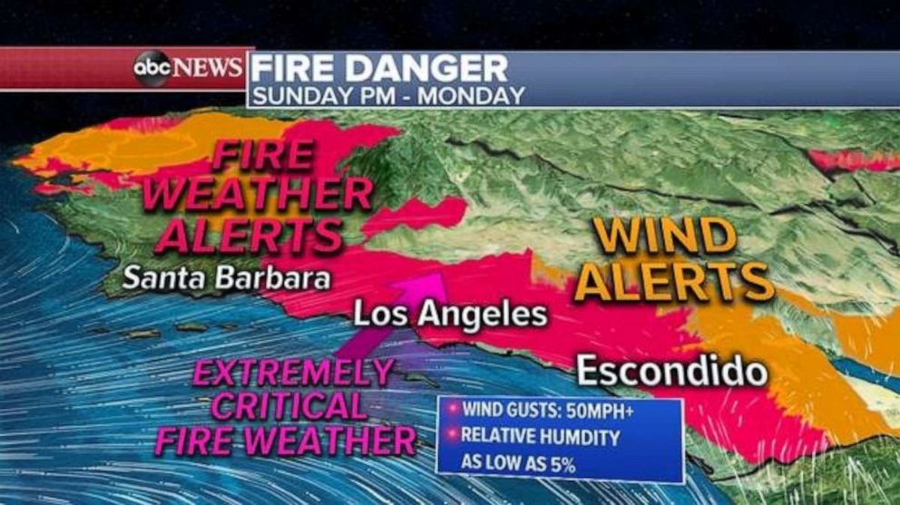
There will be extremely critical fire weather Monday for some of the highest elevations in the Los Angeles metropolitan areas with wind gusts of up to 50 mph and relative humidity as low as 5% is possible.
Elsewhere, very cold air will begin to spill into the Rockies and Central U.S. this week. The strong high pressure system that is bringing this cold air should help to create a pressure and thermal gradient over parts of California.
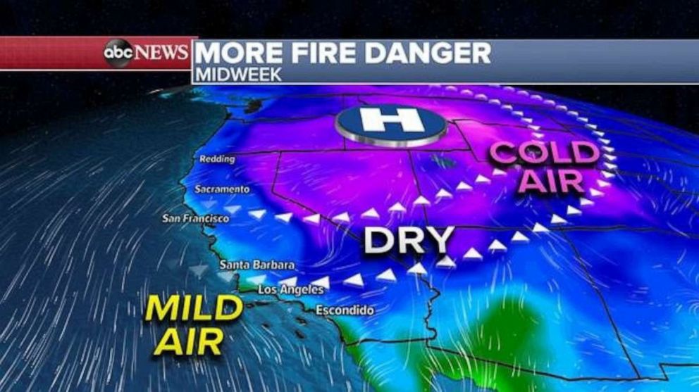
By midweek, another dry Santa Ana wind event will get underway in Southern California, with the NWS already noting that it could be the most significant Santa Ana Wind event for Southern California this year.
The remnants of Olga have fully phased with a cold front and the moisture is now associated with a classic mid-latitude cyclone.
There were 37 reports of damaging winds in the Mississippi River Valley on Saturday as Post Tropical Cyclone Olga phased with the cold front. Over 10 inches of rain was reported just outside of New Orleans, Louisiana, and 7 inches of rain was reported in Tuscaloosa, Alabama.
Moisture along this frontal system is moving east this morning. There could be a couple of severe storms that spawn in parts of North Carolina up through parts of the Delmarva peninsula. Brief tornadoes cannot be ruled out during the day Sunday, as this region tends to have brief spin-ups.
Locally, heavy rain will move into the Northeast later Sunday morning and last through much of the day with a possibility of 1 to 2 inches of rain falling.
This entire storm system will clear the U.S. by late Sunday with no impacts on Monday.
A new winter storm is developing Sunday near the I-25 Corridor from Cheyenne to Denver to Colorado Springs. Snow will begin to increase in coverage later Sunday across the region and last into Monday.
Snow will fall overnight tonight in Denver metropolitan area and could last into the morning commute.
Locally, 4 to 8 inches of snow is expected in the urban corridor of I-25 near Denver. Eight to 16 inches of snow is possible in the Front Range Foothills and the Northern Central Mountains of Colorado.
Related Topics

Popular Reads
ABC News Live