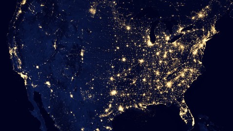
'Black Marble': Earth at Night

Composite image of continental United States at night. NASA Earth Observatory/NOAA NGDC.
Earth-watching scientists over at NASA today rolled out what they call the " Black Marble," a series of new images and video featuring Earth as seen from space at night.
The images come from a new sensor on board the Suomi National Polar-orbiting Partnership satellite (NPP) launched last year by NASA and NOAA.
NASA's composite animation was stitched together with images gathered over 312 satellite orbits. It took that many passes to get cloud-free images of every continent and island on the planet.
NASA claims the new sensor - called VIIRS, or the Visible Infrared Imaging Radiometer Suite - is so sensitive it can pick up the light of a single ship in the middle of the ocean.
Scientists say the capability to observe Earth at night will help them get a more complete view of storms and other weather conditions that can't be seen as well with other sensors used in daylight. Images from VIIRS are being used to forecast low clouds and fog at coastal airports like San Francisco, NASA said.
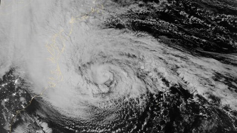
The satellite also captured Hurricane Sandy as it bore down on the east coast in October.

NASA
NASA has, over the years, released daytime versions of the entire Earth from space, dubbed the " Blue Marble."
The new images were released in San Francisco today at an annual meeting of earth scientists held by the American Geophysical Union.